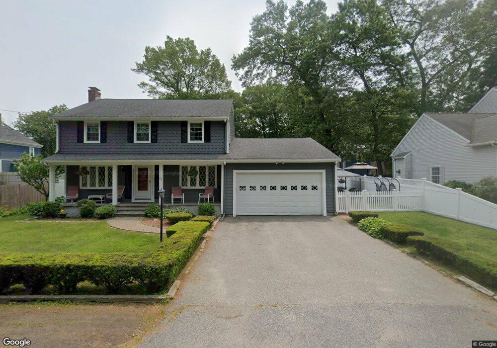
43 Matthews St Dedham, MA 02026
Oakdale NeighborhoodEstimated Value: $736,167 - $771,000
3
Beds
2
Baths
1,104
Sq Ft
$683/Sq Ft
Est. Value
About This Home
This home is located at 43 Matthews St, Dedham, MA 02026 and is currently estimated at $753,542, approximately $682 per square foot. 43 Matthews St is a home located in Norfolk County with nearby schools including Oakdale Elementary School, Dedham Middle School, and Dedham High School.
Ownership History
Date
Name
Owned For
Owner Type
Purchase Details
Closed on
May 23, 2002
Sold by
Gong Zejun
Bought by
Bottaro Antohny D and Bottaro Teresa M
Current Estimated Value
Home Financials for this Owner
Home Financials are based on the most recent Mortgage that was taken out on this home.
Original Mortgage
$250,000
Interest Rate
7.01%
Mortgage Type
Purchase Money Mortgage
Purchase Details
Closed on
Oct 29, 1998
Sold by
Tiberi Cesidio P and Tiberi Rosalie C
Bought by
Gong Zejun
Home Financials for this Owner
Home Financials are based on the most recent Mortgage that was taken out on this home.
Original Mortgage
$168,000
Interest Rate
6.68%
Mortgage Type
Purchase Money Mortgage
Create a Home Valuation Report for This Property
The Home Valuation Report is an in-depth analysis detailing your home's value as well as a comparison with similar homes in the area
Home Values in the Area
Average Home Value in this Area
Purchase History
| Date | Buyer | Sale Price | Title Company |
|---|---|---|---|
| Bottaro Antohny D | $349,360 | -- | |
| Gong Zejun | $210,000 | -- |
Source: Public Records
Mortgage History
| Date | Status | Borrower | Loan Amount |
|---|---|---|---|
| Open | Gong Zejun | $180,000 | |
| Closed | Bottaro Antohny D | $250,000 | |
| Previous Owner | Gong Zejun | $168,000 | |
| Previous Owner | Gong Zejun | $105,000 |
Source: Public Records
Tax History
| Year | Tax Paid | Tax Assessment Tax Assessment Total Assessment is a certain percentage of the fair market value that is determined by local assessors to be the total taxable value of land and additions on the property. | Land | Improvement |
|---|---|---|---|---|
| 2025 | $8,135 | $644,600 | $350,100 | $294,500 |
| 2024 | $7,709 | $616,700 | $322,300 | $294,400 |
| 2023 | $7,737 | $602,600 | $299,100 | $303,500 |
| 2022 | $7,086 | $530,800 | $273,600 | $257,200 |
| 2021 | $6,865 | $502,200 | $273,600 | $228,600 |
| 2020 | $6,569 | $478,800 | $262,100 | $216,700 |
| 2019 | $6,309 | $445,900 | $237,900 | $208,000 |
| 2018 | $6,070 | $417,200 | $217,100 | $200,100 |
| 2017 | $5,846 | $396,100 | $208,400 | $187,700 |
| 2016 | $5,776 | $372,900 | $185,200 | $187,700 |
| 2015 | $5,518 | $347,700 | $176,300 | $171,400 |
| 2014 | $5,472 | $340,300 | $176,300 | $164,000 |
Source: Public Records
Map
Nearby Homes
- 6 Snow Ln
- 59 Hamilton Ave
- 58 Jersey St
- 600 East St
- 926 East St
- 50 Sprague St
- 441 Washington St Unit 301
- 56 Mount Vernon St
- 45 Circuit Rd
- 98 Cedar St Unit 2
- 165 Highland St Unit 165
- 28 Linden Place
- 46 Church St
- 442 High St
- 55 Church St Unit 1
- 44 Court St
- 186 Carroll Ave
- 21 Birch St
- 8 Hillview Terrace
- 22 Azalea Cir
- 39 Matthews St
- 39 Matthews St Unit 39
- 22 Oscars Way
- 26 Oscars Way
- 51 Matthews St
- 291 Central Ave
- 30 Oscars Way
- 30 Oscars Way
- 83 Taft Ln
- 23 Oscars Way
- 23 Oscars Way Unit /23
- 315 Central Ave
- 58 Wildwood Dr
- 29 Plain St
- 50 Wildwood Dr
- 62 Wildwood Dr
- 7 Oscars Way
- 70 Wildwood Dr
- 298 Central Ave
- 292 Central Ave
Your Personal Tour Guide
Ask me questions while you tour the home.