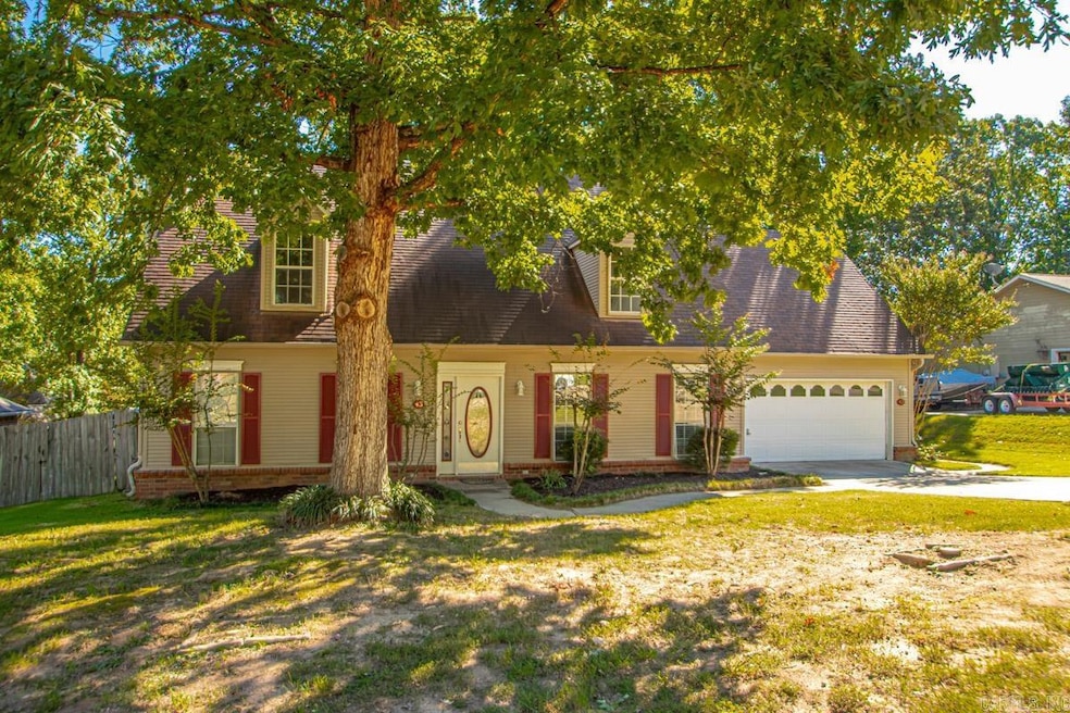
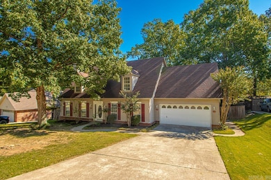
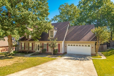
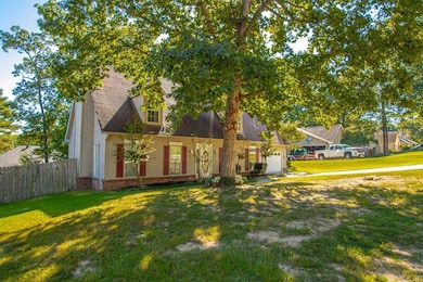
43 Neal Cove Bryant, AR 72022
Estimated payment $1,840/month
Highlights
- Traditional Architecture
- Main Floor Primary Bedroom
- Bonus Room
- Bryant Elementary School Rated A
- Separate Formal Living Room
- Home Office
About This Home
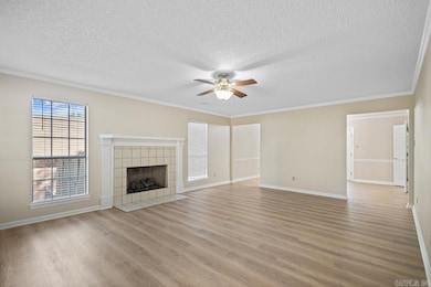
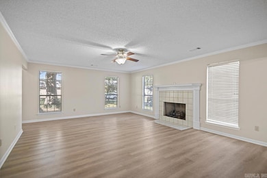
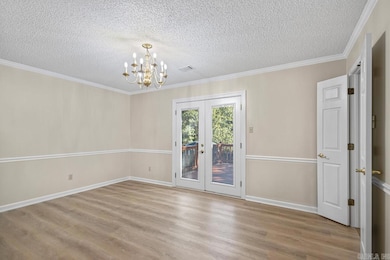
Fresh, inviting, and move-in ready. 43 Neal Cove sits in the sought after Bryant Oaks subdivision in Bryant, AR. This classic 4 bedroom, 2.5 bath home was built in 1990 and refreshed with new interior paint and durable vinyl plank flooring for a clean, modern look. A sunlit living room centers on a gas fireplace. The kitchen was thoughtfully expanded in 2012, adding abundant cabinetry, generous counter space, and a gas range. The open flow keeps cooks connected to conversation whether you are hosting friends or supervising homework. Upstairs, three comfortable bedrooms provide flexibility for guests, a nursery, or a home office. The primary suite includes a walk-in closet and a private bath. Out back, a fully fenced yard with mature trees offers shade and privacy. A large deck extends the living space for weeknight dinners, weekend projects, and quiet evenings. Well kept, updated where it counts, and ready for its next owner, this Bryant home delivers everyday comfort in a location buyers ask for. If you are searching for a home for sale in Bryant AR with four bedrooms, an expanded kitchen, a gas fireplace, 2 car garage, and a fenced backyard, put 43 Neal Cove on your list.
Home Details
Home Type
- Single Family
Est. Annual Taxes
- $1,890
Year Built
- Built in 1990
Lot Details
- 0.27 Acre Lot
- Cul-De-Sac
- Wood Fence
- Level Lot
Parking
- 2 Car Garage
Home Design
- Traditional Architecture
- Slab Foundation
- Architectural Shingle Roof
- Metal Siding
Interior Spaces
- 3,003 Sq Ft Home
- 2-Story Property
- Gas Log Fireplace
- Separate Formal Living Room
- Formal Dining Room
- Home Office
- Bonus Room
- Fire and Smoke Detector
- Laundry Room
Kitchen
- Eat-In Kitchen
- Breakfast Bar
- Stove
- Gas Range
- Microwave
- Plumbed For Ice Maker
- Dishwasher
- Disposal
Flooring
- Tile
- Luxury Vinyl Tile
Bedrooms and Bathrooms
- 4 Bedrooms
- Primary Bedroom on Main
- Walk-In Closet
- Walk-in Shower
Outdoor Features
- Outdoor Storage
- Porch
Utilities
- Central Heating and Cooling System
- Gas Water Heater
Map
Home Values in the Area
Average Home Value in this Area
Tax History
| Year | Tax Paid | Tax Assessment Tax Assessment Total Assessment is a certain percentage of the fair market value that is determined by local assessors to be the total taxable value of land and additions on the property. | Land | Improvement |
|---|---|---|---|---|
| 2025 | $2,390 | $46,245 | $7,020 | $39,225 |
| 2024 | $2,180 | $46,245 | $7,020 | $39,225 |
| 2023 | $1,861 | $46,245 | $7,020 | $39,225 |
| 2022 | $1,754 | $46,245 | $7,020 | $39,225 |
| 2021 | $1,661 | $38,850 | $5,400 | $33,450 |
| 2020 | $1,661 | $38,850 | $5,400 | $33,450 |
| 2019 | $1,661 | $38,850 | $5,400 | $33,450 |
| 2018 | $1,686 | $38,850 | $5,400 | $33,450 |
| 2017 | $1,606 | $38,850 | $5,400 | $33,450 |
| 2016 | $1,735 | $35,550 | $5,400 | $30,150 |
| 2015 | $1,735 | $35,550 | $5,400 | $30,150 |
| 2014 | $1,385 | $35,550 | $5,400 | $30,150 |
Property History
| Date | Event | Price | List to Sale | Price per Sq Ft |
|---|---|---|---|---|
| 10/13/2025 10/13/25 | For Sale | $319,900 | -- | $107 / Sq Ft |
Purchase History
| Date | Type | Sale Price | Title Company |
|---|---|---|---|
| Warranty Deed | $139,666 | -- | |
| Warranty Deed | $140,000 | -- | |
| Warranty Deed | $142,000 | -- | |
| Warranty Deed | $121,600 | -- | |
| Quit Claim Deed | -- | -- | |
| Warranty Deed | $17,000 | -- |
Mortgage History
| Date | Status | Loan Amount | Loan Type |
|---|---|---|---|
| Open | $118,000 | Adjustable Rate Mortgage/ARM |
Source: Cooperative Arkansas REALTORS® MLS
MLS Number: 25041030
APN: 840-03134-000
Disclaimer: Certain information contained herein is derived from information provided by parties other than Homes.com. All information provided is deemed reliable, but is not guaranteed to be accurate and should be independently verified.
![]() IDX information is provided exclusively for personal, non-commercial use, and may not be used for any purpose other than to identify prospective properties consumers may be interested in purchasing.
IDX information is provided exclusively for personal, non-commercial use, and may not be used for any purpose other than to identify prospective properties consumers may be interested in purchasing.
- 511 Holly Lynn Dr
- 2302 Chelsea Dr
- 1000 Shobe Rd
- 708 Pattywood Dr
- 0.85 Acres N Reynolds Rd
- 3.39 Acres N Reynolds Rd
- 6001 Coral Ridge Dr
- lot 7 Kindness Ct
- 1 Neal St
- 210 Dell Dr
- 2710 Richland Park Dr
- Lot 18 Ethel Dr
- 2025 N Reynolds Rd
- 23395 I-30 S
- 1810 Bishop Rd
- 5 Arcadia Cir
- 2203 Defoe Cir
- 1315 Helen Ct
- 3458 Garden Club Dr
- 3200 Robbins Dr
- 501 Bristol Dr
- 903 Bristol Dr
- 2009 Cedarwood Cove
- 3323 Moss Creek Dr
- 3372 Garden Club Dr
- 406 SE 1st St
- 408 SE 1st St
- 110 SE 2nd Unit 2 St
- 1916 Brandon Cove
- 211 SE 3rd St
- 4102 Stoneybrook Dr
- 3313 Henson Place
- 2500 Bellerive Ave
- 503 Griffis Rd
- 3500 Double Eagle Way
- 1015 Allyson Ave
- 6097 Saddle Hill Dr
- 2806 Hurricane Lake Rd
- 3025 Highway 5 N Unit Several
- 5100 Hurricane Dr
