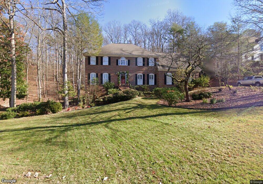
43 Rock Crest Dr Unit 131 Signal Mountain, TN 37377
Estimated Value: $827,000 - $994,000
--
Bed
5
Baths
4,018
Sq Ft
$225/Sq Ft
Est. Value
About This Home
This home is located at 43 Rock Crest Dr Unit 131, Signal Mountain, TN 37377 and is currently estimated at $902,824, approximately $224 per square foot. 43 Rock Crest Dr Unit 131 is a home located in Hamilton County with nearby schools including Thrasher Elementary School and Signal Mountain Middle/High School.
Ownership History
Date
Name
Owned For
Owner Type
Purchase Details
Closed on
Oct 28, 2020
Sold by
Bouldin Jane A and Bouldin James A
Bought by
Simpson John Raymond and Simpson Sherry S
Current Estimated Value
Home Financials for this Owner
Home Financials are based on the most recent Mortgage that was taken out on this home.
Original Mortgage
$290,000
Outstanding Balance
$234,000
Interest Rate
2.8%
Mortgage Type
New Conventional
Estimated Equity
$668,824
Purchase Details
Closed on
Oct 31, 2006
Sold by
Vavalides James H and Vavalides Connie P
Bought by
Bouldin James A and Bouldin Jane A
Purchase Details
Closed on
May 25, 2004
Sold by
Behuniak Marion M
Bought by
Vavalides James H and Vavalides Connie P
Home Financials for this Owner
Home Financials are based on the most recent Mortgage that was taken out on this home.
Original Mortgage
$210,000
Interest Rate
5.88%
Mortgage Type
Unknown
Purchase Details
Closed on
May 17, 1999
Sold by
Behuniak Marion M
Bought by
Behuniak Marion M and Marion M Behuniak Revocable Living Trust
Create a Home Valuation Report for This Property
The Home Valuation Report is an in-depth analysis detailing your home's value as well as a comparison with similar homes in the area
Home Values in the Area
Average Home Value in this Area
Purchase History
| Date | Buyer | Sale Price | Title Company |
|---|---|---|---|
| Simpson John Raymond | $540,000 | None Available | |
| Bouldin James A | $485,000 | None Available | |
| Vavalides James H | $399,000 | Pioneer Title Agency Inc | |
| Behuniak Marion M | -- | -- |
Source: Public Records
Mortgage History
| Date | Status | Borrower | Loan Amount |
|---|---|---|---|
| Open | Simpson John Raymond | $290,000 | |
| Previous Owner | Vavalides Jim | $330,000 | |
| Previous Owner | Vavalides James H | $35,000 | |
| Previous Owner | Vavalides James H | $210,000 | |
| Previous Owner | Vavalides James H | $35,000 |
Source: Public Records
Tax History Compared to Growth
Tax History
| Year | Tax Paid | Tax Assessment Tax Assessment Total Assessment is a certain percentage of the fair market value that is determined by local assessors to be the total taxable value of land and additions on the property. | Land | Improvement |
|---|---|---|---|---|
| 2024 | $3,016 | $134,800 | $0 | $0 |
| 2023 | $3,016 | $134,800 | $0 | $0 |
| 2022 | $3,016 | $134,800 | $0 | $0 |
| 2021 | $3,016 | $134,800 | $0 | $0 |
| 2020 | $4,284 | $154,925 | $0 | $0 |
| 2019 | $4,284 | $154,925 | $0 | $0 |
| 2018 | $4,284 | $154,925 | $0 | $0 |
| 2017 | $4,284 | $154,925 | $0 | $0 |
| 2016 | $3,711 | $0 | $0 | $0 |
| 2015 | $3,711 | $134,200 | $0 | $0 |
| 2014 | $3,711 | $0 | $0 | $0 |
Source: Public Records
Map
Nearby Homes
- 15 Grayswood Hill Rd
- 14 Carriage Hill
- 206 Palisades Dr
- 103 Arrow Dr
- 409 Mississippi Ave
- 220 Palisades Dr
- 1425 Palisades Rd
- 608 Texas Ave
- 105 Mountain Court Dr
- 779 James Blvd
- 115 Golf Dr
- 1059 Balmoral Dr
- 1108 Sunset Dr
- 921 Ridgeway Ave
- 212 N Palisades Dr
- 907 Kentucky Ave
- 1425 Sunset Dr
- 1419 Sunset Dr
- 0 Cash Canyon Rd Unit 1510156
- 0 Cash Canyon Rd Unit 1509275
- 43 Rock Crest Dr
- 45 Rock Crest Dr Unit 3
- 45 Rock Crest Dr Unit 332
- 42 Rock Crest Dr Unit 3
- 44 Rock Crest Dr
- 44 Rock Crest Dr Unit 332
- 41 Rock Crest Dr
- 41 Rock Crest Dr Unit 3
- 40 Rock Crest Dr
- 46 Rock Crest Dr
- 46 Rock Crest Dr Unit 332
- 5 Glenarn Ct
- 2 Grayswood Hill Rd
- 48 Rock Crest Dr
- 22 Rock Crest Dr
- 22 Rock Crest Dr Unit 2
- 20 Rock Crest Dr
- 20 Rock Crest Dr Unit 2
- 24 Rock Crest Dr
- 4 Grayswood Hill Rd