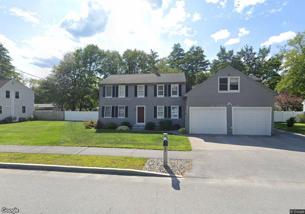
43 S Curtisville Rd Concord, NH 03301
East Concord NeighborhoodEstimated Value: $593,000 - $628,000
3
Beds
3
Baths
2,210
Sq Ft
$275/Sq Ft
Est. Value
About This Home
This home is located at 43 S Curtisville Rd, Concord, NH 03301 and is currently estimated at $608,699, approximately $275 per square foot. 43 S Curtisville Rd is a home located in Merrimack County with nearby schools including Broken Ground School, Rundlett Middle School, and Concord High School.
Ownership History
Date
Name
Owned For
Owner Type
Purchase Details
Closed on
Jul 25, 2017
Sold by
Sterl Bradford
Bought by
Martel Nathan R
Current Estimated Value
Home Financials for this Owner
Home Financials are based on the most recent Mortgage that was taken out on this home.
Original Mortgage
$274,928
Outstanding Balance
$228,972
Interest Rate
3.89%
Mortgage Type
FHA
Estimated Equity
$379,727
Purchase Details
Closed on
Feb 28, 2017
Sold by
Sterl Bradford
Bought by
Sterl Bradford
Purchase Details
Closed on
Nov 9, 2012
Sold by
Sterl Deborah L
Bought by
Sterl Bradford
Purchase Details
Closed on
Aug 23, 1988
Bought by
Sterl Bradford
Create a Home Valuation Report for This Property
The Home Valuation Report is an in-depth analysis detailing your home's value as well as a comparison with similar homes in the area
Home Values in the Area
Average Home Value in this Area
Purchase History
| Date | Buyer | Sale Price | Title Company |
|---|---|---|---|
| Martel Nathan R | $280,000 | -- | |
| Sterl Bradford | -- | -- | |
| Sterl Bradford | -- | -- | |
| Sterl Bradford | $137,000 | -- |
Source: Public Records
Mortgage History
| Date | Status | Borrower | Loan Amount |
|---|---|---|---|
| Open | Martel Nathan R | $274,928 | |
| Previous Owner | Sterl Bradford | $275,793 | |
| Previous Owner | Sterl Bradford | $245,000 |
Source: Public Records
Tax History Compared to Growth
Tax History
| Year | Tax Paid | Tax Assessment Tax Assessment Total Assessment is a certain percentage of the fair market value that is determined by local assessors to be the total taxable value of land and additions on the property. | Land | Improvement |
|---|---|---|---|---|
| 2024 | $11,201 | $404,500 | $103,700 | $300,800 |
| 2023 | $10,865 | $404,500 | $103,700 | $300,800 |
| 2022 | $10,473 | $404,500 | $103,700 | $300,800 |
| 2021 | $10,030 | $399,300 | $103,700 | $295,600 |
| 2020 | $9,717 | $363,100 | $76,200 | $286,900 |
| 2019 | $9,501 | $342,000 | $73,000 | $269,000 |
| 2018 | $8,900 | $315,700 | $73,000 | $242,700 |
| 2017 | $7,390 | $261,700 | $69,400 | $192,300 |
| 2016 | $7,380 | $266,700 | $71,200 | $195,500 |
| 2015 | $6,562 | $240,000 | $64,200 | $175,800 |
| 2014 | $6,434 | $240,000 | $64,200 | $175,800 |
| 2013 | $6,139 | $240,000 | $64,200 | $175,800 |
| 2012 | $5,890 | $241,700 | $64,200 | $177,500 |
Source: Public Records
Map
Nearby Homes
- 32 E Side Dr
- 8 NE Village Rd
- 12 E Side Dr Unit 4-13
- 17 Burns Ave Unit 2
- 11 Eastman St
- 294 Portsmouth St
- 59 Branch Turnpike
- 13 Ellsworth St
- 43 Branch Turnpike
- 50 Branch Turnpike
- 24 Cricket Ln
- 58 Branch Turnpike Unit 73
- 58 Branch Turnpike Unit 26
- 2 Shaker Rd
- 19 Grappone Dr
- 6 Heights Rd
- 61 Mountain Rd
- 6 Irving Dr
- 1 Guay St
- 6 Lawrence Street Extension
- 45 S Curtisville Rd
- 41 S Curtisville Rd
- 47 S Curtisville Rd
- 44 S Curtisville Rd
- 131 Portsmouth St
- 39 S Curtisville Rd
- 39 N Curtisville Rd
- 6 Dominique Dr
- 127 Portsmouth St
- 135 Portsmouth St
- 10 Dominique Dr
- 37 S Curtisville Rd
- 48 S Curtisville Rd
- 125 Portsmouth St
- 11 Hampton St
- 12 Dominique Dr
- 40 S Curtisville Rd
- 13 Hampton St
- 16 Dominique Dr
- 132 Portsmouth St