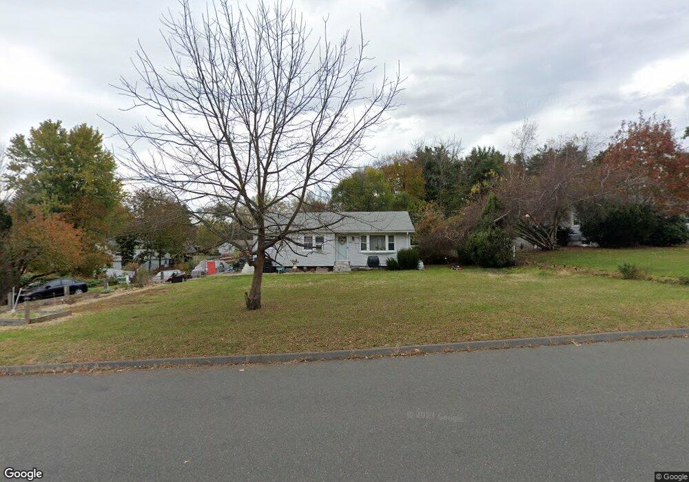
430 Benedict Dr South Windsor, CT 06074
Estimated Value: $339,000 - $354,000
3
Beds
2
Baths
990
Sq Ft
$348/Sq Ft
Est. Value
About This Home
This home is located at 430 Benedict Dr, South Windsor, CT 06074 and is currently estimated at $344,531, approximately $348 per square foot. 430 Benedict Dr is a home located in Hartford County with nearby schools including Timothy Edwards School, South Windsor High School, and St Bridget School.
Ownership History
Date
Name
Owned For
Owner Type
Purchase Details
Closed on
Aug 2, 2004
Sold by
Ferry Michael A
Bought by
Phillips Murry
Current Estimated Value
Home Financials for this Owner
Home Financials are based on the most recent Mortgage that was taken out on this home.
Original Mortgage
$140,000
Outstanding Balance
$70,445
Interest Rate
6.33%
Estimated Equity
$274,086
Purchase Details
Closed on
Feb 25, 1999
Sold by
Sheldon Patricia
Bought by
Ferry Michael
Home Financials for this Owner
Home Financials are based on the most recent Mortgage that was taken out on this home.
Original Mortgage
$91,200
Interest Rate
6.78%
Create a Home Valuation Report for This Property
The Home Valuation Report is an in-depth analysis detailing your home's value as well as a comparison with similar homes in the area
Home Values in the Area
Average Home Value in this Area
Purchase History
| Date | Buyer | Sale Price | Title Company |
|---|---|---|---|
| Phillips Murry | $194,000 | -- | |
| Ferry Michael | $129,500 | -- |
Source: Public Records
Mortgage History
| Date | Status | Borrower | Loan Amount |
|---|---|---|---|
| Open | Ferry Michael | $140,000 | |
| Previous Owner | Ferry Michael | $80,600 | |
| Previous Owner | Ferry Michael | $91,200 | |
| Previous Owner | Ferry Michael | $73,500 |
Source: Public Records
Tax History
| Year | Tax Paid | Tax Assessment Tax Assessment Total Assessment is a certain percentage of the fair market value that is determined by local assessors to be the total taxable value of land and additions on the property. | Land | Improvement |
|---|---|---|---|---|
| 2025 | $5,765 | $161,900 | $94,700 | $67,200 |
| 2024 | $5,579 | $161,900 | $94,700 | $67,200 |
| 2023 | $5,365 | $161,900 | $94,700 | $67,200 |
| 2022 | $4,873 | $125,700 | $87,700 | $38,000 |
| 2021 | $4,759 | $125,700 | $87,700 | $38,000 |
| 2020 | $4,762 | $125,700 | $87,700 | $38,000 |
| 2019 | $4,839 | $125,700 | $87,700 | $38,000 |
| 2018 | $4,735 | $125,700 | $87,700 | $38,000 |
| 2017 | $4,821 | $126,600 | $87,700 | $38,900 |
| 2016 | $4,727 | $126,600 | $87,700 | $38,900 |
| 2015 | $4,626 | $126,600 | $87,700 | $38,900 |
| 2014 | $4,496 | $126,600 | $87,700 | $38,900 |
Source: Public Records
Map
Nearby Homes
- 169 Avery St
- 35 Shares Ln Unit 35
- 413 Lady Bug Ln Unit 413
- 65 Foster St
- 486 Tolland Turnpike
- 195 Oakland St Unit A
- 48 Devonshire Dr
- 39 W Vernon St
- 136 Gilbert Ln
- 99 Union St
- 112 Gilbert Ln
- 295 Phoenix St
- 51 Carriage Dr
- 17 North St
- 85 Lydall St
- 266 Knollwood Rd
- 16 Coleman Rd
- 46 Green Rd
- 15 Stock Place
- 37 Vista View Ln Unit 37
- 420 Benedict Dr
- 136 Pine Tree Ln
- 124 Pine Tree Ln
- 410 Benedict Dr
- 146 Pine Tree Ln
- 425 Benedict Dr
- 419 Benedict Dr
- 400 Benedict Dr
- 154 Pine Tree Ln
- 110 Pine Tree Ln
- 5 Peach Tree Ln
- 13 Highview Rd
- 135 Pine Tree Ln
- 125 Pine Tree Ln
- 7 Highview Rd
- 145 Pine Tree Ln
- 160 Pine Tree Ln
- 19 Peach Tree Ln
- 115 Pine Tree Ln
- 21 Highview Rd