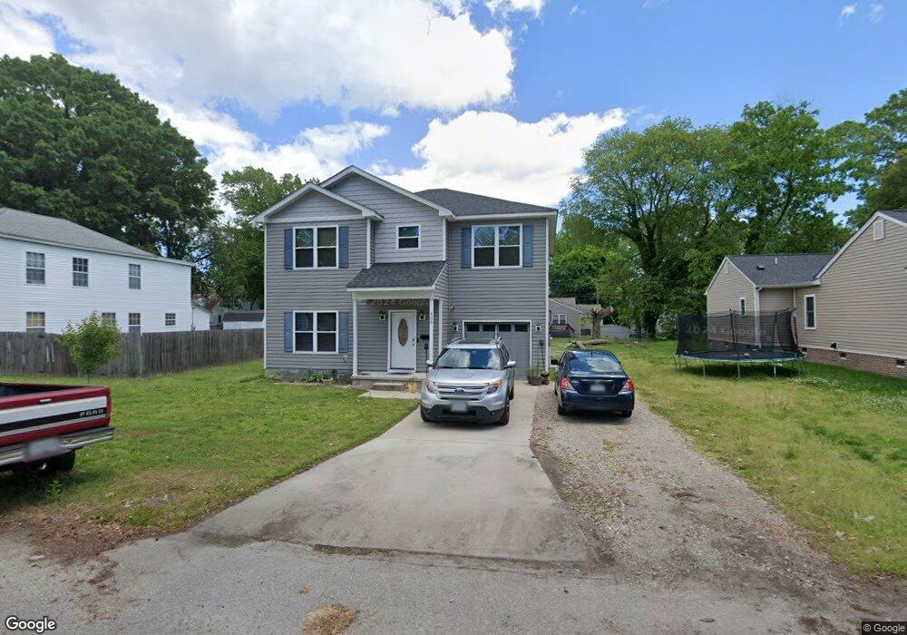
430 Highland Ave Hampton, VA 23661
Wythe NeighborhoodEstimated Value: $340,000 - $422,000
4
Beds
3
Baths
2,000
Sq Ft
$187/Sq Ft
Est. Value
About This Home
This home is located at 430 Highland Ave, Hampton, VA 23661 and is currently estimated at $373,428, approximately $186 per square foot. 430 Highland Ave is a home located in Hampton City with nearby schools including Hunter B. Andrews PK-8 School, C. Alton Lindsay Middle School, and Hampton High School.
Ownership History
Date
Name
Owned For
Owner Type
Purchase Details
Closed on
Jul 17, 2018
Sold by
Cff Properties Llc
Bought by
Kinsey Michael M and Kinsey Alesha
Current Estimated Value
Home Financials for this Owner
Home Financials are based on the most recent Mortgage that was taken out on this home.
Original Mortgage
$225,735
Outstanding Balance
$197,212
Interest Rate
4.87%
Mortgage Type
FHA
Estimated Equity
$176,216
Purchase Details
Closed on
Apr 7, 2016
Sold by
Lewis Britt Doris
Bought by
Cff Properties Llc A Virginia Limited Li
Create a Home Valuation Report for This Property
The Home Valuation Report is an in-depth analysis detailing your home's value as well as a comparison with similar homes in the area
Home Values in the Area
Average Home Value in this Area
Purchase History
| Date | Buyer | Sale Price | Title Company |
|---|---|---|---|
| Kinsey Michael M | $229,900 | Attorney | |
| Cff Properties Llc A Virginia Limited Li | $30,000 | Titlequest Of Hampton Roads |
Source: Public Records
Mortgage History
| Date | Status | Borrower | Loan Amount |
|---|---|---|---|
| Open | Kinsey Michael M | $225,735 |
Source: Public Records
Tax History
| Year | Tax Paid | Tax Assessment Tax Assessment Total Assessment is a certain percentage of the fair market value that is determined by local assessors to be the total taxable value of land and additions on the property. | Land | Improvement |
|---|---|---|---|---|
| 2025 | $3,782 | $332,700 | $45,000 | $287,700 |
| 2024 | $3,771 | $327,900 | $45,000 | $282,900 |
| 2023 | $3,437 | $296,300 | $45,000 | $251,300 |
| 2022 | $3,230 | $273,700 | $40,000 | $233,700 |
| 2021 | $2,940 | $237,100 | $34,000 | $203,100 |
| 2020 | $2,837 | $228,800 | $32,000 | $196,800 |
| 2019 | $2,807 | $226,400 | $35,000 | $191,400 |
| 2018 | $1,621 | $35,000 | $35,000 | $0 |
| 2017 | $434 | $0 | $0 | $0 |
Source: Public Records
Map
Nearby Homes
- 438 Highland Ave
- 405 Seminole Rd
- 423 Shenandoah Rd
- 429 Shenandoah Rd
- 615 Westwood Ave
- 3213 Shell Rd
- 3503 Fairfax Dr
- 621 Fairland Ave
- 632 Westwood Ave
- 428 Colonial Ave
- 3818 Shell Rd
- 714 Milford Ave
- 814 Downing St
- 15 Victor St
- 2711 Shell Rd
- 3308 Matoaka Rd
- 410 Worster Ave
- 416 Worster Ave
- 421 Glendale Rd
- 806 Fairland Ave
- 432 Highland Ave
- 426 Highland Ave
- 434 Highland Ave
- 427 Homestead Ave
- 425 Homestead Ave
- 420 Highland Ave
- 423 Homestead Ave
- 436 Highland Ave
- 421 Homestead Ave
- 431 Homestead Ave
- 433 Highland Ave
- 429 Highland Ave
- 427 Highland Ave
- 418 Highland Ave
- 431 Highland Ave
- 425 Highland Ave
- 423 Highland Ave
- 433 Homestead Ave
- 435 Highland Ave
- 421 Highland Ave
Your Personal Tour Guide
Ask me questions while you tour the home.