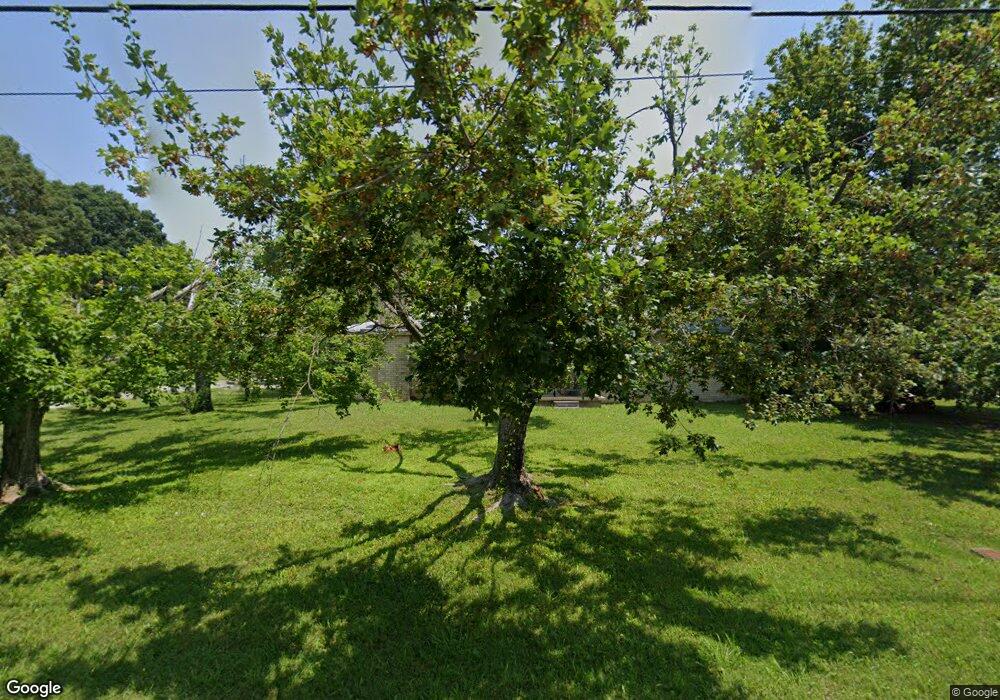
430 Old Stewart Rd Tennessee Ridge, TN 37178
Estimated Value: $171,304 - $235,000
--
Bed
1
Bath
1,400
Sq Ft
$141/Sq Ft
Est. Value
About This Home
This home is located at 430 Old Stewart Rd, Tennessee Ridge, TN 37178 and is currently estimated at $197,076, approximately $140 per square foot. 430 Old Stewart Rd is a home located in Houston County.
Ownership History
Date
Name
Owned For
Owner Type
Purchase Details
Closed on
Nov 8, 2006
Bought by
Collard Michael E and Collard Michelene
Current Estimated Value
Purchase Details
Closed on
Aug 17, 1991
Bought by
Maxwell Curtis C and Maxwell Jewell M
Purchase Details
Closed on
Oct 15, 1990
Bought by
Osborne Ellis and Osborne Bobby
Purchase Details
Closed on
Sep 16, 1983
Bought by
Osborne Rodger C and Osborne Alta M
Create a Home Valuation Report for This Property
The Home Valuation Report is an in-depth analysis detailing your home's value as well as a comparison with similar homes in the area
Home Values in the Area
Average Home Value in this Area
Purchase History
| Date | Buyer | Sale Price | Title Company |
|---|---|---|---|
| Collard Michael E | $52,800 | -- | |
| Maxwell Curtis C | $40,000 | -- | |
| Osborne Ellis | $27,000 | -- | |
| Osborne Rodger C | -- | -- |
Source: Public Records
Tax History Compared to Growth
Tax History
| Year | Tax Paid | Tax Assessment Tax Assessment Total Assessment is a certain percentage of the fair market value that is determined by local assessors to be the total taxable value of land and additions on the property. | Land | Improvement |
|---|---|---|---|---|
| 2024 | -- | $38,800 | $1,675 | $37,125 |
| 2023 | $871 | $38,800 | $1,675 | $37,125 |
| 2022 | $787 | $22,025 | $1,150 | $20,875 |
| 2021 | $776 | $22,025 | $1,150 | $20,875 |
| 2020 | $760 | $22,025 | $1,150 | $20,875 |
| 2019 | $760 | $19,050 | $1,625 | $17,425 |
| 2018 | $751 | $19,050 | $1,625 | $17,425 |
| 2017 | $751 | $19,050 | $1,625 | $17,425 |
| 2016 | $751 | $19,050 | $1,625 | $17,425 |
| 2015 | $751 | $19,050 | $1,625 | $17,425 |
| 2014 | -- | $19,038 | $0 | $0 |
Source: Public Records
Map
Nearby Homes
- 0 Carl Taylor Rd
- 110 Peachtree St
- 0 Taylor St Unit RTC2764409
- 0 Taylor St Unit RTC2764404
- 0 Taylor St Unit RTC2764411
- 0 Taylor St Unit RTC2764420
- 0 Taylor St Unit RTC2764418
- 0 Taylor St Unit RTC2764423
- 0 Taylor St Unit RTC2764415
- 0 Taylor Cir Unit RTC2764401
- 0 Taylor Cir Unit RTC2764358
- 0 Taylor Cir Unit RTC2764385
- 0 Taylor Cir Unit RTC2764390
- 155 Rolling Hills Dr
- 0 Main St N Unit RTC2988796
- 0 Main St N Unit RTC3003416
- 0 Main St N Unit RTC2987692
- 0 Main St N Unit RTC2988794
- 0 Main St N Unit RTC2988130
- 0 Main St N Unit RTC2988128
- 410 Old Stewart Rd
- 425 Old Stewart Rd
- 390 Old Stewart Rd
- 50 Towering Oaks Dr
- 470 Old Stewart Rd
- 445 Old Stewart Rd
- 30 Pond St
- 385 Old Stewart Rd
- 405 Old Stewart Rd
- 75 Towering Oaks Dr
- 55 Pine Dr
- 500 Old Stewart Rd
- 70 Pond St
- 15 Pine Dr
- 100 Towering Oaks Dr
- 365 Old Stewart Rd
- 75 Pine Dr
- 345 Old Stewart Rd
- 320 Old Stewart Rd
- 110 Towering Oaks Dr
