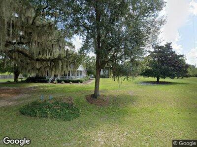
430 River Rd Lakeland, GA 31635
Estimated Value: $250,496 - $399,000
4
Beds
2
Baths
2,417
Sq Ft
$125/Sq Ft
Est. Value
About This Home
This home is located at 430 River Rd, Lakeland, GA 31635 and is currently estimated at $302,624, approximately $125 per square foot. 430 River Rd is a home located in Lanier County with nearby schools including Lanier County Elementary School, Lanier County Middle School, and Lanier County High School.
Ownership History
Date
Name
Owned For
Owner Type
Purchase Details
Closed on
Mar 10, 2017
Sold by
Cerrone Patricia
Bought by
Bolling Christopher D
Current Estimated Value
Home Financials for this Owner
Home Financials are based on the most recent Mortgage that was taken out on this home.
Original Mortgage
$171,000
Interest Rate
4.17%
Mortgage Type
New Conventional
Purchase Details
Closed on
Jul 11, 2013
Sold by
Farmers & Merchants Bank
Bought by
Cerrone Patricia
Home Financials for this Owner
Home Financials are based on the most recent Mortgage that was taken out on this home.
Original Mortgage
$120,000
Interest Rate
4%
Mortgage Type
New Conventional
Purchase Details
Closed on
May 1, 2012
Sold by
Roe George J
Bought by
Farmers & Merchants Bank
Create a Home Valuation Report for This Property
The Home Valuation Report is an in-depth analysis detailing your home's value as well as a comparison with similar homes in the area
Home Values in the Area
Average Home Value in this Area
Purchase History
| Date | Buyer | Sale Price | Title Company |
|---|---|---|---|
| Bolling Christopher D | $180,000 | -- | |
| Cerrone Patricia | $150,000 | -- | |
| Farmers & Merchants Bank | -- | -- |
Source: Public Records
Mortgage History
| Date | Status | Borrower | Loan Amount |
|---|---|---|---|
| Closed | Bolling Rentals Llc | $62,028 | |
| Open | Bolling Christopher | $164,000 | |
| Closed | Bolling Christopher D | $171,000 | |
| Previous Owner | Cerrone Patricia | $120,000 |
Source: Public Records
Tax History Compared to Growth
Tax History
| Year | Tax Paid | Tax Assessment Tax Assessment Total Assessment is a certain percentage of the fair market value that is determined by local assessors to be the total taxable value of land and additions on the property. | Land | Improvement |
|---|---|---|---|---|
| 2024 | $2,250 | $85,040 | $6,720 | $78,320 |
| 2023 | $1,515 | $49,708 | $4,200 | $45,508 |
| 2022 | $1,515 | $49,708 | $4,200 | $45,508 |
| 2021 | $1,612 | $49,708 | $4,200 | $45,508 |
| 2020 | $1,624 | $49,708 | $4,200 | $45,508 |
| 2019 | $1,624 | $49,708 | $4,200 | $45,508 |
| 2018 | $1,624 | $49,708 | $4,200 | $45,508 |
| 2017 | $1,626 | $49,708 | $4,200 | $45,508 |
| 2016 | $1,632 | $49,708 | $4,200 | $45,508 |
| 2015 | -- | $49,708 | $4,200 | $45,508 |
| 2014 | -- | $49,708 | $4,200 | $45,508 |
| 2013 | -- | $49,708 | $4,200 | $45,508 |
Source: Public Records
Map
Nearby Homes
- 41 Browning Ln
- 23 Browning Ln
- 631 River Rd
- 288 U S 221
- 10 Acres Hwy 221
- 31 Acres Hwy 221
- TBT River Rd
- 8 ACRE Hwy 221
- 111 E Bostick Ave
- 46 E Bostick Ave
- 23 E Bostick Ave
- 58 S Lakeshore Dr
- 0 Georgia 37
- 15 Studstill St
- 94 W Thigpen Ave
- 13 W Lee Ave
- 13 Pine Breeze Ct
- 161 W Main St
- 12 Pine Breeze Cir
- 77 E Howell Dr