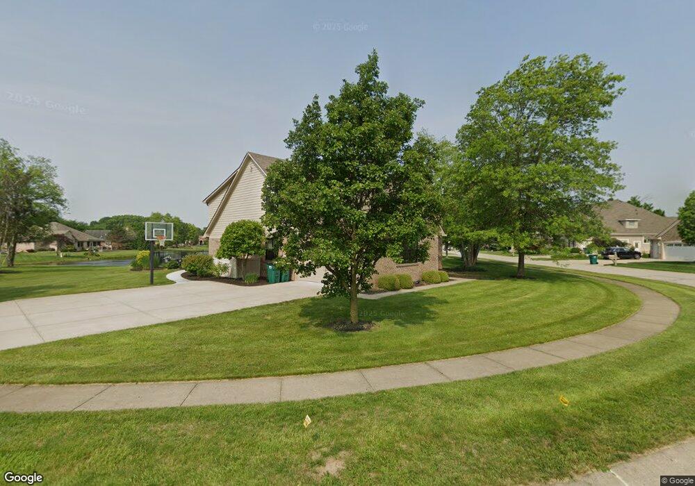
430 Saint Andrews Dr Franklin, IN 46131
Estimated Value: $477,856 - $587,000
4
Beds
3
Baths
2,662
Sq Ft
$195/Sq Ft
Est. Value
About This Home
This home is located at 430 Saint Andrews Dr, Franklin, IN 46131 and is currently estimated at $519,214, approximately $195 per square foot. 430 Saint Andrews Dr is a home located in Johnson County with nearby schools including Needham Elementary School, Franklin Community Middle School, and Custer Baker Intermediate School.
Ownership History
Date
Name
Owned For
Owner Type
Purchase Details
Closed on
Feb 26, 2018
Sold by
Smythe James Mark and Smythe Tanya L
Bought by
Hornung Timothy J and Roberts Jennifer
Current Estimated Value
Home Financials for this Owner
Home Financials are based on the most recent Mortgage that was taken out on this home.
Original Mortgage
$220,000
Outstanding Balance
$187,484
Interest Rate
4.15%
Mortgage Type
New Conventional
Estimated Equity
$331,730
Purchase Details
Closed on
Dec 6, 2012
Sold by
Woodard Hope R
Bought by
Smythe James Mark and Smythe Tanya L
Home Financials for this Owner
Home Financials are based on the most recent Mortgage that was taken out on this home.
Original Mortgage
$257,306
Interest Rate
3.37%
Mortgage Type
FHA
Purchase Details
Closed on
Nov 8, 2010
Sold by
Woodard Hoper R and Woodard Philip D
Bought by
Johnson Hope R
Home Financials for this Owner
Home Financials are based on the most recent Mortgage that was taken out on this home.
Original Mortgage
$256,000
Interest Rate
4.27%
Mortgage Type
New Conventional
Purchase Details
Closed on
Oct 29, 2010
Sold by
Woodard Hope R
Bought by
Smythe James and Smythe Tanya L
Home Financials for this Owner
Home Financials are based on the most recent Mortgage that was taken out on this home.
Original Mortgage
$256,000
Interest Rate
4.27%
Mortgage Type
New Conventional
Purchase Details
Closed on
Apr 30, 2007
Sold by
Blackwell Deborah J
Bought by
Woodard Hope R and Woodard Phillip D
Home Financials for this Owner
Home Financials are based on the most recent Mortgage that was taken out on this home.
Original Mortgage
$265,000
Interest Rate
6.2%
Mortgage Type
New Conventional
Purchase Details
Closed on
Nov 27, 2006
Sold by
Hampton Dan L and Hampton Lisa A
Bought by
Blackwell Deborah J
Home Financials for this Owner
Home Financials are based on the most recent Mortgage that was taken out on this home.
Original Mortgage
$230,000
Interest Rate
8.97%
Mortgage Type
Adjustable Rate Mortgage/ARM
Create a Home Valuation Report for This Property
The Home Valuation Report is an in-depth analysis detailing your home's value as well as a comparison with similar homes in the area
Home Values in the Area
Average Home Value in this Area
Purchase History
| Date | Buyer | Sale Price | Title Company |
|---|---|---|---|
| Hornung Timothy J | -- | -- | |
| Smythe James Mark | -- | None Available | |
| Johnson Hope R | -- | Nations Title Agency Inc | |
| Smythe James | $268,500 | None Available | |
| Woodard Hope R | -- | None Available | |
| Blackwell Deborah J | -- | None Available |
Source: Public Records
Mortgage History
| Date | Status | Borrower | Loan Amount |
|---|---|---|---|
| Open | Hornung Timothy J | $220,000 | |
| Previous Owner | Smythe James Mark | $257,306 | |
| Previous Owner | Johnson Hope R | $256,000 | |
| Previous Owner | Smythe James | $256,102 | |
| Previous Owner | Woodard Hope R | $265,000 | |
| Previous Owner | Blackwell Deborah J | $230,000 |
Source: Public Records
Tax History Compared to Growth
Tax History
| Year | Tax Paid | Tax Assessment Tax Assessment Total Assessment is a certain percentage of the fair market value that is determined by local assessors to be the total taxable value of land and additions on the property. | Land | Improvement |
|---|---|---|---|---|
| 2025 | $4,224 | $393,200 | $39,000 | $354,200 |
| 2024 | $4,224 | $378,500 | $39,000 | $339,500 |
| 2023 | $4,367 | $381,000 | $39,000 | $342,000 |
| 2022 | $4,066 | $357,400 | $36,100 | $321,300 |
| 2021 | $3,414 | $297,400 | $36,100 | $261,300 |
| 2020 | $2,980 | $258,200 | $36,100 | $222,100 |
| 2019 | $2,976 | $258,200 | $36,100 | $222,100 |
| 2018 | $2,722 | $262,700 | $36,100 | $226,600 |
| 2017 | $2,623 | $244,800 | $36,100 | $208,700 |
| 2016 | $2,409 | $237,300 | $36,100 | $201,200 |
| 2014 | $2,255 | $209,000 | $36,100 | $172,900 |
| 2013 | $2,255 | $210,900 | $36,100 | $174,800 |
Source: Public Records
Map
Nearby Homes
- 2117 Jennifer Ct
- 1990 Red Oak Dr
- 1850 Longest Dr
- 1083 Beechtree Ln
- 1185 Beechtree Ln
- 1682 Millpond Ln
- 1669 Millpond Ln
- 1646 Millpond Ln
- 1636 Millpond Ln
- 1679 Millpond Ln
- 1690 Millpond Ln
- 1642 Millpond Ln
- 1663 Millpond Ln
- 1640 Millpond Ln
- 1650 Millpond Ln
- 1654 Millpond Ln
- 1660 Millpond Ln
- 1653 Millpond Ln
- 1686 Millpond Ln
- 1630 Millpond Ln
- 2075 Saint Andrews Ct
- 420 Saint Andrews Dr
- 2080 Saint Andrews Ct
- 2060 Saint Andrews Ct
- 2055 Saint Andrews Ct
- 435 Saint Andrews Dr
- 2090 Saint Andrews Ct
- 425 Saint Andrews Dr
- 410 Saint Andrews Dr
- 445 Saint Andrews Dr
- 2080 Fairway Lakes Dr
- 415 St Andrews Dr
- 415 Saint Andrews Dr
- 2070 Fairway Lakes Dr
- 2035 Saint Andrews Ct
- 2040 Saint Andrews Ct
- 510 Paris Dr
- 0 St Andrews Dr Unit 21053550
- 0 St Andrews Dr Unit 21151974