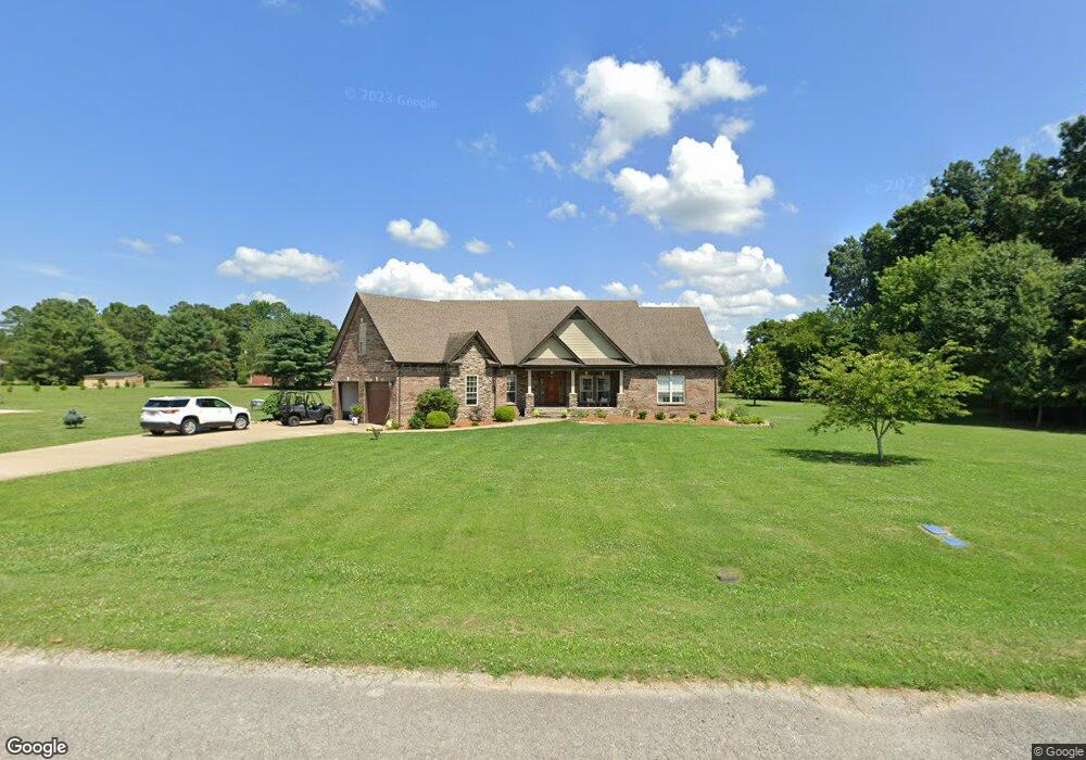
430 Sundance Dr Lawrenceburg, TN 38464
Estimated Value: $427,000 - $513,000
--
Bed
1
Bath
2,326
Sq Ft
$197/Sq Ft
Est. Value
About This Home
This home is located at 430 Sundance Dr, Lawrenceburg, TN 38464 and is currently estimated at $458,822, approximately $197 per square foot. 430 Sundance Dr is a home with nearby schools including Ingram Sowell Elementary School, Lawrenceburg Public Elementary School, and David Crockett Elementary School.
Ownership History
Date
Name
Owned For
Owner Type
Purchase Details
Closed on
Oct 14, 2010
Bought by
Evers Cyril
Current Estimated Value
Purchase Details
Closed on
Jun 25, 2004
Bought by
Ez Properties
Purchase Details
Closed on
Aug 16, 2001
Sold by
Daniel Larry W
Bought by
First Farmers & Merchants
Purchase Details
Closed on
Oct 30, 1978
Bought by
Daniels Larry and Daniels Linda
Create a Home Valuation Report for This Property
The Home Valuation Report is an in-depth analysis detailing your home's value as well as a comparison with similar homes in the area
Home Values in the Area
Average Home Value in this Area
Purchase History
| Date | Buyer | Sale Price | Title Company |
|---|---|---|---|
| Evers Cyril | -- | -- | |
| Ez Properties | $250,000 | -- | |
| First Farmers & Merchants | $200,000 | -- | |
| Daniels Larry | -- | -- |
Source: Public Records
Tax History Compared to Growth
Tax History
| Year | Tax Paid | Tax Assessment Tax Assessment Total Assessment is a certain percentage of the fair market value that is determined by local assessors to be the total taxable value of land and additions on the property. | Land | Improvement |
|---|---|---|---|---|
| 2025 | $2,960 | $95,250 | $0 | $0 |
| 2024 | $2,960 | $95,250 | $7,775 | $87,475 |
| 2023 | $2,960 | $95,250 | $7,775 | $87,475 |
| 2022 | $2,960 | $95,250 | $7,775 | $87,475 |
| 2021 | $2,676 | $60,875 | $3,400 | $57,475 |
| 2020 | $2,676 | $60,875 | $3,400 | $57,475 |
| 2019 | $2,676 | $60,875 | $3,400 | $57,475 |
| 2018 | $2,676 | $60,875 | $3,400 | $57,475 |
| 2017 | $2,676 | $60,875 | $3,400 | $57,475 |
| 2016 | $2,676 | $60,875 | $3,400 | $57,475 |
| 2015 | $2,534 | $60,875 | $3,400 | $57,475 |
| 2014 | $2,336 | $56,125 | $3,400 | $52,725 |
Source: Public Records
Map
Nearby Homes
- 114 Hummingbird Ln
- 132 Sundance Dr
- 52 Beuerlein Cir
- 14 Delana Ave
- 975 Weakley Creek Rd
- 4000 Weakley Creek Rd
- 4951 Weakley Creek Rd
- 970 9th St
- 14 Community Rd
- 801 Douglas Dr
- 1303 5th Ave
- 717 Toben Terrace
- 48 Woodland Cir
- 31 Community Rd
- 802 Daniel Dr
- 546 Kent St
- 602 7th St
- 545 Kent St
- 335 Robins St
- 507 Kent St
- 448 Sundance Dr
- 385 Sundance Dr
- 427 Sundance Dr
- 2160 Pine Ridge Dr
- 2150 Pine Ridge Dr
- 2200 Pine Ridge Dr
- 42 Glade Ct
- 466 Sundance Dr
- 101 Hummingbird Ln
- 2170 Pine Ridge Dr
- 508 Sundance Dr
- 553 Weakley Creek Rd
- 1980 Lance Dr
- 100 Hummingbird Ln
- 2155 Pine Ridge Dr
- 0 Hummingbird Ln Unit 1667113
- 2180 Pine Ridge Dr
- 563 Weakley Creek Rd
- 72 Hummingbird Ln
- 47 Hummingbird Ln