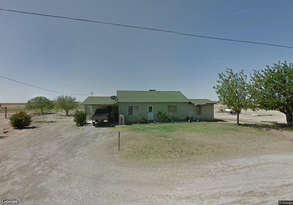
4301 Brantley Rd Carlsbad, NM 88220
Estimated Value: $231,000 - $560,565
3
Beds
2
Baths
2,918
Sq Ft
$136/Sq Ft
Est. Value
About This Home
This home is located at 4301 Brantley Rd, Carlsbad, NM 88220 and is currently estimated at $397,188, approximately $136 per square foot. 4301 Brantley Rd is a home located in Eddy County with nearby schools including Loving Elementary School, Loving Middle School, and Loving High School.
Ownership History
Date
Name
Owned For
Owner Type
Purchase Details
Closed on
Sep 4, 2020
Sold by
Jones Robert C and Greenwood Kathy L
Bought by
Carrasco Jesus and Carrasco Kimberly
Current Estimated Value
Home Financials for this Owner
Home Financials are based on the most recent Mortgage that was taken out on this home.
Original Mortgage
$600,000
Interest Rate
2.9%
Mortgage Type
Commercial
Purchase Details
Closed on
Aug 25, 2020
Sold by
Gard Williams Frances Lee and Williams Lesley S
Bought by
Jones Robert and Greenwood Kathy
Home Financials for this Owner
Home Financials are based on the most recent Mortgage that was taken out on this home.
Original Mortgage
$600,000
Interest Rate
2.9%
Mortgage Type
Commercial
Create a Home Valuation Report for This Property
The Home Valuation Report is an in-depth analysis detailing your home's value as well as a comparison with similar homes in the area
Home Values in the Area
Average Home Value in this Area
Purchase History
| Date | Buyer | Sale Price | Title Company |
|---|---|---|---|
| Carrasco Jesus | -- | None Available | |
| Jones Robert | -- | Pioneer Title And Escrow |
Source: Public Records
Mortgage History
| Date | Status | Borrower | Loan Amount |
|---|---|---|---|
| Previous Owner | Carrasco Jesus | $600,000 |
Source: Public Records
Tax History Compared to Growth
Tax History
| Year | Tax Paid | Tax Assessment Tax Assessment Total Assessment is a certain percentage of the fair market value that is determined by local assessors to be the total taxable value of land and additions on the property. | Land | Improvement |
|---|---|---|---|---|
| 2025 | $1,666 | $128,713 | $20,033 | $108,680 |
| 2024 | $1,666 | $125,305 | $20,033 | $105,272 |
| 2023 | $1,666 | $123,143 | $20,033 | $103,110 |
| 2022 | $1,616 | $120,420 | $20,033 | $100,387 |
| 2021 | $1,672 | $117,254 | $20,033 | $97,221 |
| 2020 | $1,750 | $106,534 | $17,515 | $89,019 |
| 2019 | $1,532 | $103,773 | $16,494 | $87,279 |
| 2018 | $1,378 | $90,977 | $7,853 | $83,124 |
| 2017 | $1,973 | $88,495 | $7,917 | $80,578 |
| 2015 | $1,545 | $0 | $0 | $0 |
| 2014 | $1,342 | $0 | $0 | $0 |
Source: Public Records
Map
Nearby Homes
- 4029 E Derrick Rd
- R233 - K Carrasco Rd
- 6015 Grandi Rd
- 1000 E Derrick Rd
- E of 5508 Avitia
- 1510 Papershell Rd
- 612 W Cedar St
- 1618 Skyline Dr
- 1610 Skyline Dr
- 309 S Sixth St
- 203 S 6th St
- 5504 S Thomason Rd
- 270 Onsurez Rd
- E E Harkness Rd
- 1601 Cottontop Rd
- 4407 S Thomason Rd
- 1028 Murray Dr
- 7000 Old Cavern Hwy
- 1024 Malibu Way
- E of 503 Seneca Ln
- 4301 Brantley Rd Unit 4301-2 Brantley Rd
- 4401 Brantley Rd
- 2497 Pecos Hwy
- 4221 Brantley Rd
- 2519 Pecos Hwy
- 2519 Pecos Hwy
- 4228 Brantley Rd
- 4215 Brantley Rd
- 3 S Roberson Rd
- 4116 Brantley Rd
- 7220 Porter Rd
- 2539 Pecos Hwy Unit 2541 Pecos Hwy
- 2539 Pecos Hwy
- 7218 Porter Rd
- 2541 Pecos Hwy
- 2541 Pecos Hwy
- 4008 Brantley Rd
- 7216 Porter Rd
- 7004 Porter Rd
- 34 S Roberson Rd