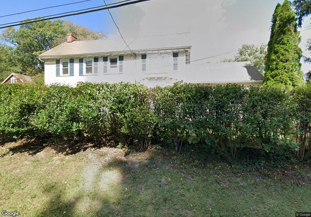
4301 Durham Rd Doylestown, PA 18902
Estimated Value: $657,000 - $896,000
4
Beds
2
Baths
2,002
Sq Ft
$368/Sq Ft
Est. Value
About This Home
This home is located at 4301 Durham Rd, Doylestown, PA 18902 and is currently estimated at $736,265, approximately $367 per square foot. 4301 Durham Rd is a home located in Bucks County with nearby schools including Cold Spring Elementary School, Holicong Middle School, and Central Bucks High School - East.
Ownership History
Date
Name
Owned For
Owner Type
Purchase Details
Closed on
Apr 27, 1998
Sold by
Kozlosky Barbara A
Bought by
Walsh Matthew T and Walsh Alison B
Current Estimated Value
Home Financials for this Owner
Home Financials are based on the most recent Mortgage that was taken out on this home.
Original Mortgage
$180,000
Interest Rate
6.9%
Purchase Details
Closed on
Apr 6, 1994
Sold by
Kozlosky Frank P and Kozlosky Barbara
Bought by
Kozlosky Barbara A
Create a Home Valuation Report for This Property
The Home Valuation Report is an in-depth analysis detailing your home's value as well as a comparison with similar homes in the area
Home Values in the Area
Average Home Value in this Area
Purchase History
| Date | Buyer | Sale Price | Title Company |
|---|---|---|---|
| Walsh Matthew T | $240,000 | -- | |
| Kozlosky Barbara A | -- | -- |
Source: Public Records
Mortgage History
| Date | Status | Borrower | Loan Amount |
|---|---|---|---|
| Previous Owner | Walsh Matthew T | $180,000 | |
| Closed | Walsh Matthew T | $36,000 |
Source: Public Records
Tax History
| Year | Tax Paid | Tax Assessment Tax Assessment Total Assessment is a certain percentage of the fair market value that is determined by local assessors to be the total taxable value of land and additions on the property. | Land | Improvement |
|---|---|---|---|---|
| 2025 | $4,819 | $29,600 | $10,960 | $18,640 |
| 2024 | $4,819 | $29,600 | $10,960 | $18,640 |
| 2023 | $4,656 | $29,600 | $10,960 | $18,640 |
| 2022 | $4,600 | $29,600 | $10,960 | $18,640 |
| 2021 | $4,545 | $29,600 | $10,960 | $18,640 |
| 2020 | $4,545 | $29,600 | $10,960 | $18,640 |
| 2019 | $2,294 | $29,600 | $10,960 | $18,640 |
| 2018 | $4,515 | $29,600 | $10,960 | $18,640 |
| 2017 | $4,478 | $29,600 | $10,960 | $18,640 |
| 2016 | $4,523 | $29,600 | $10,960 | $18,640 |
| 2015 | -- | $29,600 | $10,960 | $18,640 |
| 2014 | -- | $29,600 | $10,960 | $18,640 |
Source: Public Records
Map
Nearby Homes
- 4925 Redfield Rd
- 6680 Point Pleasant Pike
- 5182 Point Pleasant Pike
- 5730 Carversville Rd
- 5491 Long Ln
- 4964 Point Pleasant Pike
- 5829 Ridgeview Dr
- 5805 Ridgeview Dr
- 4848 Tall Oak Ct
- 4533 Deep Creek Way
- 3468 Holicong Rd
- 4190 Milords Ln
- 3689 Hancock Ln
- 4928 Edgewood Rd
- 5987 Point Pleasant Pike
- 4525 Deep Glen Way
- 6185 Mechanicsville Rd
- 4672 Woodfield Cir
- 4777 Old Easton Rd
- 6163 Carversville Rd
- 5189 Woodward Dr
- 4315 Durham Rd
- 5188 Woodward Dr
- 4321 Durham Rd
- 5171 Woodward Dr
- 5240 Carversville Rd
- 4279 Brayson Ln
- 4230 Durham Rd
- 5230 Carversville Rd
- 5153 Woodward Dr
- 5154 Woodward Dr
- 4285 Brayson Ln
- 4290 Salem St
- 5220 Carversville Rd
- 4290 Brayson Ln
- 4304 Salem St
- 4318 Salem St
- 4274 Salem St
- 4351 Durham Rd
- 4258 Salem St