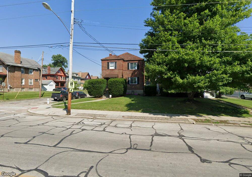
4301 Forest Ave Unit 30 Cincinnati, OH 45212
Estimated Value: $393,000 - $515,000
3
Beds
3
Baths
2,520
Sq Ft
$177/Sq Ft
Est. Value
About This Home
This home is located at 4301 Forest Ave Unit 30, Cincinnati, OH 45212 and is currently estimated at $446,998, approximately $177 per square foot. 4301 Forest Ave Unit 30 is a home located in Hamilton County with nearby schools including Norwood High School, Cornerstone Christian Academy, and Immaculate Conception Academy.
Ownership History
Date
Name
Owned For
Owner Type
Purchase Details
Closed on
Apr 25, 2016
Sold by
Redwine William H
Bought by
Wood Adam W and Wood Tara N
Current Estimated Value
Home Financials for this Owner
Home Financials are based on the most recent Mortgage that was taken out on this home.
Interest Rate
3.59%
Purchase Details
Closed on
Mar 8, 2016
Sold by
Mcgarth Patrick R
Bought by
Redwine William H and Redwine Patsy F
Home Financials for this Owner
Home Financials are based on the most recent Mortgage that was taken out on this home.
Interest Rate
3.59%
Purchase Details
Closed on
Sep 26, 2013
Sold by
Abati Valerie M and Schneider Erick
Bought by
Mcgrath Patrick R
Home Financials for this Owner
Home Financials are based on the most recent Mortgage that was taken out on this home.
Original Mortgage
$160,000
Interest Rate
4.5%
Mortgage Type
New Conventional
Purchase Details
Closed on
Sep 22, 2009
Sold by
Norris Richard M and Norris Pam
Bought by
Abati Valerie M
Home Financials for this Owner
Home Financials are based on the most recent Mortgage that was taken out on this home.
Original Mortgage
$174,400
Interest Rate
5.19%
Mortgage Type
New Conventional
Purchase Details
Closed on
Aug 25, 2003
Sold by
Meade Douglas W and Meade Tianne J
Bought by
Norris Richard M
Home Financials for this Owner
Home Financials are based on the most recent Mortgage that was taken out on this home.
Original Mortgage
$180,000
Interest Rate
4.75%
Mortgage Type
Purchase Money Mortgage
Purchase Details
Closed on
Jul 25, 1997
Sold by
Lane Daniel Paul and Lane Dianna L
Bought by
Meade Douglas W and Meade Tianne J
Home Financials for this Owner
Home Financials are based on the most recent Mortgage that was taken out on this home.
Original Mortgage
$50,000
Interest Rate
7.68%
Purchase Details
Closed on
Dec 29, 1994
Sold by
Mckechnie Arthur
Bought by
Lane Daniel Paul and Lane Dianna L
Home Financials for this Owner
Home Financials are based on the most recent Mortgage that was taken out on this home.
Original Mortgage
$29,585
Interest Rate
9.24%
Mortgage Type
Seller Take Back
Create a Home Valuation Report for This Property
The Home Valuation Report is an in-depth analysis detailing your home's value as well as a comparison with similar homes in the area
Home Values in the Area
Average Home Value in this Area
Purchase History
| Date | Buyer | Sale Price | Title Company |
|---|---|---|---|
| Wood Adam W | $264,500 | -- | |
| Redwine William H | $246,000 | -- | |
| Mcgrath Patrick R | $230,000 | Fidelity National Title | |
| Abati Valerie M | $218,000 | Attorney | |
| Norris Richard M | $180,000 | -- | |
| Meade Douglas W | $35,000 | -- | |
| Lane Daniel Paul | -- | -- |
Source: Public Records
Mortgage History
| Date | Status | Borrower | Loan Amount |
|---|---|---|---|
| Closed | Redwine William H | -- | |
| Previous Owner | Redwine William H | -- | |
| Previous Owner | Mcgrath Patrick R | $160,000 | |
| Previous Owner | Abati Valerie M | $174,400 | |
| Previous Owner | Norris Richard M | $180,000 | |
| Previous Owner | Meade Douglas W | $50,000 | |
| Previous Owner | Lane Daniel Paul | $29,585 |
Source: Public Records
Tax History
| Year | Tax Paid | Tax Assessment Tax Assessment Total Assessment is a certain percentage of the fair market value that is determined by local assessors to be the total taxable value of land and additions on the property. | Land | Improvement |
|---|---|---|---|---|
| 2025 | $7,347 | $202,511 | $38,798 | $163,713 |
| 2024 | $7,248 | $121,118 | $38,798 | $82,320 |
| 2023 | $7,405 | $121,118 | $38,798 | $82,320 |
| 2022 | $7,567 | $111,091 | $23,272 | $87,819 |
| 2021 | $7,290 | $111,091 | $23,272 | $87,819 |
| 2020 | $7,497 | $111,091 | $23,272 | $87,819 |
| 2019 | $6,832 | $92,576 | $19,394 | $73,182 |
| 2018 | $6,842 | $92,576 | $19,394 | $73,182 |
| 2017 | $6,505 | $92,576 | $19,394 | $73,182 |
| 2016 | $5,746 | $80,501 | $14,739 | $65,762 |
| 2015 | $5,177 | $80,501 | $14,739 | $65,762 |
| 2014 | $5,213 | $80,501 | $14,739 | $65,762 |
| 2013 | $5,027 | $76,301 | $13,521 | $62,780 |
Source: Public Records
Map
Nearby Homes
- 4317 Smith Rd
- 4308 Smith Rd
- 2432 Robertson Ave
- 2604 Melrose Ave
- 2620 Melrose Ave
- 4026 Burwood Ave
- 4311 Beech St
- 4010 S Jefferson Ave
- 2223 Madison Ave
- 2557 Shanmoor Ave
- 2241 Cameron Ave
- 3933 Grove Ave
- 2718 Minot Ave
- 4217 28th St
- 2724 Markbreit Ave
- 4206 Lafayette Ave
- 3950 Elsmere Ave
- 3912 Edwards Rd
- 2049 Sherman Ave
- 3908 Edwards Rd
- 4301 Forest Ave
- 4305 Forest Ave
- 4305 Forest Ave Unit 30
- 4303 Forest Ave Unit THIRTY
- 4309 Forest Ave Unit THIRTY
- 4309 Forest Ave Unit THIRTY
- 2320 Washington Ave
- 4315 Forest Ave Unit THIRTY
- 4317 Forest Ave Unit THIRTY
- 4317 Forest Ave Unit THIRTY
- 4319 Forest Ave Unit THIRTY
- 4245 Forest Ave
- 4323 Forest Ave Unit THIRTY
- 4311 Forest Ave Unit THIRTY
- 4327 Forest Ave Unit THIRTY
- 4329 Forest Ave Unit THIRTY
- 2318 Washington Ave
- 4331 Forest Ave Unit THIRTY
- 4333 Forest Ave Unit THIRTY
- 2325 Washington Ave
Your Personal Tour Guide
Ask me questions while you tour the home.