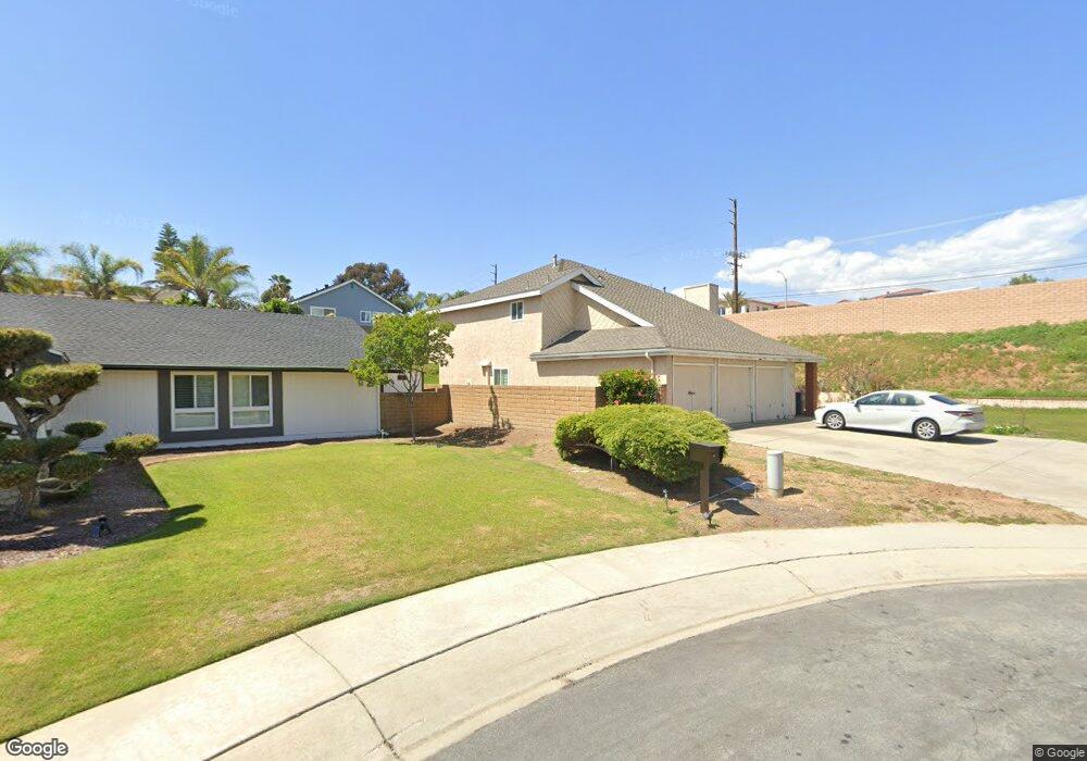
4301 San Pablo Cir Yorba Linda, CA 92886
Estimated Value: $1,445,000 - $1,592,000
4
Beds
3
Baths
2,546
Sq Ft
$599/Sq Ft
Est. Value
About This Home
This home is located at 4301 San Pablo Cir, Yorba Linda, CA 92886 and is currently estimated at $1,525,550, approximately $599 per square foot. 4301 San Pablo Cir is a home located in Orange County with nearby schools including Mabel M. Paine Elementary, Yorba Linda Middle School, and Yorba Linda High School.
Ownership History
Date
Name
Owned For
Owner Type
Purchase Details
Closed on
Mar 21, 1997
Sold by
Beck Roy R and Beck Enedelia
Bought by
Wakai Robert J and Wakai Coleen Yuri
Current Estimated Value
Home Financials for this Owner
Home Financials are based on the most recent Mortgage that was taken out on this home.
Original Mortgage
$160,000
Outstanding Balance
$19,609
Interest Rate
7.86%
Estimated Equity
$1,505,941
Create a Home Valuation Report for This Property
The Home Valuation Report is an in-depth analysis detailing your home's value as well as a comparison with similar homes in the area
Home Values in the Area
Average Home Value in this Area
Purchase History
| Date | Buyer | Sale Price | Title Company |
|---|---|---|---|
| Wakai Robert J | $271,000 | Fidelity National Title Ins |
Source: Public Records
Mortgage History
| Date | Status | Borrower | Loan Amount |
|---|---|---|---|
| Open | Wakai Robert J | $160,000 |
Source: Public Records
Tax History Compared to Growth
Tax History
| Year | Tax Paid | Tax Assessment Tax Assessment Total Assessment is a certain percentage of the fair market value that is determined by local assessors to be the total taxable value of land and additions on the property. | Land | Improvement |
|---|---|---|---|---|
| 2025 | $5,148 | $441,365 | $238,045 | $203,320 |
| 2024 | $5,148 | $432,711 | $233,377 | $199,334 |
| 2023 | $5,048 | $424,227 | $228,801 | $195,426 |
| 2022 | $4,988 | $415,909 | $224,314 | $191,595 |
| 2021 | $4,896 | $407,754 | $219,915 | $187,839 |
| 2020 | $4,792 | $403,573 | $217,660 | $185,913 |
| 2019 | $4,626 | $395,660 | $213,392 | $182,268 |
| 2018 | $4,567 | $387,902 | $209,207 | $178,695 |
| 2017 | $4,492 | $380,297 | $205,105 | $175,192 |
| 2016 | $4,402 | $372,841 | $201,084 | $171,757 |
| 2015 | $4,347 | $367,241 | $198,063 | $169,178 |
| 2014 | $4,219 | $360,048 | $194,183 | $165,865 |
Source: Public Records
Map
Nearby Homes
- 4302 Eureka Ave
- 18141 Bastanchury Rd
- 18118 Joel Brattain Dr
- 18211 Joel Brattain Dr
- 17781 Lerene Dr
- 18302 Piper Place
- 4317 Canyon Coral Ln
- 4845 Eisenhower Ct
- 4891 Eureka Ave Unit 25
- 3880 Hogan Dr
- 18345 Watson Way
- 18534 Cobblestone Ct
- 18568 Arbor Gate Ln
- 18044 Burke Ln
- 18083 Burke Ln
- 4125 Temhurst Ct
- 18640 Seabiscuit Run
- 18665 Seabiscuit Run
- 5141 Siesta Ln
- 17411 Bramble Ct
- 4311 San Pablo Cir
- 4302 Casa Loma Ave
- 4302 San Pablo Cir
- 4312 Casa Loma Ave
- 4321 San Pablo Cir
- 4312 San Pablo Cir
- 4322 San Pablo Cir
- 4331 San Pablo Cir
- 18014 Clove Dr
- 4332 Casa Loma Ave
- 4332 San Pablo Cir
- 4311 San Simeon Cir
- 4301 San Simeon Cir
- 4312 La Cadena Cir
- 4341 San Pablo Cir
- 4321 San Simeon Cir
- 4232 Casa Loma Ave
- 4302 La Cadena Cir
- 4342 Casa Loma Ave
- 4322 La Cadena Cir