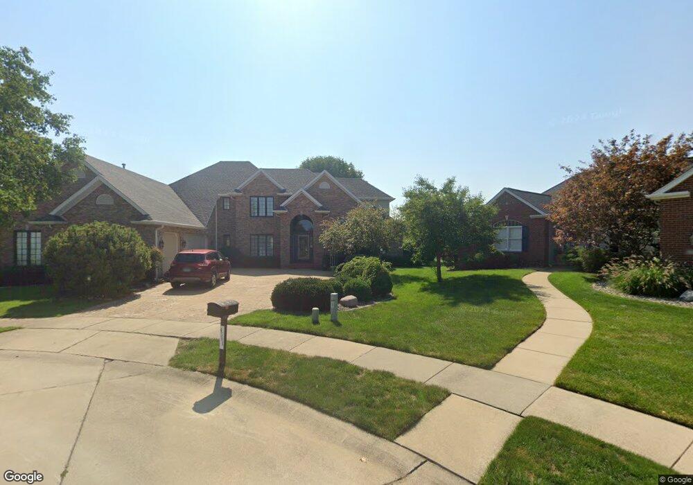
4301 Stonebridge Ct Champaign, IL 61822
Estimated Value: $577,928 - $720,000
Studio
--
Bath
--
Sq Ft
14,723
Sq Ft Lot
About This Home
This home is located at 4301 Stonebridge Ct, Champaign, IL 61822 and is currently estimated at $622,732. 4301 Stonebridge Ct is a home located in Champaign County with nearby schools including Centennial High School, Countryside School, and Swann Special Care Center-Elem/Secondary School.
Ownership History
Date
Name
Owned For
Owner Type
Purchase Details
Closed on
Jul 31, 2012
Sold by
Downing Constance E
Bought by
Choi Soo Y and Choi Jae Kyoun
Current Estimated Value
Home Financials for this Owner
Home Financials are based on the most recent Mortgage that was taken out on this home.
Original Mortgage
$300,000
Interest Rate
3.65%
Mortgage Type
Purchase Money Mortgage
Purchase Details
Closed on
Jan 30, 2007
Sold by
Downing James R and Downing Constance E
Bought by
Downing Constance E
Create a Home Valuation Report for This Property
The Home Valuation Report is an in-depth analysis detailing your home's value as well as a comparison with similar homes in the area
Purchase History
| Date | Buyer | Sale Price | Title Company |
|---|---|---|---|
| Choi Soo Y | $400,000 | None Available | |
| Downing Constance E | -- | None Available |
Source: Public Records
Mortgage History
| Date | Status | Borrower | Loan Amount |
|---|---|---|---|
| Previous Owner | Choi Soo Y | $300,000 |
Source: Public Records
Tax History
| Year | Tax Paid | Tax Assessment Tax Assessment Total Assessment is a certain percentage of the fair market value that is determined by local assessors to be the total taxable value of land and additions on the property. | Land | Improvement |
|---|---|---|---|---|
| 2024 | $13,668 | $173,010 | $50,410 | $122,600 |
| 2023 | $13,668 | $157,570 | $45,910 | $111,660 |
| 2022 | $12,815 | $145,360 | $42,350 | $103,010 |
| 2021 | $12,497 | $142,510 | $41,520 | $100,990 |
| 2020 | $12,516 | $142,510 | $41,520 | $100,990 |
| 2019 | $12,103 | $139,580 | $40,670 | $98,910 |
| 2018 | $11,822 | $137,380 | $40,030 | $97,350 |
| 2017 | $11,406 | $132,230 | $38,530 | $93,700 |
| 2016 | $10,216 | $129,510 | $37,740 | $91,770 |
| 2015 | $10,285 | $127,220 | $37,070 | $90,150 |
| 2014 | $10,198 | $127,220 | $37,070 | $90,150 |
| 2013 | $10,106 | $127,220 | $37,070 | $90,150 |
Source: Public Records
Map
Nearby Homes
- 4309 Stonebridge Ct
- 4111 Farhills Dr
- 4511 Copper Ridge Rd
- 4406 Crossgate Dr
- 4002 Lakepoint Rd
- 2010 Strand Dr
- 2109 Emerald Dr
- 1914 Trout Valley Dr
- 4203 Curtis Meadow Dr
- 1914 Woodfield Rd
- 2317 Joseph St
- 4809 W Windsor Rd Unit B07
- 4809 W Windsor Rd Unit B15
- 4809 W Windsor Rd Unit C23
- 4809 W Windsor Rd Unit C12
- 4809 W Windsor Rd Unit B24
- 4809 W Windsor Rd Unit A15
- 4809 W Windsor Rd Unit F28
- 7 Briar Hill Cir Unit G
- 5005 Stonebridge Dr
- 4303 Stonebridge Ct
- 4302 Stonebridge Ct
- 4304 Stonebridge Ct
- 4305 Stonebridge Ct
- 4306 Stonebridge Ct
- 4307 Stonebridge Ct
- 4308 Stonebridge Ct
- 2114 Crossgate Ct
- 4311 Stonebridge Ct
- 4310 Stonebridge Ct
- 2301 Blackhawk Point
- 2111 Crossgate Ct
- 2303 Blackhawk Point
- 2302 Blackhawk Point
- 2304 Sandpoint
- 2302 Sandpoint
- 2112 Crossgate Ct
- 4313 Stonebridge Ct
- 4312 Stonebridge Ct
- 2109 Crossgate Ct
Your Personal Tour Guide
Ask me questions while you tour the home.