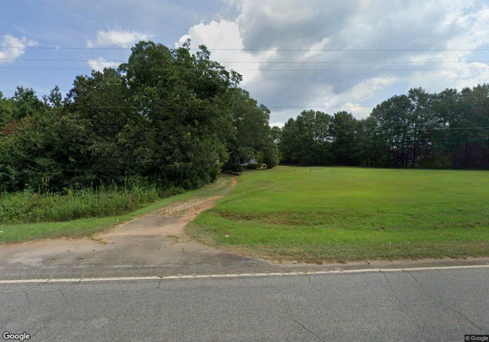
4303 Highway 29 S Anderson, SC 29626
Estimated Value: $73,374 - $220,000
--
Bed
--
Bath
952
Sq Ft
$177/Sq Ft
Est. Value
About This Home
This home is located at 4303 Highway 29 S, Anderson, SC 29626 and is currently estimated at $168,094, approximately $176 per square foot. 4303 Highway 29 S is a home with nearby schools including Crescent High School.
Ownership History
Date
Name
Owned For
Owner Type
Purchase Details
Closed on
Apr 27, 2015
Sold by
Poole Rufus Edgar
Bought by
Poole Barbara and Poole John Scott
Current Estimated Value
Home Financials for this Owner
Home Financials are based on the most recent Mortgage that was taken out on this home.
Original Mortgage
$38,600
Outstanding Balance
$30,025
Interest Rate
3.95%
Mortgage Type
New Conventional
Estimated Equity
$138,069
Purchase Details
Closed on
Oct 31, 2014
Sold by
Estate Of Willie Mae Poole
Bought by
Poole Rufus Edgar and Rish Carolyn
Purchase Details
Closed on
Sep 11, 2007
Sold by
Rish Carolyn and Mitchell Teresa
Bought by
Poole Willie Mae
Create a Home Valuation Report for This Property
The Home Valuation Report is an in-depth analysis detailing your home's value as well as a comparison with similar homes in the area
Home Values in the Area
Average Home Value in this Area
Purchase History
| Date | Buyer | Sale Price | Title Company |
|---|---|---|---|
| Poole Barbara | -- | -- | |
| Poole Rufus Edgar | $34,500 | -- | |
| Poole Rufus Edgar | -- | -- | |
| Poole Willie Mae | -- | Attorney |
Source: Public Records
Mortgage History
| Date | Status | Borrower | Loan Amount |
|---|---|---|---|
| Open | Poole Rufus Edgar | $38,600 |
Source: Public Records
Tax History Compared to Growth
Tax History
| Year | Tax Paid | Tax Assessment Tax Assessment Total Assessment is a certain percentage of the fair market value that is determined by local assessors to be the total taxable value of land and additions on the property. | Land | Improvement |
|---|---|---|---|---|
| 2024 | $954 | $2,490 | $1,600 | $890 |
| 2023 | $954 | $2,490 | $1,600 | $890 |
| 2022 | $912 | $2,490 | $1,600 | $890 |
| 2021 | $800 | $2,250 | $1,500 | $750 |
| 2020 | $795 | $2,250 | $1,500 | $750 |
| 2019 | $795 | $2,250 | $1,500 | $750 |
| 2018 | $786 | $2,250 | $1,500 | $750 |
| 2017 | -- | $2,250 | $1,500 | $750 |
| 2016 | $730 | $2,120 | $1,230 | $890 |
| 2015 | $762 | $1,410 | $820 | $590 |
| 2014 | -- | $1,410 | $820 | $590 |
Source: Public Records
Map
Nearby Homes
- 4274 Highway 29 S
- 143 George Merck Rd
- 102 Hickory Forest Dr
- 117 Hickory Forest Dr
- 110 , 112 Hickory Forest Dr
- 4800 S 29 Hwy
- 301 Burts Garage Rd
- 3901 U S 29
- 102 Canter Ln
- 111 Anthony Dr
- 113 Anthony Dr
- 01 Evergreen Church Rd
- 205 Latimer Rd
- 305 Amy St
- 800 Murphy Rd
- 154 Yellow Pine Dr
- 00 Trump Pointe
- 0 Trump Pointe Unit 20286225
- 2916 Highway 29 S
- 113 Tate Dr
- 4324 Highway 29 S
- 4328 Highway 29 S
- 4317 Route 29
- 4336 Highway 29 S
- 4277 Highway 29 S
- 101 Broadwell Mill Rd
- 3700 Highway 29 S
- 113 Broadwell Mill Rd
- 104 Broadwell Mill Rd
- 220 George Merck Rd
- 108 Broadwell Mill Rd
- A George Merck Rd
- 128 Broadwell Mill Rd
- 141 Broadwell Mill Rd
- 4423 Highway 29 S
- 4233 Highway 29 S
- 140 Broadwell Mill Rd
- 236 George Merck Rd
- 144 Broadwell Mill Rd
- 123 Allendale Cir
