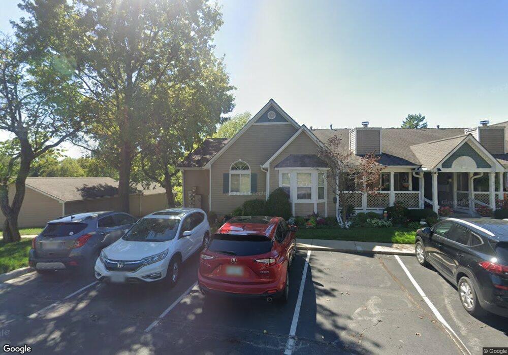
4304 S Bryant Ct Unit 30 Independence, MO 64055
39th East NeighborhoodEstimated Value: $195,000 - $270,000
2
Beds
2
Baths
1,429
Sq Ft
$156/Sq Ft
Est. Value
About This Home
This home is located at 4304 S Bryant Ct Unit 30, Independence, MO 64055 and is currently estimated at $222,743, approximately $155 per square foot. 4304 S Bryant Ct Unit 30 is a home located in Jackson County with nearby schools including William Southern Elementary School, Bridger Middle School, and Pioneer Ridge Middle School.
Ownership History
Date
Name
Owned For
Owner Type
Purchase Details
Closed on
Aug 23, 2004
Sold by
Loss Velta M
Bought by
Pettis Traci
Current Estimated Value
Home Financials for this Owner
Home Financials are based on the most recent Mortgage that was taken out on this home.
Original Mortgage
$108,893
Outstanding Balance
$53,891
Interest Rate
5.97%
Mortgage Type
FHA
Estimated Equity
$168,852
Create a Home Valuation Report for This Property
The Home Valuation Report is an in-depth analysis detailing your home's value as well as a comparison with similar homes in the area
Home Values in the Area
Average Home Value in this Area
Purchase History
| Date | Buyer | Sale Price | Title Company |
|---|---|---|---|
| Pettis Traci | -- | Ctic |
Source: Public Records
Mortgage History
| Date | Status | Borrower | Loan Amount |
|---|---|---|---|
| Open | Pettis Traci | $108,893 |
Source: Public Records
Tax History
| Year | Tax Paid | Tax Assessment Tax Assessment Total Assessment is a certain percentage of the fair market value that is determined by local assessors to be the total taxable value of land and additions on the property. | Land | Improvement |
|---|---|---|---|---|
| 2025 | $2,106 | $31,415 | $4,427 | $26,988 |
| 2024 | $2,058 | $30,400 | $1,100 | $29,300 |
| 2023 | $2,058 | $30,400 | $1,100 | $29,300 |
| 2022 | $1,768 | $23,940 | $989 | $22,951 |
| 2021 | $1,768 | $23,940 | $989 | $22,951 |
| 2020 | $1,591 | $20,933 | $989 | $19,944 |
| 2019 | $1,565 | $20,933 | $989 | $19,944 |
| 2018 | $886,719 | $16,245 | $989 | $15,256 |
| 2017 | $1,272 | $16,245 | $989 | $15,256 |
| 2016 | $1,266 | $16,005 | $989 | $15,016 |
| 2014 | $1,219 | $15,751 | $989 | $14,762 |
Source: Public Records
Map
Nearby Homes
- 4317 S Megan Ct Unit 19
- 4326 S Bryant Dr
- 4322 S Milton Dr
- 4225 S Milton Dr
- 16904 E 43rd St S
- 17005 E 43rd Terrace Ct S
- 4005 S Coachman Dr
- 17012 E 46th Street Ct S
- 4315 S Davidson Dr
- 17105 E 45th St S
- 17221 E 44th Terrace Ct S
- 4705 S Brentwood Ave
- 4707 S Brentwood Ave
- 4709 S Brentwood Ave
- 4711 S Brentwood Ave
- 17318 E Us Highway 40
- 4712 S Brentwood Ave
- 4714 S Brentwood Ave
- 3824 S Milton Dr
- 15504 E 44th Terrace S
- 4304 S Bryant Ct Unit 5
- 4304 S Bryant Dr Unit 5
- 4304 S Bryant Ct Unit 6
- 4304 S Bryant Ct Unit 32
- 4304 S Bryant Ct Unit 31
- 4304 S Bryant Ct Unit 29
- 4304 S Bryant Ct Unit 27
- 4304 S Bryant Ct Unit 28
- 4304 S Bryant St
- 4304 S Bryant Ct Unit 1
- 4304 S Bryant Ct Unit 2
- 4304 S Bryant #2 Ct
- 5917 S Bryant Dr
- 4311 S Megan Ct Unit 1
- 4311 S Megan Ct Unit 6
- 4311 S Megan Ct Unit 21
- 4311 S Megan Ct Unit 24
- 4311 S Megan Ct Unit 25
- 4311 S Megan Ct Unit 22
- 4311 S Megan Ct Unit 26
Your Personal Tour Guide
Ask me questions while you tour the home.