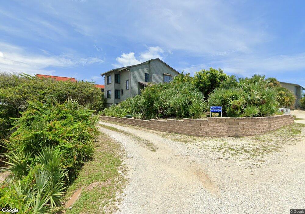
4305 S Atlantic Ave Unit B1 New Smyrna Beach, FL 32169
New Smyrna Beachfront NeighborhoodEstimated Value: $647,853 - $1,500,000
3
Beds
3
Baths
1,580
Sq Ft
$622/Sq Ft
Est. Value
About This Home
This home is located at 4305 S Atlantic Ave Unit B1, New Smyrna Beach, FL 32169 and is currently estimated at $982,213, approximately $621 per square foot. 4305 S Atlantic Ave Unit B1 is a home located in Volusia County with nearby schools including Coronado Beach Elementary School, New Smyrna Beach Middle School, and Knight's Christian Academy.
Ownership History
Date
Name
Owned For
Owner Type
Purchase Details
Closed on
Jan 4, 2017
Sold by
Palmer Paul C and Palmer Mollie O
Bought by
Palmer Paul C and Palmer Mollie O
Current Estimated Value
Purchase Details
Closed on
Dec 5, 2016
Sold by
Palmer John B
Bought by
Palmer Paul C and Palmer Mollie O
Purchase Details
Closed on
Dec 2, 2016
Sold by
Palmer Paul C and Palmer Mollie P
Bought by
Palmer Paul C and Palmer Mollie O
Purchase Details
Closed on
Feb 5, 2015
Sold by
Palmer Paul C and Palmer Mollie O
Bought by
Palmer Paul C and Palmer Mollie O
Purchase Details
Closed on
Feb 15, 1992
Bought by
Palmer Paul C and Palmer Mollie O
Purchase Details
Closed on
Jan 15, 1978
Bought by
Palmer Paul C and Palmer Mollie O
Create a Home Valuation Report for This Property
The Home Valuation Report is an in-depth analysis detailing your home's value as well as a comparison with similar homes in the area
Home Values in the Area
Average Home Value in this Area
Purchase History
| Date | Buyer | Sale Price | Title Company |
|---|---|---|---|
| Palmer Paul C | -- | Attorney | |
| Palmer Paul C | -- | Attorney | |
| Palmer Paul C | -- | None Available | |
| Palmer Paul C | -- | Attorney | |
| Palmer Paul C | $140,000 | -- | |
| Palmer Paul C | $75,200 | -- |
Source: Public Records
Tax History Compared to Growth
Tax History
| Year | Tax Paid | Tax Assessment Tax Assessment Total Assessment is a certain percentage of the fair market value that is determined by local assessors to be the total taxable value of land and additions on the property. | Land | Improvement |
|---|---|---|---|---|
| 2025 | $9,040 | $573,823 | $252,000 | $321,823 |
| 2024 | $9,040 | $581,199 | $252,000 | $329,199 |
| 2023 | $9,040 | $524,118 | $196,200 | $327,918 |
| 2022 | $8,352 | $489,531 | $196,200 | $293,331 |
| 2021 | $8,036 | $447,439 | $171,000 | $276,439 |
| 2020 | $7,615 | $422,332 | $171,000 | $251,332 |
| 2019 | $8,142 | $498,588 | $171,000 | $327,588 |
| 2018 | $7,357 | $420,378 | $150,300 | $270,078 |
| 2017 | $6,948 | $387,336 | $144,900 | $242,436 |
| 2016 | $6,850 | $365,539 | $0 | $0 |
| 2015 | $6,585 | $345,928 | $0 | $0 |
| 2014 | $5,621 | $251,019 | $0 | $0 |
Source: Public Records
Map
Nearby Homes
- 4225 S Atlantic Ave Unit 2070
- 4325 Sea Mist Dr Unit 247
- 4322 Sea Mist Dr
- 4401 Sea Mist Dr Unit 201
- 4285 Sea Mist Dr
- 881 Windover Ct Unit 50A
- 898 Baybreeze Way Unit 880
- 4287 Sea Mist Dr
- 4403 Sea Mist Dr Unit 211
- 858 Baybreeze Way Unit 68C
- 4405 Sea Mist Dr Unit 114
- 4405 Sea Mist Dr Unit 218
- 4366 Sea Cove
- 4411 Sea Mist Ct Unit 174
- 4411 Sea Mist Ct Unit 275
- 4407 Sea Mist Ct Unit 267
- 4381 S Atlantic Ave Unit 504
- 4175 S Atlantic Ave Unit 314
- 4175 S Atlantic Ave Unit 4110
- 4175 S Atlantic Ave Unit 2280
- 4305 S Atlantic Ave Unit B4
- 4305 S Atlantic Ave Unit B3
- 4305 S Atlantic Ave Unit B2
- 4305 S Atlantic Ave Unit A-1
- 4305 S Atlantic Ave Unit A-4
- 4305 S Atlantic Ave Unit C-10
- 4303 S Atlantic Ave
- 4315 S Atlantic Ave Unit 9
- 4315 S Atlantic Ave Unit A-2
- 4315 S Atlantic Ave Unit B8
- 4315 S Atlantic Ave Unit B7
- 4315 S Atlantic Ave Unit B5
- 4315 S Atlantic Ave Unit B6
- 4315 Sea Mist Dr Unit 2670
- 4315 Sea Mist Dr Unit 2660
- 4315 Sea Mist Dr Unit 2650
- 4315 Sea Mist Dr Unit 2640
- 4315 Sea Mist Dr Unit 1670
- 4315 Sea Mist Dr Unit 1660
- 4315 Sea Mist Dr Unit 1650