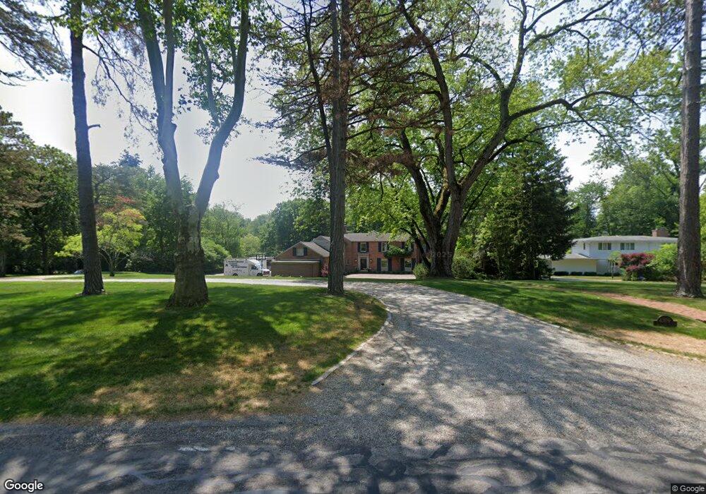
4309 Brookside Rd Ottawa Hills, OH 43615
Estimated Value: $700,000 - $1,094,455
4
Beds
4
Baths
4,898
Sq Ft
$187/Sq Ft
Est. Value
About This Home
This home is located at 4309 Brookside Rd, Ottawa Hills, OH 43615 and is currently estimated at $917,485, approximately $187 per square foot. 4309 Brookside Rd is a home located in Lucas County with nearby schools including Ottawa Hills Elementary School, Ottawa Hills High School, and Central Academy Of Ohio.
Ownership History
Date
Name
Owned For
Owner Type
Purchase Details
Closed on
Jun 12, 2009
Sold by
Tapper Jane W
Bought by
Souder W Granger and The W Granger Souder Revocable Trust
Current Estimated Value
Home Financials for this Owner
Home Financials are based on the most recent Mortgage that was taken out on this home.
Original Mortgage
$350,000
Interest Rate
4.85%
Mortgage Type
Purchase Money Mortgage
Purchase Details
Closed on
Apr 15, 1993
Sold by
Tapper Richard I and Tapper Jane W
Create a Home Valuation Report for This Property
The Home Valuation Report is an in-depth analysis detailing your home's value as well as a comparison with similar homes in the area
Home Values in the Area
Average Home Value in this Area
Purchase History
| Date | Buyer | Sale Price | Title Company |
|---|---|---|---|
| Souder W Granger | $600,000 | Attorney | |
| -- | -- | -- |
Source: Public Records
Mortgage History
| Date | Status | Borrower | Loan Amount |
|---|---|---|---|
| Previous Owner | Souder W Granger | $350,000 |
Source: Public Records
Tax History Compared to Growth
Tax History
| Year | Tax Paid | Tax Assessment Tax Assessment Total Assessment is a certain percentage of the fair market value that is determined by local assessors to be the total taxable value of land and additions on the property. | Land | Improvement |
|---|---|---|---|---|
| 2024 | $10,392 | $235,760 | $64,435 | $171,325 |
| 2023 | $19,645 | $203,630 | $79,695 | $123,935 |
| 2022 | $19,837 | $203,630 | $79,695 | $123,935 |
| 2021 | $20,100 | $203,630 | $79,695 | $123,935 |
| 2020 | $21,278 | $194,215 | $77,140 | $117,075 |
| 2019 | $19,320 | $194,215 | $77,140 | $117,075 |
| 2018 | $19,244 | $194,215 | $77,140 | $117,075 |
| 2017 | $19,334 | $181,300 | $51,590 | $129,710 |
| 2016 | $19,158 | $518,000 | $147,400 | $370,600 |
| 2015 | $19,232 | $518,000 | $147,400 | $370,600 |
| 2014 | $27,982 | $181,300 | $51,590 | $129,710 |
| 2013 | $18,655 | $181,300 | $51,590 | $129,710 |
Source: Public Records
Map
Nearby Homes
- 2222 Talmadge Rd
- 4028 Brookside Rd
- 2130 Richards Rd
- 4519 W Bancroft St
- 4057 Hillandale Rd
- 4515 W Bancroft St
- 2009 Garden Ln
- 3765 Brookside Rd
- 4236 S Terrace View St
- 4705 W Bancroft St
- 3925 Hillandale Rd
- 4709 W Bancroft St
- 2611 Evergreen Rd
- 4239 W Central Ave
- 2026 Pautucket Rd
- 4545 Indian Rd
- 2513 Ashborne Place
- 2901 Evergreen Rd
- 3205 Talmadge Rd
- 2720 Derby Rd
- 4331 Brookside Rd
- 2464 Talmadge Rd
- 4339 Brookside Rd
- 4251 Brookside Rd
- 2412 Brookview Dr
- 4318 Brookside Rd
- 2511 Talmadge Rd
- 4330 Brookside Rd
- 2442 Brookview Dr
- 4245 Brookside Rd
- 2390 Brookview Dr
- 4250 Brookside Rd
- 4237 Brookside Rd
- 4236 Brookside Rd
- 4342 Brookside Rd
- 2520 Talmadge Rd
- 2529 Talmadge Rd
- 2370 Brookview Dr
- 4356 Brookside Rd
- 4229 Brookside Rd