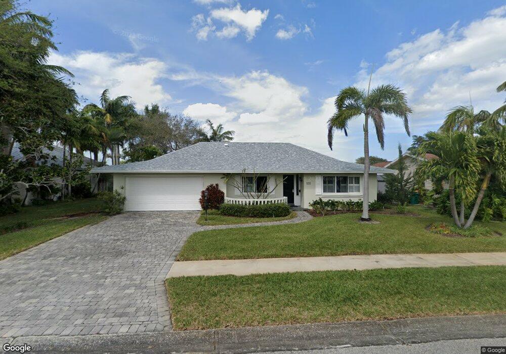
431 Aruba Ct Satellite Beach, FL 32937
Estimated Value: $720,000 - $770,000
3
Beds
2
Baths
1,951
Sq Ft
$379/Sq Ft
Est. Value
About This Home
This home is located at 431 Aruba Ct, Satellite Beach, FL 32937 and is currently estimated at $739,494, approximately $379 per square foot. 431 Aruba Ct is a home located in Brevard County with nearby schools including Sea Park Elementary School, Satellite Senior High School, and DeLaura Middle School.
Ownership History
Date
Name
Owned For
Owner Type
Purchase Details
Closed on
Oct 1, 2024
Sold by
Saunders Elizabeth B and Mary B Saunders Revocable Living Trust
Bought by
Saunders Elizabeth Branch
Current Estimated Value
Purchase Details
Closed on
Aug 8, 2019
Sold by
Saunders Mary Branch and Saunders Mary B
Bought by
Livi Saunders Mary B and Livi Mary B Saunders Revocable
Purchase Details
Closed on
Jan 3, 2002
Sold by
Saunders Mary Branch and Saunders William F
Bought by
Saunders Mary Branch
Create a Home Valuation Report for This Property
The Home Valuation Report is an in-depth analysis detailing your home's value as well as a comparison with similar homes in the area
Home Values in the Area
Average Home Value in this Area
Purchase History
| Date | Buyer | Sale Price | Title Company |
|---|---|---|---|
| Saunders Elizabeth Branch | $100 | None Listed On Document | |
| Saunders Elizabeth Branch | $100 | None Listed On Document | |
| Livi Saunders Mary B | -- | Attorney | |
| Saunders Mary Branch | -- | Attorney | |
| Saunders Mary Branch | -- | -- |
Source: Public Records
Tax History Compared to Growth
Tax History
| Year | Tax Paid | Tax Assessment Tax Assessment Total Assessment is a certain percentage of the fair market value that is determined by local assessors to be the total taxable value of land and additions on the property. | Land | Improvement |
|---|---|---|---|---|
| 2025 | $3,254 | $672,780 | -- | -- |
| 2024 | $3,208 | $258,860 | -- | -- |
| 2023 | $3,208 | $251,330 | $0 | $0 |
| 2022 | $3,044 | $244,010 | $0 | $0 |
| 2021 | $3,163 | $236,910 | $0 | $0 |
| 2020 | $3,111 | $233,640 | $0 | $0 |
| 2019 | $3,064 | $228,390 | $0 | $0 |
| 2018 | $3,072 | $224,140 | $0 | $0 |
| 2017 | $3,104 | $219,530 | $0 | $0 |
| 2016 | $3,159 | $215,020 | $190,000 | $25,020 |
| 2015 | $3,251 | $213,530 | $190,000 | $23,530 |
| 2014 | $3,275 | $211,840 | $175,000 | $36,840 |
Source: Public Records
Map
Nearby Homes
- 451 Bridgetown Ct
- 454 Point Lobos Dr
- 443 Port Royal Blvd
- 384 Point Lobos Dr
- 349 W Arlington St
- 696 Palos Verde Dr
- 341 W Arlington St
- 314 Point Lobos Dr
- 49 Sorrento Ct
- 659 Monterey Dr
- 679 Monterey Dr
- 333 S Patrick Dr Unit 11
- 484 Lanternback Island Dr
- 345 S Point Ct
- 471 Lighthouse Landing St
- 428 Penguin Dr
- 335 Coral Reef Dr
- 124 Lanternback Island Dr
- 681 Ventura Dr
- 457 S Waterway Dr