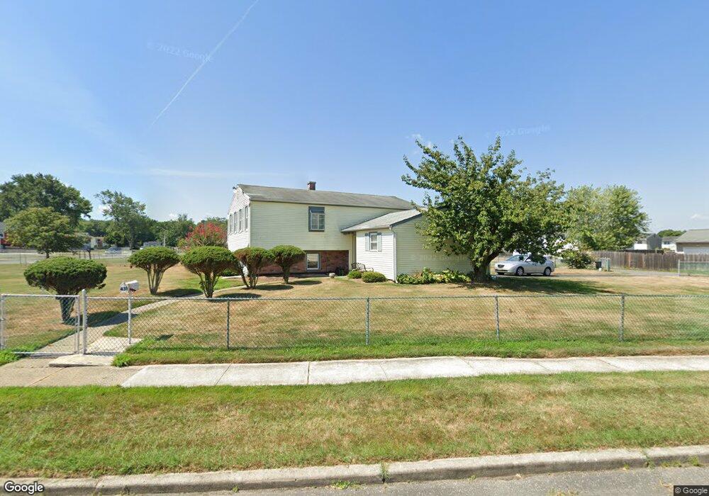
431 Dartmouth Ave Pemberton, NJ 08068
Estimated Value: $280,156 - $407,000
--
Bed
--
Bath
1,755
Sq Ft
$198/Sq Ft
Est. Value
About This Home
This home is located at 431 Dartmouth Ave, Pemberton, NJ 08068 and is currently estimated at $348,039, approximately $198 per square foot. 431 Dartmouth Ave is a home located in Burlington County.
Ownership History
Date
Name
Owned For
Owner Type
Purchase Details
Closed on
Dec 26, 2002
Sold by
Detusche Bank National Trust Co
Bought by
Prater Synthie
Current Estimated Value
Home Financials for this Owner
Home Financials are based on the most recent Mortgage that was taken out on this home.
Original Mortgage
$9,500
Outstanding Balance
$4,079
Interest Rate
6.11%
Mortgage Type
Credit Line Revolving
Estimated Equity
$343,960
Purchase Details
Closed on
Apr 1, 1996
Sold by
Daniels Gary L
Bought by
Va
Purchase Details
Closed on
Apr 10, 1995
Sold by
Mcstay Yang
Bought by
Mcstay Glen D
Create a Home Valuation Report for This Property
The Home Valuation Report is an in-depth analysis detailing your home's value as well as a comparison with similar homes in the area
Home Values in the Area
Average Home Value in this Area
Purchase History
| Date | Buyer | Sale Price | Title Company |
|---|---|---|---|
| Prater Synthie | $75,100 | Commonwealth Land Title | |
| Va | -- | -- | |
| Mcstay Glen D | -- | -- |
Source: Public Records
Mortgage History
| Date | Status | Borrower | Loan Amount |
|---|---|---|---|
| Open | Prater Synthie | $9,500 | |
| Open | Prater Synthie | $66,728 |
Source: Public Records
Tax History Compared to Growth
Tax History
| Year | Tax Paid | Tax Assessment Tax Assessment Total Assessment is a certain percentage of the fair market value that is determined by local assessors to be the total taxable value of land and additions on the property. | Land | Improvement |
|---|---|---|---|---|
| 2025 | $4,947 | $161,400 | $30,200 | $131,200 |
| 2024 | $4,642 | $161,400 | $30,200 | $131,200 |
| 2023 | $4,642 | $161,400 | $30,200 | $131,200 |
| 2022 | $4,296 | $161,400 | $30,200 | $131,200 |
| 2021 | $3,771 | $161,400 | $30,200 | $131,200 |
| 2020 | $3,966 | $161,400 | $30,200 | $131,200 |
| 2019 | $3,798 | $161,400 | $30,200 | $131,200 |
| 2018 | $3,669 | $161,400 | $30,200 | $131,200 |
| 2017 | $3,593 | $161,400 | $30,200 | $131,200 |
| 2016 | $3,932 | $105,200 | $19,000 | $86,200 |
| 2015 | $3,901 | $105,200 | $19,000 | $86,200 |
| 2014 | $3,729 | $105,200 | $19,000 | $86,200 |
Source: Public Records
Map
Nearby Homes
- 250 Purdue Ave
- 448 Cornell Ave
- 86 Scrapetown Rd
- 143 Oak Pines Blvd
- 148 Oak Pines Blvd
- 421 Lakeview Terrace
- 0 Pemberton Vincentown Rd
- 2 Cedar Ln
- 914 Pemberton Browns Mills Rd
- 912 Pemberton Browns Mills Rd
- 912 Pemberton - Browns Mills Rd
- 120 Hanover St
- 112 Kinsley Rd
- 110 Lemmon Ave
- 161 Lemmon Ave
- 197 Kinsley Rd
- 219 Kinsley Rd
- 60 Hanover St
- 216 Kinsley Rd
- 200 Norcross Ln Unit 202
- 231 Villanova Ave
- 432 Dartmouth Ave
- 226 Purdue Ave
- 434 Dartmouth Ave
- 233 Villanova Ave
- 430 Dartmouth Ave
- 435 Dartmouth Ave
- 436 Dartmouth Ave
- 230 Purdue Ave
- 236 Villanova Ave
- 438 Dartmouth Ave
- 232 Purdue Ave
- 433 Cornell Ave
- 431 Cornell Ave
- 435 Cornell Ave
- 439 Dartmouth Ave
- 437 Cornell Ave
- 429 Cornell Ave
- 438 Temple Rd
- 229 Purdue Ave