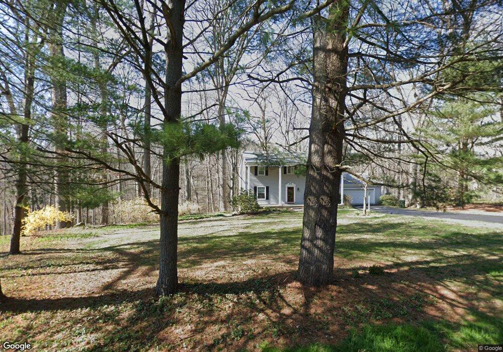
431 Dean Dr Kennett Square, PA 19348
East Marlborough NeighborhoodEstimated Value: $592,395 - $678,000
4
Beds
3
Baths
2,184
Sq Ft
$293/Sq Ft
Est. Value
About This Home
This home is located at 431 Dean Dr, Kennett Square, PA 19348 and is currently estimated at $639,099, approximately $292 per square foot. 431 Dean Dr is a home located in Chester County with nearby schools including Hillendale Elementary School, Charles F. Patton Middle School, and Unionville High School.
Ownership History
Date
Name
Owned For
Owner Type
Purchase Details
Closed on
Mar 11, 1999
Sold by
Maddox Robert B and Maddox Denise M
Bought by
Mcclung Thomas J and Mcclung Beverly I
Current Estimated Value
Home Financials for this Owner
Home Financials are based on the most recent Mortgage that was taken out on this home.
Original Mortgage
$174,400
Interest Rate
6.99%
Create a Home Valuation Report for This Property
The Home Valuation Report is an in-depth analysis detailing your home's value as well as a comparison with similar homes in the area
Home Values in the Area
Average Home Value in this Area
Purchase History
| Date | Buyer | Sale Price | Title Company |
|---|---|---|---|
| Mcclung Thomas J | $218,000 | -- |
Source: Public Records
Mortgage History
| Date | Status | Borrower | Loan Amount |
|---|---|---|---|
| Previous Owner | Mcclung Thomas J | $174,400 |
Source: Public Records
Tax History
| Year | Tax Paid | Tax Assessment Tax Assessment Total Assessment is a certain percentage of the fair market value that is determined by local assessors to be the total taxable value of land and additions on the property. | Land | Improvement |
|---|---|---|---|---|
| 2025 | $1,271 | $188,800 | $55,320 | $133,480 |
| 2024 | $1,271 | $188,800 | $55,320 | $133,480 |
| 2023 | $1,271 | $188,800 | $55,320 | $133,480 |
| 2022 | $1,057 | $188,800 | $55,320 | $133,480 |
| 2021 | $1,271 | $188,800 | $55,320 | $133,480 |
| 2020 | $1,023 | $188,800 | $55,320 | $133,480 |
| 2019 | $1,237 | $188,800 | $55,320 | $133,480 |
| 2018 | $1,237 | $188,800 | $55,320 | $133,480 |
| 2017 | $1,237 | $188,800 | $55,320 | $133,480 |
| 2016 | $820 | $188,800 | $55,320 | $133,480 |
| 2015 | $820 | $188,800 | $55,320 | $133,480 |
| 2014 | $820 | $188,800 | $55,320 | $133,480 |
Source: Public Records
Map
Nearby Homes
- 491 N Mill Rd
- 159 Penns Manor Dr
- 256 Line Rd
- 234 Lily Ln
- 235 Kestrel Ct
- 225 Kestrel Ct
- 602 D St
- 631 Magnolia Ct
- 621 Magnolia Ct
- 107 W State St
- 118 Austin Dr
- 126 Austin Dr
- 629 W Mulberry St
- 619 W Mulberry St
- 607 W Mulberry St
- 332 Redbud Ln
- 326 Redbud Ln
- 311 E State St
- 312 Riverbirch Cir Unit 802
- 824 Waverly Rd
Your Personal Tour Guide
Ask me questions while you tour the home.