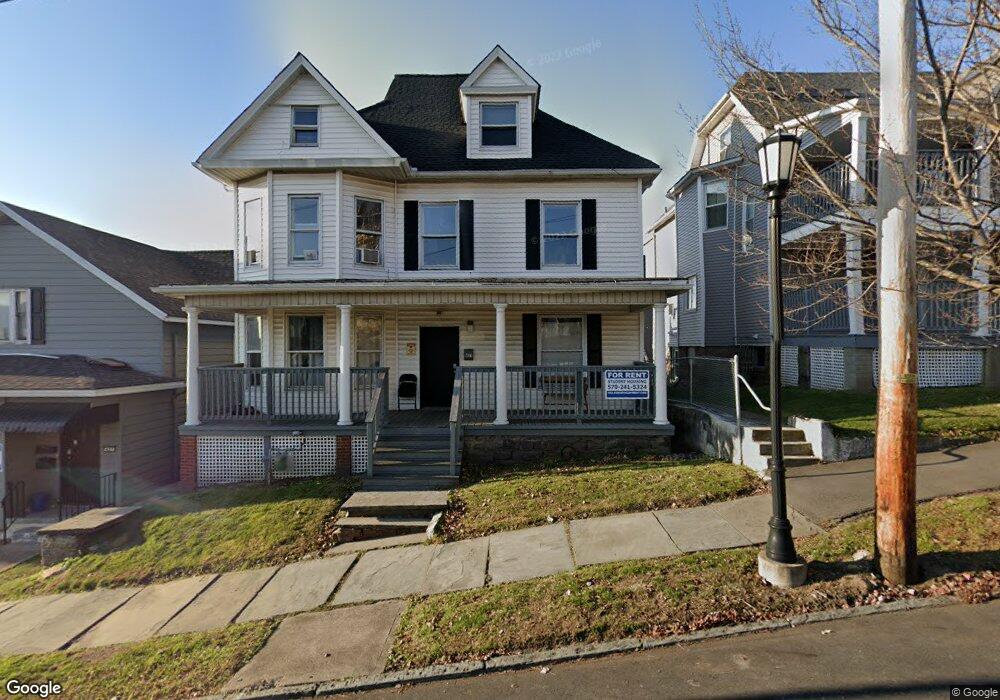
431 N Webster Ave Unit L8 Scranton, PA 18510
Hill Section NeighborhoodEstimated Value: $272,000 - $477,000
--
Bed
--
Bath
--
Sq Ft
6,360
Sq Ft Lot
About This Home
This home is located at 431 N Webster Ave Unit L8, Scranton, PA 18510 and is currently estimated at $358,000. 431 N Webster Ave Unit L8 is a home located in Lackawanna County with nearby schools including Jackson Davis Elementary School, Longdale Elementary School, and Pinchbeck Elementary School.
Ownership History
Date
Name
Owned For
Owner Type
Purchase Details
Closed on
Mar 27, 2015
Sold by
Suhocki Michael and Suhocki Patricia
Bought by
Hillside Development Llc
Current Estimated Value
Purchase Details
Closed on
Sep 15, 2010
Sold by
Cascio Charles J and Cascio Joan A
Bought by
Suhocki Michael
Create a Home Valuation Report for This Property
The Home Valuation Report is an in-depth analysis detailing your home's value as well as a comparison with similar homes in the area
Home Values in the Area
Average Home Value in this Area
Purchase History
| Date | Buyer | Sale Price | Title Company |
|---|---|---|---|
| Hillside Development Llc | $225,000 | None Available | |
| Suhocki Michael | $207,500 | None Available |
Source: Public Records
Tax History Compared to Growth
Tax History
| Year | Tax Paid | Tax Assessment Tax Assessment Total Assessment is a certain percentage of the fair market value that is determined by local assessors to be the total taxable value of land and additions on the property. | Land | Improvement |
|---|---|---|---|---|
| 2025 | $5,255 | $14,000 | $6,050 | $7,950 |
| 2024 | $4,853 | $14,000 | $6,050 | $7,950 |
| 2023 | $4,853 | $14,000 | $6,050 | $7,950 |
| 2022 | $4,748 | $14,000 | $6,050 | $7,950 |
| 2021 | $4,748 | $14,000 | $6,050 | $7,950 |
| 2020 | $4,673 | $14,000 | $6,050 | $7,950 |
| 2019 | $4,411 | $14,000 | $6,050 | $7,950 |
| 2018 | $4,411 | $14,000 | $6,050 | $7,950 |
| 2017 | $4,345 | $14,000 | $6,050 | $7,950 |
| 2016 | $1,809 | $14,000 | $6,050 | $7,950 |
| 2015 | $3,397 | $14,000 | $6,050 | $7,950 |
| 2014 | -- | $14,000 | $6,050 | $7,950 |
Source: Public Records
Map
Nearby Homes
- 432 Taylor Ave
- 560 N Webster Ave
- 550 Clay Ave Unit 8c
- 316 Taylor Ave
- 1325 Olive St
- 527 Quincy Ave
- 621 Clay Ave
- 545 Prescott Ave
- 329 Prescott Ave
- 516 Harrison Ave
- 7 Oakwood Place
- 228 Prescott Ave
- 342 Harrison Ave
- 715 Prescott Ave Unit L17
- 616-618 Harrison Ave
- 805-807 N Irving Ave
- 621 Madison Ave Unit 623
- 622 Jefferson Ave
- 826 N Irving Ave
- 640 Jefferson Ave
- 433 N Mahon Ct
- 427 N Webster Ave
- 421 N Webster Ave Unit 423
- 417 N Webster Ave Unit 419
- 426 428 N Webster
- 416 Mahon Ct Unit 418
- 426 N Webster Ave Unit 428
- 415 N Webster Ave
- 426 N 428 Webster Ave
- 415 Mahon Ct
- 413 Mahon Ct
- 422 N Webster Ave
- 418 N Webster Ave Unit 420
- 1202 Vine St Unit 7
- 1202 Vine St Unit 5
- 1202 Vine St Unit 1
- 1202 Vine St Unit 2
- 1202 Vine St
- 435 N Webster Ave
- 414 N Webster Ave Unit 416