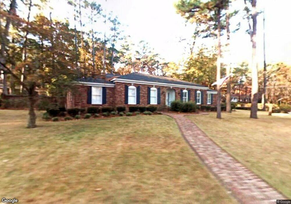
431 Sheffield Cir Augusta, GA 30909
West Augusta NeighborhoodEstimated Value: $324,464 - $371,000
3
Beds
3
Baths
2,242
Sq Ft
$157/Sq Ft
Est. Value
About This Home
This home is located at 431 Sheffield Cir, Augusta, GA 30909 and is currently estimated at $351,866, approximately $156 per square foot. 431 Sheffield Cir is a home located in Richmond County with nearby schools including First Coast Technical Institute, R.B. Hunt Elementary School, and A. Brian Merry Elementary School.
Ownership History
Date
Name
Owned For
Owner Type
Purchase Details
Closed on
Jul 25, 2002
Sold by
Black Margaret Julia New and Last Will & Testament
Bought by
Newsome Joseph L and Newsome Deborah S
Current Estimated Value
Home Financials for this Owner
Home Financials are based on the most recent Mortgage that was taken out on this home.
Original Mortgage
$119,920
Outstanding Balance
$50,692
Interest Rate
6.67%
Estimated Equity
$301,174
Purchase Details
Closed on
Sep 25, 1995
Sold by
Black George Shannon and Black Est
Bought by
Black Margaret Julia Newton
Create a Home Valuation Report for This Property
The Home Valuation Report is an in-depth analysis detailing your home's value as well as a comparison with similar homes in the area
Home Values in the Area
Average Home Value in this Area
Purchase History
| Date | Buyer | Sale Price | Title Company |
|---|---|---|---|
| Newsome Joseph L | $149,900 | -- | |
| Black Margaret Julia Newton | -- | -- |
Source: Public Records
Mortgage History
| Date | Status | Borrower | Loan Amount |
|---|---|---|---|
| Open | Newsome Joseph L | $119,920 |
Source: Public Records
Tax History Compared to Growth
Tax History
| Year | Tax Paid | Tax Assessment Tax Assessment Total Assessment is a certain percentage of the fair market value that is determined by local assessors to be the total taxable value of land and additions on the property. | Land | Improvement |
|---|---|---|---|---|
| 2025 | $1,476 | $128,728 | $15,200 | $113,528 |
| 2024 | $1,476 | $94,826 | $15,200 | $79,626 |
| 2023 | $1,158 | $104,009 | $15,200 | $88,809 |
| 2022 | $1,057 | $68,898 | $15,200 | $53,698 |
| 2021 | $1,183 | $72,795 | $15,200 | $57,595 |
| 2020 | $1,177 | $71,595 | $14,000 | $57,595 |
| 2019 | $1,232 | $71,595 | $14,000 | $57,595 |
| 2018 | $1,239 | $71,595 | $14,000 | $57,595 |
| 2017 | $1,228 | $71,595 | $14,000 | $57,595 |
| 2016 | $1,224 | $71,215 | $14,000 | $57,215 |
| 2015 | $1,224 | $71,215 | $14,000 | $57,215 |
| 2014 | $1,224 | $71,215 | $14,000 | $57,215 |
Source: Public Records
Map
Nearby Homes
- 503 Sheffield Dr
- 2920 Sussex Rd
- 2507 Pinebluff Ct
- 505 Stratford Dr
- 441 Aumond Rd
- 2924 Mayfair Ct
- 427 Aumond Rd
- 2703 Oakbluff Ct
- 3116 Exeter Rd
- 2901 Sussex Rd
- 2914 Westchester Dr
- 3121 Ramsgate Rd
- 3118 Exeter Rd
- 3122 Sussex Rd
- 3129 Edinburgh Dr
- 3101 Trafalgar Dr
- 3129 Ramsgate Rd
- 3125 Exeter Rd
- 2413 Woodbluff Ct
- 3084 Westwood Rd
- 429 Dover Ct
- 433 Sheffield Cir
- 3003 Sussex Rd
- 440 Sheffield Cir
- 442 Sheffield Cir
- 438 Sheffield Cir
- 427 Dover Ct
- 3005 Sussex Rd
- 444 Sheffield Cir
- 436 Sheffield Cir
- 419 Sheffield Cir
- 425 Dover Ct
- 2927 Kipling Dr
- 2929 Kipling Dr
- 435 Sheffield Cir
- 3007 Sussex Rd
- 2931 Kipling Dr
- 3004 Sussex Rd
- 423 Dover Ct
- 434 Sheffield Cir