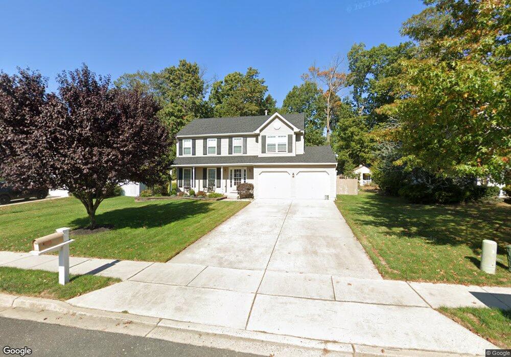
431 Stockton Loop Williamstown, NJ 08094
Estimated Value: $414,652 - $536,000
--
Bed
--
Bath
1,901
Sq Ft
$245/Sq Ft
Est. Value
About This Home
This home is located at 431 Stockton Loop, Williamstown, NJ 08094 and is currently estimated at $464,913, approximately $244 per square foot. 431 Stockton Loop is a home located in Gloucester County with nearby schools including Williamstown High School, St. Mary School, and Finest of the Wheat Christian.
Ownership History
Date
Name
Owned For
Owner Type
Purchase Details
Closed on
Nov 27, 2002
Sold by
K Hovnanian Venture I Llc
Bought by
Hutt Amy L and Hutt Patrick D
Current Estimated Value
Home Financials for this Owner
Home Financials are based on the most recent Mortgage that was taken out on this home.
Original Mortgage
$142,400
Outstanding Balance
$61,607
Interest Rate
6.34%
Estimated Equity
$403,306
Create a Home Valuation Report for This Property
The Home Valuation Report is an in-depth analysis detailing your home's value as well as a comparison with similar homes in the area
Home Values in the Area
Average Home Value in this Area
Purchase History
| Date | Buyer | Sale Price | Title Company |
|---|---|---|---|
| Hutt Amy L | $178,680 | Citizens Title |
Source: Public Records
Mortgage History
| Date | Status | Borrower | Loan Amount |
|---|---|---|---|
| Open | Hutt Amy L | $142,400 |
Source: Public Records
Tax History Compared to Growth
Tax History
| Year | Tax Paid | Tax Assessment Tax Assessment Total Assessment is a certain percentage of the fair market value that is determined by local assessors to be the total taxable value of land and additions on the property. | Land | Improvement |
|---|---|---|---|---|
| 2025 | $8,500 | $232,100 | $54,200 | $177,900 |
| 2024 | $8,437 | $232,100 | $54,200 | $177,900 |
| 2023 | $8,437 | $232,100 | $54,200 | $177,900 |
| 2022 | $8,397 | $232,100 | $54,200 | $177,900 |
| 2021 | $8,451 | $232,100 | $54,200 | $177,900 |
| 2020 | $8,441 | $232,100 | $54,200 | $177,900 |
| 2019 | $8,390 | $232,100 | $54,200 | $177,900 |
| 2018 | $8,253 | $232,100 | $54,200 | $177,900 |
| 2017 | $7,782 | $219,700 | $66,100 | $153,600 |
| 2016 | $7,683 | $219,700 | $66,100 | $153,600 |
| 2015 | $7,463 | $219,700 | $66,100 | $153,600 |
| 2014 | $7,246 | $219,700 | $66,100 | $153,600 |
Source: Public Records
Map
Nearby Homes
- 415 Stockton Loop
- 1011 S Beecham Rd
- 1602 Pin Oak Rd
- 1605 Pin Oak Rd
- 304 Thackeray Ln
- 1601 White Oak Ln
- 921 N Beecham Rd
- 1017 Micawber Dr
- 959 S Main St
- 1638 Red Oak Rd
- 1406 Exposition Dr
- 112 Hemlock Dr
- 206 Raphael Ct
- 505 Matisse Way Unit 505
- 1735 Black Oak Rd
- 1430 Cranleigh Ln
- 2406 Exposition Dr Unit 2406
- 943 Sykesville Rd
- 643 Blue Bell Rd
- 112 Shisler Ave
- 501 Stockton Dr
- 429 Stockton Loop
- 1145 S Beecham Rd
- 1141 S Beecham Rd
- 427 Stockton Loop
- 503 Stockton Dr
- 1149 S Beecham Rd
- 505 Stockton Dr
- 425 Stockton Loop
- 426 Stockton Loop
- 315 Pickwick Dr
- 1153 S Beecham Rd
- 1133 S Beecham Rd
- 314 Pickwick Dr
- 507 Stockton Dr
- 423 Stockton Loop
- 1140 S Beecham Rd
- 304 Pickwick Dr
- 424 Stockton Loop
- 402 Stockton Loop