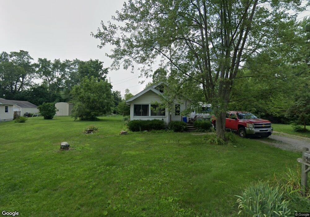
4310 Carney Dr Maumee, OH 43537
Estimated Value: $116,000 - $162,000
2
Beds
1
Bath
704
Sq Ft
$204/Sq Ft
Est. Value
About This Home
This home is located at 4310 Carney Dr, Maumee, OH 43537 and is currently estimated at $143,446, approximately $203 per square foot. 4310 Carney Dr is a home located in Lucas County with nearby schools including Maumee Intermediate School, Fairfield Elementary School, and Maumee Middle School.
Ownership History
Date
Name
Owned For
Owner Type
Purchase Details
Closed on
Sep 20, 2022
Sold by
Leasor Michelle and Opaczewski Michelle Marie
Bought by
Leasor Clint W
Current Estimated Value
Purchase Details
Closed on
May 10, 2004
Sold by
Leasor Clint W and Leasor Michelle
Bought by
Leasor Clint W and Leasor Michelle
Home Financials for this Owner
Home Financials are based on the most recent Mortgage that was taken out on this home.
Original Mortgage
$68,170
Interest Rate
5.85%
Mortgage Type
New Conventional
Purchase Details
Closed on
Jul 1, 1999
Sold by
Michalak Lynne M
Bought by
Leasor Clint W and Opaczewski Michelle
Home Financials for this Owner
Home Financials are based on the most recent Mortgage that was taken out on this home.
Original Mortgage
$72,105
Interest Rate
7.62%
Purchase Details
Closed on
Sep 21, 1993
Sold by
Taylor Lynne Marie #
Purchase Details
Closed on
Aug 21, 1992
Sold by
Mcfarland Ernest M
Create a Home Valuation Report for This Property
The Home Valuation Report is an in-depth analysis detailing your home's value as well as a comparison with similar homes in the area
Home Values in the Area
Average Home Value in this Area
Purchase History
| Date | Buyer | Sale Price | Title Company |
|---|---|---|---|
| Leasor Clint W | -- | None Listed On Document | |
| Leasor Clint W | -- | Agg Title | |
| Leasor Clint W | $75,900 | -- | |
| -- | -- | -- | |
| -- | $44,500 | -- |
Source: Public Records
Mortgage History
| Date | Status | Borrower | Loan Amount |
|---|---|---|---|
| Previous Owner | Leasor Clint W | $68,170 | |
| Previous Owner | Leasor Clint W | $72,105 |
Source: Public Records
Tax History Compared to Growth
Tax History
| Year | Tax Paid | Tax Assessment Tax Assessment Total Assessment is a certain percentage of the fair market value that is determined by local assessors to be the total taxable value of land and additions on the property. | Land | Improvement |
|---|---|---|---|---|
| 2024 | $1,391 | $41,370 | $12,425 | $28,945 |
| 2023 | $2,565 | $32,550 | $10,010 | $22,540 |
| 2022 | $2,108 | $30,100 | $10,010 | $20,090 |
| 2021 | $2,217 | $30,100 | $10,010 | $20,090 |
| 2020 | $2,270 | $27,965 | $9,310 | $18,655 |
| 2019 | $2,214 | $27,965 | $9,310 | $18,655 |
| 2018 | $2,042 | $28,175 | $9,310 | $18,865 |
| 2017 | $1,890 | $23,555 | $7,455 | $16,100 |
| 2016 | $1,870 | $67,300 | $21,300 | $46,000 |
| 2015 | $1,861 | $67,300 | $21,300 | $46,000 |
| 2014 | $1,695 | $23,110 | $7,320 | $15,790 |
| 2013 | $1,695 | $23,110 | $7,320 | $15,790 |
Source: Public Records
Map
Nearby Homes
- 4437 Beck Dr
- 948 Joliet Dr
- 969 Joliet Dr
- 6002 Monclova Rd
- 504 W John St
- 712 W Harrison St
- 234 W Dudley St
- 220 W Wayne St
- 306 Clinton St
- 28330 W River Rd
- 6621 Monclova Rd
- 1301 Cass Rd
- 232 E Wayne St
- 1626 Woodstream Rd
- 125 Ottekee Dr
- 326 E Dudley St
- 26951 Ottekee Dr
- 1539 Cass Rd
- 4335 Crystal Ridge Dr E
- 1213 Hunt St