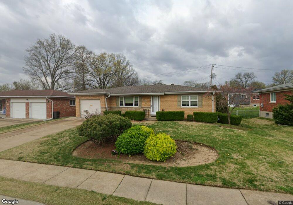
4310 Debra Kay Ln Saint Louis, MO 63123
Lemay NeighborhoodEstimated Value: $221,541 - $247,000
2
Beds
1
Bath
1,107
Sq Ft
$214/Sq Ft
Est. Value
About This Home
This home is located at 4310 Debra Kay Ln, Saint Louis, MO 63123 and is currently estimated at $237,135, approximately $214 per square foot. 4310 Debra Kay Ln is a home located in St. Louis County with nearby schools including Bayless Elementary School, Bayless Junior High School, and Bayless Senior High School.
Ownership History
Date
Name
Owned For
Owner Type
Purchase Details
Closed on
Jun 5, 2011
Sold by
Tangaro Marylou and Stretch Mary
Bought by
Stretch Michael J
Current Estimated Value
Purchase Details
Closed on
Jun 4, 1998
Sold by
Linomaz Alois W and Linomaz William A
Bought by
Stretch Michael J and Stretch Robert M
Home Financials for this Owner
Home Financials are based on the most recent Mortgage that was taken out on this home.
Original Mortgage
$90,542
Outstanding Balance
$18,303
Interest Rate
7.17%
Mortgage Type
FHA
Estimated Equity
$218,832
Purchase Details
Closed on
Apr 30, 1997
Sold by
Linomaz Alois W
Bought by
Linomaz Alois W
Create a Home Valuation Report for This Property
The Home Valuation Report is an in-depth analysis detailing your home's value as well as a comparison with similar homes in the area
Home Values in the Area
Average Home Value in this Area
Purchase History
| Date | Buyer | Sale Price | Title Company |
|---|---|---|---|
| Stretch Michael J | -- | None Available | |
| Stretch Michael J | -- | First American Title | |
| Linomaz Alois W | -- | -- | |
| Linomaz William A | -- | -- |
Source: Public Records
Mortgage History
| Date | Status | Borrower | Loan Amount |
|---|---|---|---|
| Open | Stretch Michael J | $90,542 |
Source: Public Records
Tax History Compared to Growth
Tax History
| Year | Tax Paid | Tax Assessment Tax Assessment Total Assessment is a certain percentage of the fair market value that is determined by local assessors to be the total taxable value of land and additions on the property. | Land | Improvement |
|---|---|---|---|---|
| 2025 | $2,407 | $39,170 | $12,650 | $26,520 |
| 2024 | $2,407 | $33,040 | $6,820 | $26,220 |
| 2023 | $2,368 | $33,040 | $6,820 | $26,220 |
| 2022 | $2,417 | $28,520 | $7,790 | $20,730 |
| 2021 | $2,188 | $28,520 | $7,790 | $20,730 |
| 2020 | $2,093 | $25,260 | $8,650 | $16,610 |
| 2019 | $2,088 | $25,260 | $8,650 | $16,610 |
| 2018 | $2,114 | $22,690 | $6,730 | $15,960 |
| 2017 | $1,985 | $22,690 | $6,730 | $15,960 |
| 2016 | $1,777 | $19,940 | $4,450 | $15,490 |
| 2015 | $1,785 | $19,940 | $4,450 | $15,490 |
| 2014 | -- | $21,810 | $4,860 | $16,950 |
Source: Public Records
Map
Nearby Homes
- 4248 Kay Ln Unit 9
- 8911 Kammerer Ave
- 4415 Cayuga Dr
- 8706 Fatima Dr
- 4409 Fatima Dr
- 9038 Kickapoo Dr
- 4500 Spring Dr
- 4013 Birchwood Place
- 4606 Heege Rd
- 1434 Friar Tuck Ln
- 4084 Paule Ave
- 816 Forman Rd
- 4048 Paule Ave Unit 4048
- 4338 Seibert Ave
- 1520 Union Rd
- 8628 Hillery Dr
- 8709 Holbrook Dr
- 4530 Grasso Ave
- 4700 Stone Ave
- 4704 Stone Ave
- 4316 Debra Kay Ln
- 4302 Debra Kay Ln
- 909 Union Rd
- 4313 Kay Ln
- 4311 Debra Kay Ln
- 4322 Debra Kay Ln
- 4317 Debra Kay Ln
- 843 Union Rd
- 4319 Kay Ln
- 4323 Debra Kay Ln
- 4328 Debra Kay Ln
- 4325 Kay Ln
- 4308 Kay Ln
- 4300 Kay Ln
- 4314 Kay Ln
- 4312 Schmittwoods Ct
- 4329 Debra Kay Ln
- 4318 Schmittwoods Ct
- 4334 Debra Kay Ln
- 4320 Kay Ln