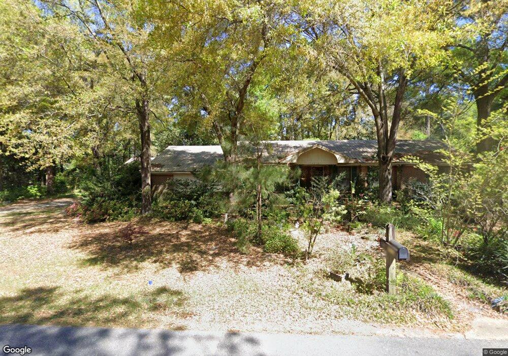
4312 Michael Blvd Mobile, AL 36609
Jackson Heights NeighborhoodEstimated Value: $234,000 - $321,000
3
Beds
2
Baths
2,272
Sq Ft
$125/Sq Ft
Est. Value
About This Home
This home is located at 4312 Michael Blvd, Mobile, AL 36609 and is currently estimated at $283,878, approximately $124 per square foot. 4312 Michael Blvd is a home located in Mobile County with nearby schools including Elizabeth Fonde Elementary School, Elizabeth S Chastang-Fournier K-8 School, and WP Davidson High School.
Ownership History
Date
Name
Owned For
Owner Type
Purchase Details
Closed on
Feb 21, 2025
Sold by
Reinsch Richard Paul and Reinsch Karen M
Bought by
Point Cartwright Properties Llc
Current Estimated Value
Home Financials for this Owner
Home Financials are based on the most recent Mortgage that was taken out on this home.
Original Mortgage
$260,000
Outstanding Balance
$110,521
Interest Rate
6.93%
Mortgage Type
Construction
Estimated Equity
$173,357
Purchase Details
Closed on
Aug 6, 2007
Sold by
Reinsch Richard Paul and Reinsch Karen M
Bought by
Reinsch Richard Paul and Reinsch Karen M
Home Financials for this Owner
Home Financials are based on the most recent Mortgage that was taken out on this home.
Original Mortgage
$73,000
Interest Rate
6.56%
Mortgage Type
Unknown
Create a Home Valuation Report for This Property
The Home Valuation Report is an in-depth analysis detailing your home's value as well as a comparison with similar homes in the area
Home Values in the Area
Average Home Value in this Area
Purchase History
| Date | Buyer | Sale Price | Title Company |
|---|---|---|---|
| Point Cartwright Properties Llc | $168,000 | None Listed On Document | |
| Reinsch Richard Paul | -- | None Available |
Source: Public Records
Mortgage History
| Date | Status | Borrower | Loan Amount |
|---|---|---|---|
| Open | Point Cartwright Properties Llc | $260,000 | |
| Previous Owner | Reinsch Richard Paul | $73,000 |
Source: Public Records
Tax History Compared to Growth
Tax History
| Year | Tax Paid | Tax Assessment Tax Assessment Total Assessment is a certain percentage of the fair market value that is determined by local assessors to be the total taxable value of land and additions on the property. | Land | Improvement |
|---|---|---|---|---|
| 2024 | $1,076 | $17,840 | $3,500 | $14,340 |
| 2023 | $1,076 | $18,070 | $3,500 | $14,570 |
| 2022 | $995 | $16,710 | $3,500 | $13,210 |
| 2021 | $915 | $15,460 | $3,500 | $11,960 |
| 2020 | $915 | $15,460 | $3,500 | $11,960 |
| 2019 | $932 | $15,740 | $0 | $0 |
| 2018 | $916 | $15,480 | $0 | $0 |
| 2017 | $999 | $16,780 | $0 | $0 |
| 2016 | $1,028 | $17,240 | $0 | $0 |
| 2013 | $1,213 | $17,460 | $0 | $0 |
Source: Public Records
Map
Nearby Homes
- 312 Gaines Ave
- 4256 Michael Blvd
- 4317 Packingham Dr
- 275 Hillcrest Dr
- 409 Byron Ave E
- 312 Dogwood Dr
- 304 Dogwood Dr
- 308 Mcqueen Ave
- 241 Suzanne Cir
- 363 Mcqueen Ave
- 4728 Wicker Way
- 4457 Suzanne Cir
- 236 Lakewood Dr E
- 728 Spring Station Rd
- 0 Bellevue Ln
- 712 Spring Station Rd
- 233 Suzanne Cir
- 417 Thornton Place
- 803 Regents Dr E
- 1213 Edinburgh Ct
- 313 Byron Ave E
- 4309 Michael Blvd
- 309 Byron Ave E
- 355 Byron Ave E
- 316 Byron Ave E
- 350 Byron Ave E
- 312 Byron Ave E
- 4307 Michael Blvd
- 305 Byron Ave E
- 308 Byron Ave E
- 359 Byron Ave E
- 358 Byron Ave E
- 304 Byron Ave E
- 4300 Michael Blvd
- 301 Byron Ave E
- 317 Byron Ave W
- 4301 Michael Blvd
- 362 Byron Ave E
- 363 Byron Ave E
- 351 Byron Ave W