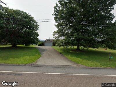
4312 State Route 711 Ligonier, PA 15658
Fairfield Township NeighborhoodEstimated Value: $121,333 - $472,000
--
Bed
--
Bath
2,456
Sq Ft
$126/Sq Ft
Est. Value
About This Home
This home is located at 4312 State Route 711, Ligonier, PA 15658 and is currently estimated at $309,833, approximately $126 per square foot. 4312 State Route 711 is a home located in Westmoreland County with nearby schools including R.K. Mellon Elementary School, Ligonier Valley Middle School, and Ligonier Valley High School.
Ownership History
Date
Name
Owned For
Owner Type
Purchase Details
Closed on
Aug 18, 2009
Sold by
Barton Mark S and Barton Marcia S
Bought by
Cannon Richard D
Current Estimated Value
Purchase Details
Closed on
Jun 9, 2008
Sold by
Lasitis Dianne M
Bought by
Barton Mark S and Barton Marcia S
Home Financials for this Owner
Home Financials are based on the most recent Mortgage that was taken out on this home.
Original Mortgage
$89,000
Interest Rate
6.13%
Mortgage Type
Purchase Money Mortgage
Purchase Details
Closed on
Sep 27, 2005
Sold by
Milas Mike J and Milas Eva C
Bought by
Lasitis Ronald J and Lasitis Dianne M
Purchase Details
Closed on
Aug 10, 2001
Sold by
Milas Mike J and Milas Eva C
Bought by
The Mike J & Eva C Milas Revocable Livin
Create a Home Valuation Report for This Property
The Home Valuation Report is an in-depth analysis detailing your home's value as well as a comparison with similar homes in the area
Home Values in the Area
Average Home Value in this Area
Purchase History
| Date | Buyer | Sale Price | Title Company |
|---|---|---|---|
| Cannon Richard D | $269,000 | None Available | |
| The Mike J & Eva C Milas Revocable Livin | -- | -- |
Source: Public Records
Mortgage History
| Date | Status | Borrower | Loan Amount |
|---|---|---|---|
| Previous Owner | Barton Mark S | $89,000 | |
| Previous Owner | Lasitis Ronald J | $145,000 |
Source: Public Records
Tax History Compared to Growth
Tax History
| Year | Tax Paid | Tax Assessment Tax Assessment Total Assessment is a certain percentage of the fair market value that is determined by local assessors to be the total taxable value of land and additions on the property. | Land | Improvement |
|---|---|---|---|---|
| 2025 | $4,747 | $39,730 | $2,740 | $36,990 |
| 2024 | $4,747 | $39,730 | $2,740 | $36,990 |
| 2023 | $4,469 | $39,730 | $2,740 | $36,990 |
| 2022 | $4,469 | $39,730 | $2,740 | $36,990 |
| 2021 | $4,469 | $39,730 | $2,740 | $36,990 |
| 2020 | $4,384 | $39,730 | $2,740 | $36,990 |
| 2019 | $4,290 | $39,730 | $2,740 | $36,990 |
| 2018 | $4,175 | $39,730 | $2,740 | $36,990 |
| 2017 | $4,108 | $39,730 | $2,740 | $36,990 |
| 2016 | $4,036 | $39,730 | $2,740 | $36,990 |
| 2015 | $3,996 | $39,730 | $2,740 | $36,990 |
| 2014 | $3,937 | $39,730 | $2,740 | $36,990 |
Source: Public Records
Map
Nearby Homes
- 736 Muir Rd
- 440 Owl Hollow Rd
- 513 Feather Ln
- 214 Mosshaven Way
- 312 Woodchuck Ln
- 342 Woodchuck Ln
- 873 Nature Run Rd
- LOT 32 Whitefield Way
- LOT 5 Settler Rd
- LOT 3 Settler Rd
- LOT 2 Settler Rd
- LOT 1 Settler Rd
- 324 Mill Rd
- 512 Brigade Ln
- 0 Iron Ore Ln Unit 1697950
- 0 Swank Road Nature Run Unit 1653023
- 0 Pennsylvania 711
- 773 Forever Ln
- 328 Thatcher Rd
- 211 Oakview Dr
- 4312 State Route 711
- 4312 Pennsylvania 711
- 4324 State Route 711
- 321 Murphy Rd
- 196 Fort Palmer Estate Rd
- 112 Otto Dr
- 327 Murphy Rd
- 4286 State Route 711
- 4280 State Route 711
- 4280 Pennsylvania 711
- 224 Fort Palmer Estate Rd
- 4275 Pennsylvania 711
- 119 Otto Dr
- 205 Fort Palmer Estate Rd
- 4275 State Route 711
- 722 Muir Rd
- 215 Fort Palmer Estate Rd
- 225 Fort Palmer Estate Rd
- 4268 State Route 711
- 109 Otto Dr
