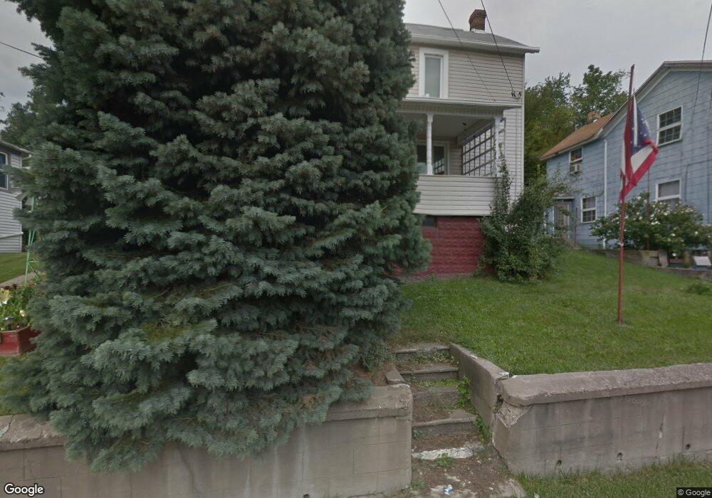
43121 Harrah St Lafferty, OH 43951
Estimated Value: $66,382 - $109,000
3
Beds
1
Bath
1,360
Sq Ft
$62/Sq Ft
Est. Value
About This Home
This home is located at 43121 Harrah St, Lafferty, OH 43951 and is currently estimated at $83,794, approximately $61 per square foot. 43121 Harrah St is a home with nearby schools including Union Local Elementary School, Union Local Middle School, and Union Local High School.
Ownership History
Date
Name
Owned For
Owner Type
Purchase Details
Closed on
Jan 10, 2011
Sold by
Bellew Marie
Bought by
Bellew Marie and Bellew Antoinette
Current Estimated Value
Purchase Details
Closed on
Oct 14, 1999
Sold by
Bellew Marie and Bellew William S
Bought by
Bellew Marie and Bellew William S
Purchase Details
Closed on
Aug 31, 1999
Sold by
Bellew Marie
Bought by
Bellew Marie
Purchase Details
Closed on
Jun 17, 1999
Sold by
Bellew Marie
Bought by
Bellew Marie Etal 4
Purchase Details
Closed on
May 5, 1999
Bought by
Bellau Marie Etal 1
Purchase Details
Closed on
Jan 1, 1986
Sold by
Melchiori Marie Barbara
Bought by
Melchiori Marie Barbara
Create a Home Valuation Report for This Property
The Home Valuation Report is an in-depth analysis detailing your home's value as well as a comparison with similar homes in the area
Purchase History
| Date | Buyer | Sale Price | Title Company |
|---|---|---|---|
| Bellew Marie | -- | Attorney | |
| Bellew Marie | -- | -- | |
| Bellew Marie | -- | -- | |
| Bellew Marie Etal 4 | -- | -- | |
| Bellau Marie Etal 1 | -- | -- | |
| Melchiori Marie Barbara | -- | -- |
Source: Public Records
Tax History
| Year | Tax Paid | Tax Assessment Tax Assessment Total Assessment is a certain percentage of the fair market value that is determined by local assessors to be the total taxable value of land and additions on the property. | Land | Improvement |
|---|---|---|---|---|
| 2025 | $234 | $7,470 | $2,040 | $5,430 |
| 2023 | $378 | $11,780 | $1,520 | $10,260 |
| 2022 | $378 | $11,781 | $1,519 | $10,262 |
| 2021 | $376 | $11,784 | $1,522 | $10,262 |
| 2020 | $342 | $10,250 | $1,320 | $8,930 |
| 2019 | $345 | $10,250 | $1,320 | $8,930 |
| 2018 | $344 | $10,250 | $1,320 | $8,930 |
| 2017 | $278 | $7,990 | $1,460 | $6,530 |
| 2016 | $283 | $7,990 | $1,460 | $6,530 |
| 2015 | $292 | $7,990 | $1,460 | $6,530 |
| 2014 | $325 | $8,590 | $1,330 | $7,260 |
| 2013 | $300 | $8,590 | $1,330 | $7,260 |
Source: Public Records
Map
Nearby Homes
- 19 acres Saffell Rd
- 15 acres Saffell Rd
- 35 acres Saffell Rd
- 70799 Bannock Uniontown Rd
- 69680 Main St
- 68895 Lloydsville Bannock Rd
- 0 Rt 40 Rd
- 0 Moriah Dr Unit 5177567
- 41152 Black Oak Rd
- 0 Lloydsville St
- 67174 Pancoast Rd S
- 46282 Atkinson Rd
- 44290 Denise Ln
- 117 A&B High St
- INLOT 19 Havenwood
- 39775 Rosemary Camp Rd
- 71320 Church St
- 0 Watson Rd Unit 5068291
- 125 Chaplins Ln
- 66164 Belmont Morristown Rd
- 43137 Harrah St
- 43111 Harrah St
- 43099 Harrah St
- 43081 Harrah St
- 43069 Harrah St
- 70221 McDo Dr
- 70216 Irwin Rd
- 70232 Irwin Rd
- 43080 Front St
- 70250 Irwin Rd
- 70189 Jordan St
- 43081 Lafferty Bannock Rd
- 43061 Lafferty Station Rd
- 43140 Mt Hope Rd
- 43140 Mount Hope Rd
- 43053 Lafferty Station Rd
- 43029 Harrah St
- 43037 Lafferty Bannock Rd
- 43129 Mount Hope Rd
- 43126 Mount Hope Rd
Your Personal Tour Guide
Ask me questions while you tour the home.