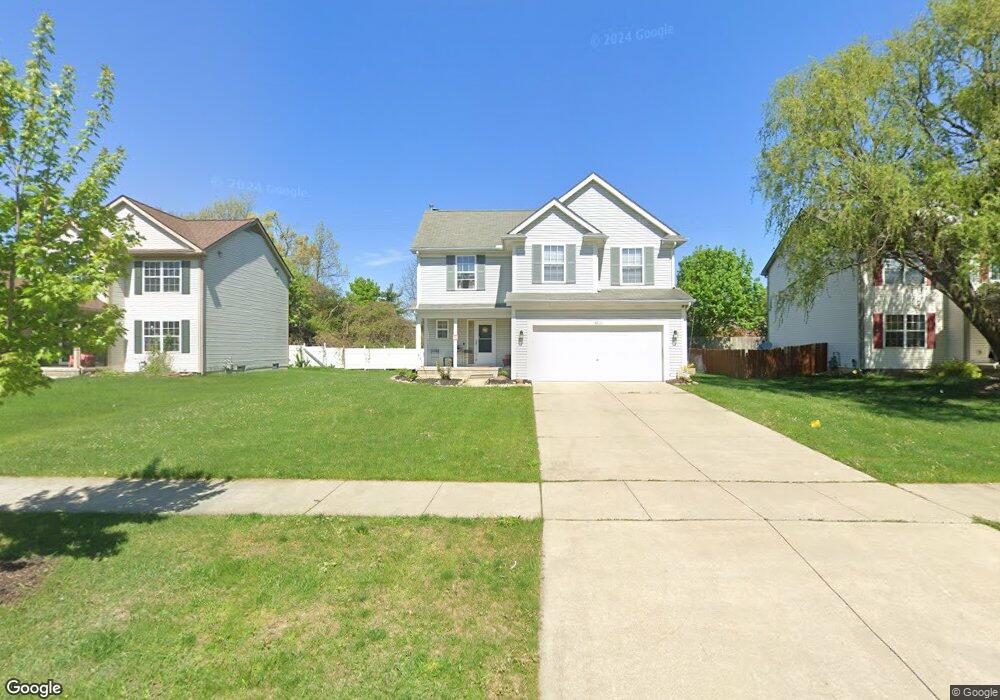
4315 Knollcrest Rd Unit 208 Ann Arbor, MI 48108
Estimated Value: $389,093 - $404,000
3
Beds
2
Baths
1,611
Sq Ft
$245/Sq Ft
Est. Value
About This Home
This home is located at 4315 Knollcrest Rd Unit 208, Ann Arbor, MI 48108 and is currently estimated at $394,773, approximately $245 per square foot. 4315 Knollcrest Rd Unit 208 is a home located in Washtenaw County with nearby schools including Carpenter Elementary School, Scarlett Middle School, and Huron High School.
Ownership History
Date
Name
Owned For
Owner Type
Purchase Details
Closed on
Jul 18, 2025
Sold by
Peralta Monique
Bought by
Wang Yawen and Pi Chunyu
Current Estimated Value
Home Financials for this Owner
Home Financials are based on the most recent Mortgage that was taken out on this home.
Original Mortgage
$232,000
Outstanding Balance
$231,606
Interest Rate
6.84%
Mortgage Type
New Conventional
Estimated Equity
$163,167
Purchase Details
Closed on
Oct 19, 2019
Sold by
Peralta Huascar
Bought by
Peralta Monique
Home Financials for this Owner
Home Financials are based on the most recent Mortgage that was taken out on this home.
Original Mortgage
$212,000
Interest Rate
3.5%
Mortgage Type
New Conventional
Purchase Details
Closed on
Mar 19, 2008
Sold by
Triangle Arborwoods Llc
Bought by
Peralta Huascar and Peralta Monique
Home Financials for this Owner
Home Financials are based on the most recent Mortgage that was taken out on this home.
Original Mortgage
$230,876
Interest Rate
5.74%
Create a Home Valuation Report for This Property
The Home Valuation Report is an in-depth analysis detailing your home's value as well as a comparison with similar homes in the area
Home Values in the Area
Average Home Value in this Area
Purchase History
| Date | Buyer | Sale Price | Title Company |
|---|---|---|---|
| Wang Yawen | $392,000 | None Listed On Document | |
| Pi Chunyu | -- | None Listed On Document | |
| Pi Chunyu | -- | None Listed On Document | |
| Peralta Monique | -- | None Available | |
| Peralta Huascar | $234,500 | Transworld Title Company Llc |
Source: Public Records
Mortgage History
| Date | Status | Borrower | Loan Amount |
|---|---|---|---|
| Open | Pi Chunyu | $232,000 | |
| Closed | Pi Chunyu | $232,000 | |
| Previous Owner | Peralta Monique | $212,000 | |
| Previous Owner | Peralta Huascar | $230,876 |
Source: Public Records
Tax History Compared to Growth
Tax History
| Year | Tax Paid | Tax Assessment Tax Assessment Total Assessment is a certain percentage of the fair market value that is determined by local assessors to be the total taxable value of land and additions on the property. | Land | Improvement |
|---|---|---|---|---|
| 2025 | $2,967 | $180,481 | $0 | $0 |
| 2024 | $2,896 | $160,273 | $0 | $0 |
| 2023 | $2,783 | $142,700 | $0 | $0 |
| 2022 | $4,230 | $134,300 | $0 | $0 |
| 2021 | $4,129 | $133,100 | $0 | $0 |
| 2020 | $4,051 | $126,700 | $0 | $0 |
| 2019 | $3,913 | $116,500 | $116,500 | $0 |
| 2018 | $3,768 | $110,700 | $0 | $0 |
| 2017 | $3,654 | $111,300 | $0 | $0 |
| 2016 | $0 | $90,964 | $0 | $0 |
| 2015 | -- | $90,692 | $0 | $0 |
| 2014 | -- | $87,859 | $0 | $0 |
| 2013 | -- | $87,859 | $0 | $0 |
Source: Public Records
Map
Nearby Homes
- 5428 Poppydrew Ln
- 5428 Poppydrew Ln Unit 3
- 3152 Promenade Cir Unit 53
- 4194 Packard St Unit 1
- 2864 Foster Ave
- 3084 Turnberry Ln
- 2514 Carlton Dr
- 4074 Crystal Creek Dr
- 3446 Charing Cross Rd
- 3958 Golfside Rd
- 4160 Silverleaf Dr
- 3005 Fernwood Ave Unit 103
- 4139 Persimmon Dr
- 3425 Norwood St
- 4267 Chandi Ct
- 3325 Packard St
- 3393 Williamsburg Rd
- 3246 Williamsburg Rd
- 3302 Williamsburg Rd
- 3342 Williamsburg St Rd
- 4327 Knollcrest Rd Unit 209
- 4303 Knollcrest Rd Unit 207
- 4339 Knollcrest Rd Unit 210
- 4291 Knollcrest Rd
- 4310 Knollcrest Dr
- 4310 Knollcrest Rd Unit 198
- 4326 Knollcrest Rd Unit 197
- 4351 Knollcrest Rd Unit 211
- 4338 Knollcrest Rd Unit 196
- 4279 Knollcrest Rd Unit 205
- 4350 Knollcrest Rd Unit 195
- 4363 Knollcrest Rd Unit 212
- 4262 Knollcrest Dr
- 4291 Center Valley Dr Unit 175
- 4303 Center Valley Dr Unit 176
- 4262 Knollcrest Rd Unit 174
- 4315 Center Valley Dr
- 4329 Center Valley Dr
- 4267 Knollcrest Rd Unit 204
- 4267 Knollcrest Dr