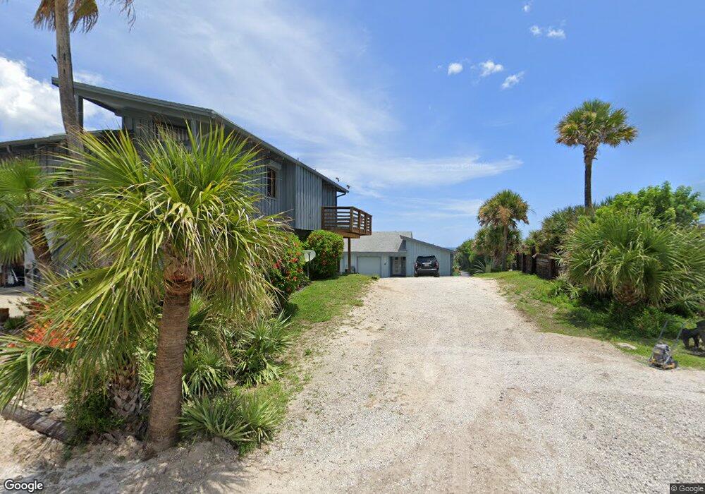
4315 S Atlantic Ave Unit B5 New Smyrna Beach, FL 32169
New Smyrna Beachfront NeighborhoodEstimated Value: $816,000 - $1,044,495
3
Beds
3
Baths
1,666
Sq Ft
$559/Sq Ft
Est. Value
About This Home
This home is located at 4315 S Atlantic Ave Unit B5, New Smyrna Beach, FL 32169 and is currently estimated at $931,832, approximately $559 per square foot. 4315 S Atlantic Ave Unit B5 is a home located in Volusia County with nearby schools including Coronado Beach Elementary School, New Smyrna Beach Middle School, and New Smyrna Beach High School.
Ownership History
Date
Name
Owned For
Owner Type
Purchase Details
Closed on
Dec 8, 2015
Sold by
Denson Todd R and Denson Steven F
Bought by
Johnson Alice F
Current Estimated Value
Purchase Details
Closed on
Jul 29, 2014
Sold by
Denson Todd R and Denson Catherine L
Bought by
Johnson Alice F
Purchase Details
Closed on
Apr 25, 2005
Sold by
Reilly Susan
Bought by
Johnson Alice F and Denson Steven F
Home Financials for this Owner
Home Financials are based on the most recent Mortgage that was taken out on this home.
Original Mortgage
$480,000
Interest Rate
5.88%
Mortgage Type
Fannie Mae Freddie Mac
Purchase Details
Closed on
Nov 15, 1989
Bought by
Johnson Alice F
Purchase Details
Closed on
Dec 15, 1986
Bought by
Johnson Alice F
Purchase Details
Closed on
Aug 15, 1978
Bought by
Johnson Alice F
Create a Home Valuation Report for This Property
The Home Valuation Report is an in-depth analysis detailing your home's value as well as a comparison with similar homes in the area
Home Values in the Area
Average Home Value in this Area
Purchase History
| Date | Buyer | Sale Price | Title Company |
|---|---|---|---|
| Johnson Alice F | $194,800 | Attorney | |
| Johnson Alice F | -- | None Available | |
| Johnson Alice F | $600,000 | -- | |
| Johnson Alice F | $100 | -- | |
| Johnson Alice F | $169,000 | -- | |
| Johnson Alice F | $84,500 | -- |
Source: Public Records
Mortgage History
| Date | Status | Borrower | Loan Amount |
|---|---|---|---|
| Previous Owner | Johnson Alice F | $480,000 |
Source: Public Records
Tax History Compared to Growth
Tax History
| Year | Tax Paid | Tax Assessment Tax Assessment Total Assessment is a certain percentage of the fair market value that is determined by local assessors to be the total taxable value of land and additions on the property. | Land | Improvement |
|---|---|---|---|---|
| 2025 | $7,165 | $483,591 | -- | -- |
| 2024 | $7,165 | $469,963 | -- | -- |
| 2023 | $7,165 | $456,275 | $0 | $0 |
| 2022 | $6,861 | $442,985 | $0 | $0 |
| 2021 | $6,986 | $430,083 | $0 | $0 |
| 2020 | $6,904 | $424,145 | $0 | $0 |
| 2019 | $6,987 | $414,609 | $0 | $0 |
| 2018 | $6,981 | $406,878 | $0 | $0 |
| 2017 | $7,044 | $398,509 | $0 | $0 |
| 2016 | $7,270 | $385,965 | $0 | $0 |
| 2015 | $7,014 | $365,860 | $0 | $0 |
| 2014 | $6,016 | $268,924 | $0 | $0 |
Source: Public Records
Map
Nearby Homes
- 4325 Sea Mist Dr Unit 247
- 4401 Sea Mist Dr Unit 201
- 4322 Sea Mist Dr
- 4403 Sea Mist Dr Unit 211
- 4225 S Atlantic Ave Unit 2070
- 4405 Sea Mist Dr Unit 114
- 4405 Sea Mist Dr Unit 218
- 4287 Sea Mist Dr
- 4285 Sea Mist Dr
- 4366 Sea Cove
- 881 Windover Ct Unit 50A
- 898 Baybreeze Way Unit 880
- 858 Baybreeze Way Unit 68C
- 4411 Sea Mist Ct Unit 174
- 4411 Sea Mist Ct Unit 275
- 4407 Sea Mist Ct Unit 267
- 4381 S Atlantic Ave Unit 504
- 4493 S Atlantic Ave Unit 3040
- 4175 S Atlantic Ave Unit 314
- 4175 S Atlantic Ave Unit 4110
- 4315 S Atlantic Ave Unit 9
- 4315 S Atlantic Ave Unit A-2
- 4315 S Atlantic Ave Unit B8
- 4315 S Atlantic Ave Unit B7
- 4315 S Atlantic Ave Unit B6
- 4303 S Atlantic Ave
- 4317 Sea Mist Dr Unit 271
- 4317 Sea Mist Dr Unit 2710
- 4317 Sea Mist Dr Unit 2700
- 4317 Sea Mist Dr Unit 2690
- 4317 Sea Mist Dr Unit 2680
- 4317 Sea Mist Dr Unit 1710
- 4317 Sea Mist Dr Unit 1700
- 4317 Sea Mist Dr Unit 1690
- 4317 Sea Mist Dr Unit 1680
- 4317 Sea Mist Dr Unit 268
- 4317 Sea Mist Dr Unit 169
- 4317 Sea Mist Dr Unit 270
- 4317 Sea Mist Dr Unit 170
- 4317 Sea Mist Dr