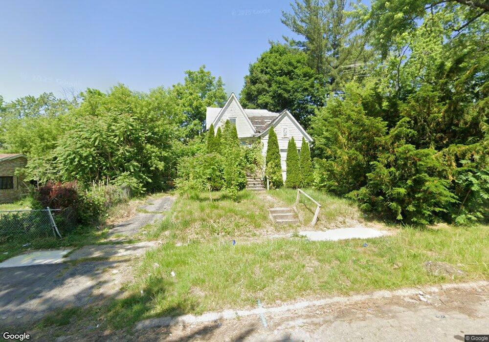
4317 Crissman St Flint, MI 48505
King Avenue Plus NeighborhoodEstimated Value: $45,000 - $60,000
4
Beds
3
Baths
1,432
Sq Ft
$37/Sq Ft
Est. Value
About This Home
This home is located at 4317 Crissman St, Flint, MI 48505 and is currently estimated at $52,500, approximately $36 per square foot. 4317 Crissman St is a home located in Genesee County with nearby schools including Brownell STEM Academy, The New Standard Academy, and Eagle's Nest Academy.
Ownership History
Date
Name
Owned For
Owner Type
Purchase Details
Closed on
Dec 20, 2022
Sold by
Genesee County Treasurer
Bought by
Genesee County Land Bank Authority
Current Estimated Value
Purchase Details
Closed on
Oct 5, 2015
Sold by
Genesee County Land Bank Authority
Bought by
Thedford Ronney
Purchase Details
Closed on
Jan 13, 2014
Sold by
The Genesee County Land Bank Authority
Bought by
Thedford Ronney
Purchase Details
Closed on
Dec 20, 2013
Sold by
Genesee County Treasurer
Bought by
Genesee County Land Bank
Purchase Details
Closed on
Nov 26, 2012
Sold by
Mission Of Hope Universal Life Church
Bought by
Damascus Inc and Neitzke Ken
Purchase Details
Closed on
Apr 9, 2010
Sold by
Chance Joseph and Chance Dorothy H
Bought by
Thema Kamaria
Create a Home Valuation Report for This Property
The Home Valuation Report is an in-depth analysis detailing your home's value as well as a comparison with similar homes in the area
Home Values in the Area
Average Home Value in this Area
Purchase History
| Date | Buyer | Sale Price | Title Company |
|---|---|---|---|
| Genesee County Land Bank Authority | -- | -- | |
| Thedford Ronney | $2,000 | None Available | |
| Thedford Ronney | $2,000 | None Available | |
| Genesee County Land Bank | -- | None Available | |
| Damascus Inc | -- | None Available | |
| Thema Kamaria | -- | None Available |
Source: Public Records
Mortgage History
| Date | Status | Borrower | Loan Amount |
|---|---|---|---|
| Closed | Thedford Ronney | $0 |
Source: Public Records
Tax History Compared to Growth
Tax History
| Year | Tax Paid | Tax Assessment Tax Assessment Total Assessment is a certain percentage of the fair market value that is determined by local assessors to be the total taxable value of land and additions on the property. | Land | Improvement |
|---|---|---|---|---|
| 2025 | -- | $0 | $0 | $0 |
| 2024 | -- | $0 | $0 | $0 |
| 2023 | -- | $0 | $0 | $0 |
| 2022 | $0 | $5,500 | $0 | $0 |
| 2021 | $550 | $5,200 | $0 | $0 |
| 2020 | $542 | $5,800 | $0 | $0 |
| 2019 | $542 | $5,800 | $0 | $0 |
| 2018 | $762 | $5,700 | $0 | $0 |
| 2017 | $763 | $0 | $0 | $0 |
| 2016 | $656 | $0 | $0 | $0 |
| 2015 | -- | $0 | $0 | $0 |
| 2014 | -- | $0 | $0 | $0 |
| 2012 | -- | $7,300 | $0 | $0 |
Source: Public Records
Map
Nearby Homes
- 733 Black Ave
- 4028 North St
- 606 Damon St
- 0 E Marengo Ave Unit 50166417
- 418 Damon St
- 370 E Moore St
- 618 E Pulaski Ave
- 680 E Pierson Rd
- 613 E van Wagoner Ave
- 313 Edwin Ave
- 726 E Parkway Ave
- 618 E Parkway Ave
- 3810 Marvin St
- 638 E Pasadena Ave
- 124 W Flint Park Blvd
- 350 E Mott Ave
- 3506 Esther St
- 306 W Bishop Ave
- 329 W Baltimore Blvd
- 325 W Marengo Ave
- 4401 Crissman St
- 4405 Crissman St
- 4309 Crissman St
- 4314 Billings St
- 4402 Billings St
- 4310 Billings St
- 4306 Billings St
- 4406 Billings St
- 4318 Crissman St
- 4402 Crissman St
- 738 Black Ave
- 742 Black Ave
- 4314 Crissman St
- 4410 Billings St
- 734 Black Ave
- 4302 Billings St
- 4406 Crissman St
- 4414 Billings St
- 4306 Crissman St
- 754 Black Ave