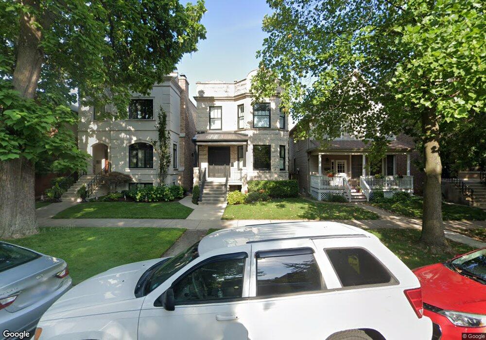
4317 N Winchester Ave Chicago, IL 60613
North Center NeighborhoodEstimated Value: $1,487,826 - $1,902,000
6
Beds
2
Baths
3,063
Sq Ft
$547/Sq Ft
Est. Value
About This Home
This home is located at 4317 N Winchester Ave, Chicago, IL 60613 and is currently estimated at $1,674,457, approximately $546 per square foot. 4317 N Winchester Ave is a home located in Cook County with nearby schools including Ravenswood Elementary School, Lake View High School, and Pilgrim Lutheran School.
Ownership History
Date
Name
Owned For
Owner Type
Purchase Details
Closed on
Nov 30, 2010
Sold by
Cartell Richard and Schmittou Catherine E
Bought by
Stock Walter M and Stock Elizabeth M
Current Estimated Value
Home Financials for this Owner
Home Financials are based on the most recent Mortgage that was taken out on this home.
Original Mortgage
$416,000
Interest Rate
4.19%
Mortgage Type
Commercial
Create a Home Valuation Report for This Property
The Home Valuation Report is an in-depth analysis detailing your home's value as well as a comparison with similar homes in the area
Home Values in the Area
Average Home Value in this Area
Purchase History
| Date | Buyer | Sale Price | Title Company |
|---|---|---|---|
| Stock Walter M | $520,000 | Git |
Source: Public Records
Mortgage History
| Date | Status | Borrower | Loan Amount |
|---|---|---|---|
| Closed | Stock Walter M | $416,000 |
Source: Public Records
Tax History Compared to Growth
Tax History
| Year | Tax Paid | Tax Assessment Tax Assessment Total Assessment is a certain percentage of the fair market value that is determined by local assessors to be the total taxable value of land and additions on the property. | Land | Improvement |
|---|---|---|---|---|
| 2024 | $21,064 | $146,194 | $51,179 | $95,015 |
| 2023 | $20,512 | $103,149 | $41,310 | $61,839 |
| 2022 | $20,512 | $103,149 | $41,310 | $61,839 |
| 2021 | $20,072 | $103,148 | $41,310 | $61,838 |
| 2020 | $21,223 | $98,372 | $22,032 | $76,340 |
| 2019 | $21,030 | $108,102 | $22,032 | $86,070 |
| 2018 | $20,675 | $108,102 | $22,032 | $86,070 |
| 2017 | $11,695 | $57,701 | $19,278 | $38,423 |
| 2016 | $11,057 | $57,701 | $19,278 | $38,423 |
| 2015 | $10,093 | $57,701 | $19,278 | $38,423 |
| 2014 | $9,647 | $54,562 | $14,688 | $39,874 |
| 2013 | $9,445 | $54,562 | $14,688 | $39,874 |
Source: Public Records
Map
Nearby Homes
- 1907 W Montrose Ave Unit 2
- 4243 N Wolcott Ave
- 4305 N Wolcott Ave
- 2039 W Berteau Ave
- 2034 W Sunnyside Ave
- 2107 W Berteau Ave
- 4545 N Wolcott Ave Unit 1
- 4153 N Hermitage Ave
- 4313 N Paulina St Unit 43133
- 4020 N Damen Ave Unit 404
- 4244 N Ashland Ave
- 2163 W Windsor Ave
- 4422 N Ashland Ave Unit G
- 4003 N Wolcott Ave Unit F
- 2030 W Irving Park Rd Unit 1
- 4415 N Ashland Ave
- 1510 W Montrose Ave
- 1828 W Larchmont Ave
- 4444 N Greenview Ave
- 4613 N Paulina St Unit 3B
- 4317 N Winchester Ave Unit 1
- 4321 N Winchester Ave
- 4315 N Winchester Ave
- 4325 N Winchester Ave
- 4311 N Winchester Ave Unit 1
- 4311 N Winchester Ave
- 4311 N Winchester Ave Unit 3
- 4311 N Winchester Ave Unit 2
- 4327 N Winchester Ave
- 4329 N Winchester Ave Unit 2
- 4331 N Winchester Ave
- 1918 W Cullom Ave Unit 203
- 1918 W Cullom Ave Unit 103
- 1918 W Cullom Ave Unit G1
- 1920 W Cullom Ave Unit 303
- 1918 W Cullom Ave Unit 302
- 1918 W Cullom Ave Unit 301
- 1920 W Cullom Ave Unit 203
- 1918 W Cullom Ave Unit 201
- 1920 W Cullom Ave Unit 103