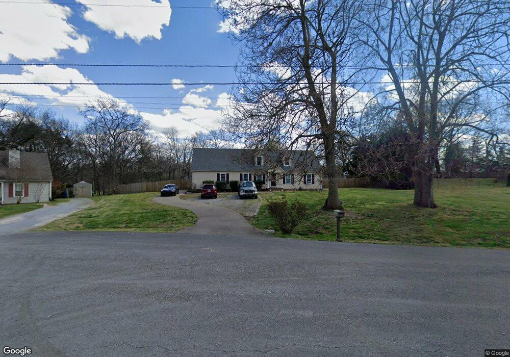
4318 Highpointe Ct Murfreesboro, TN 37129
Estimated Value: $312,266 - $384,000
--
Bed
3
Baths
1,260
Sq Ft
$279/Sq Ft
Est. Value
About This Home
This home is located at 4318 Highpointe Ct, Murfreesboro, TN 37129 and is currently estimated at $351,317, approximately $278 per square foot. 4318 Highpointe Ct is a home located in Rutherford County with nearby schools including Brown's Chapel Elementary School, Stewarts Creek Middle School, and Stewarts Creek High School.
Ownership History
Date
Name
Owned For
Owner Type
Purchase Details
Closed on
Dec 31, 2003
Sold by
Lewis Charles B and Lewis Terri
Bought by
Crisp Robert E and Crisp Maxine
Current Estimated Value
Home Financials for this Owner
Home Financials are based on the most recent Mortgage that was taken out on this home.
Original Mortgage
$127,398
Outstanding Balance
$63,484
Interest Rate
5.82%
Mortgage Type
VA
Estimated Equity
$287,833
Purchase Details
Closed on
Feb 14, 2003
Sold by
Lewis Charles B
Bought by
Lewis Charles B and Lewis Teri
Purchase Details
Closed on
Jun 26, 2000
Sold by
Neff And Associates Inc
Bought by
Lewis Charles B
Purchase Details
Closed on
Jan 13, 1999
Sold by
Lowery Michael C
Bought by
Neff & Associates
Purchase Details
Closed on
Dec 29, 1993
Sold by
Housing & Urban Dev Secty
Bought by
Michael Lowery
Create a Home Valuation Report for This Property
The Home Valuation Report is an in-depth analysis detailing your home's value as well as a comparison with similar homes in the area
Home Values in the Area
Average Home Value in this Area
Purchase History
| Date | Buyer | Sale Price | Title Company |
|---|---|---|---|
| Crisp Robert E | $124,900 | -- | |
| Lewis Charles B | -- | -- | |
| Lewis Charles B | $86,000 | -- | |
| Neff & Associates | $76,001 | -- | |
| Michael Lowery | $72,400 | -- |
Source: Public Records
Mortgage History
| Date | Status | Borrower | Loan Amount |
|---|---|---|---|
| Open | Michael Lowery | $127,398 |
Source: Public Records
Tax History Compared to Growth
Tax History
| Year | Tax Paid | Tax Assessment Tax Assessment Total Assessment is a certain percentage of the fair market value that is determined by local assessors to be the total taxable value of land and additions on the property. | Land | Improvement |
|---|---|---|---|---|
| 2025 | $1,180 | $62,875 | $13,750 | $49,125 |
| 2024 | $1,180 | $62,875 | $13,750 | $49,125 |
| 2023 | $1,057 | $56,325 | $13,750 | $42,575 |
| 2022 | $910 | $56,325 | $13,750 | $42,575 |
| 2021 | $874 | $39,400 | $9,250 | $30,150 |
| 2020 | $874 | $39,400 | $9,250 | $30,150 |
| 2019 | $874 | $39,400 | $9,250 | $30,150 |
| 2018 | $827 | $39,400 | $0 | $0 |
| 2017 | $776 | $28,950 | $0 | $0 |
| 2016 | $776 | $28,950 | $0 | $0 |
| 2015 | $776 | $28,950 | $0 | $0 |
| 2014 | $720 | $28,950 | $0 | $0 |
| 2013 | -- | $30,375 | $0 | $0 |
Source: Public Records
Map
Nearby Homes
- 4328 Highpointe Ct
- 4896 Blackman Rd
- 4310 Highpointe Ct
- 4327 Highpointe Ct
- 4317 Highpointe Ct
- 4890 Blackman Rd
- 4902 Blackman Rd
- 5108 Blackman Rd
- 4882 Blackman Rd
- 5118 Blackman Rd
- 4884 Blackman Rd
- 5310 W Calgary
- 4907 Blackman Rd
- 5128 Blackman Rd
- 4830 Blackman Rd
- 5311 W Calgary
- 4901 Blackman Rd
- 5107 Blackman Rd
- 4306 Cannonwood Ct
- 4816 Blackman Rd