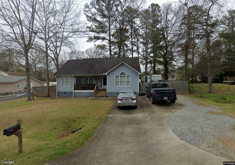
4319 Hart St Columbus, GA 31907
Eastern Columbus NeighborhoodEstimated Value: $186,000 - $202,000
3
Beds
2
Baths
1,370
Sq Ft
$139/Sq Ft
Est. Value
About This Home
This home is located at 4319 Hart St, Columbus, GA 31907 and is currently estimated at $190,678, approximately $139 per square foot. 4319 Hart St is a home located in Muscogee County with nearby schools including Reese Road Leadership Academy, Fort Middle School, and Hardaway High School.
Ownership History
Date
Name
Owned For
Owner Type
Purchase Details
Closed on
Apr 5, 2018
Sold by
Patterson Michael N
Bought by
Buster Robert G
Current Estimated Value
Create a Home Valuation Report for This Property
The Home Valuation Report is an in-depth analysis detailing your home's value as well as a comparison with similar homes in the area
Home Values in the Area
Average Home Value in this Area
Purchase History
| Date | Buyer | Sale Price | Title Company |
|---|---|---|---|
| Buster Robert G | $116,000 | -- |
Source: Public Records
Tax History Compared to Growth
Tax History
| Year | Tax Paid | Tax Assessment Tax Assessment Total Assessment is a certain percentage of the fair market value that is determined by local assessors to be the total taxable value of land and additions on the property. | Land | Improvement |
|---|---|---|---|---|
| 2025 | $130 | $63,604 | $7,004 | $56,600 |
| 2024 | $1,299 | $63,604 | $7,004 | $56,600 |
| 2023 | $613 | $63,604 | $7,004 | $56,600 |
| 2022 | $1,355 | $49,676 | $7,004 | $42,672 |
| 2021 | $1,348 | $49,948 | $7,004 | $42,944 |
| 2020 | $1,348 | $49,948 | $7,004 | $42,944 |
| 2019 | $1,354 | $46,400 | $6,920 | $39,480 |
| 2018 | $1,748 | $46,812 | $7,004 | $39,808 |
| 2017 | $1,755 | $46,812 | $7,004 | $39,808 |
| 2016 | $1,757 | $47,549 | $9,280 | $38,269 |
| 2015 | $1,765 | $47,549 | $9,280 | $38,269 |
| 2014 | $1,768 | $56,000 | $9,280 | $46,720 |
| 2013 | -- | $56,000 | $9,280 | $46,720 |
Source: Public Records
Map
Nearby Homes
- 4355 Byron St
- 2973 Grant Rd
- 4317 Byron St
- 2951 Florence Dr
- 2879 Grant Rd
- 4635 Delfair Dr
- 4732 Delfair Dr
- 2871 Barbara Rd
- 3053 Reese Rd
- 2 Hidden Woods Ct
- 2821 Barbara Rd
- 4120 Fairview Dr
- 2713 Hilyer Dr
- 3409 Ambassador Dr
- 10 Conisburgh Ct
- 4524 Hedingham Ln
- 4312 Old MacOn Rd Unit 6
- 4312 Old MacOn Rd Unit 24
- 3814 Pond View Ct
- 2661 Fernwood Ave
- 0 Hart St Unit 8279551
- 2939 Christine Rd
- 2947 Christine Rd
- 2935 Christine Rd
- 2948 Grant Rd
- 2955 Christine Rd
- 2934 Grant Rd
- 2950 Grant Rd
- 2927 Christine Rd
- 2928 Grant Rd
- 2938 Christine Rd
- 2946 Christine Rd
- 2963 Christine Rd
- 2964 Grant Rd
- 2921 Christine Rd
- 2954 Christine Rd
- 2962 Christine Rd
- 2924 Christine Rd
- 2941 Grant Rd
- 2922 Grant Rd