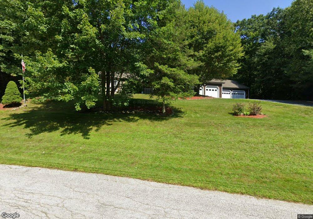
432 Deerpath Ln Pembroke, NH 03275
Estimated Value: $583,000 - $633,000
3
Beds
3
Baths
1,600
Sq Ft
$379/Sq Ft
Est. Value
About This Home
This home is located at 432 Deerpath Ln, Pembroke, NH 03275 and is currently estimated at $606,535, approximately $379 per square foot. 432 Deerpath Ln is a home located in Merrimack County with nearby schools including Pembroke Hill School, Pembroke Village School, and Three Rivers School.
Ownership History
Date
Name
Owned For
Owner Type
Purchase Details
Closed on
Aug 9, 2017
Sold by
Cadorette Christian and Cadorette Edith F
Bought by
Cadorette Christian Re
Current Estimated Value
Purchase Details
Closed on
May 13, 1985
Bought by
Cadorette Christian and Cadorette Edith
Create a Home Valuation Report for This Property
The Home Valuation Report is an in-depth analysis detailing your home's value as well as a comparison with similar homes in the area
Home Values in the Area
Average Home Value in this Area
Purchase History
| Date | Buyer | Sale Price | Title Company |
|---|---|---|---|
| Cadorette Christian Re | -- | -- | |
| Cadorette Christian | -- | -- |
Source: Public Records
Mortgage History
| Date | Status | Borrower | Loan Amount |
|---|---|---|---|
| Previous Owner | Cadorette Christian | $204,000 | |
| Previous Owner | Cadorette Christian | $200,000 |
Source: Public Records
Tax History
| Year | Tax Paid | Tax Assessment Tax Assessment Total Assessment is a certain percentage of the fair market value that is determined by local assessors to be the total taxable value of land and additions on the property. | Land | Improvement |
|---|---|---|---|---|
| 2024 | $11,330 | $576,900 | $154,100 | $422,800 |
| 2023 | $10,087 | $361,800 | $102,000 | $259,800 |
| 2022 | $9,009 | $361,800 | $102,000 | $259,800 |
| 2021 | $8,683 | $361,800 | $102,000 | $259,800 |
| 2020 | $8,900 | $361,800 | $102,000 | $259,800 |
| 2019 | $8,531 | $361,800 | $102,000 | $259,800 |
| 2018 | $8,302 | $316,400 | $92,100 | $224,300 |
| 2017 | $9,416 | $316,400 | $92,100 | $224,300 |
| 2016 | $7,647 | $263,700 | $71,000 | $192,700 |
| 2015 | $7,631 | $263,700 | $71,000 | $192,700 |
| 2014 | $7,832 | $263,700 | $71,000 | $192,700 |
| 2011 | $7,419 | $280,600 | $78,500 | $202,100 |
Source: Public Records
Map
Nearby Homes
- 214 Pembroke St
- 214 Pembroke St Unit A
- 325 Pembroke Hill Rd
- 365 Pembroke St
- 357 Pembroke St
- 474 Blane Cir Unit 40
- 441 Blane Cir Unit 12
- 340 Brickett Hill Rd
- 344 Brickett Hill Rd
- 344 Brickett Hill Rd Unit 2
- 348 Brickett Hill Rd Unit 3
- 91 Whittemore Rd
- 481 Woodlawn Ridge Rd
- 514 4th Range Rd Unit 6
- 427 Grady Ln Unit 29
- 260 Church Rd
- 426 Dawn Ct Unit 22
- 431 Dawn Ct Unit 17
- 13 Ferry Rd
- 202 Beacon Hill Rd
- 429 Deerpath Ln
- 436 Deerpath Ln
- 430 Deerpath Ln
- 435 Deerpath Ln
- 425 Deerpath Ln
- 438 Deerpath Ln
- 428 Deerpath Ln
- 421 Deerpath Ln
- 437 Deerpath Ln
- 419 Deerpath Ln
- 424 Deerpath Ln
- 440 Deerpath Ln
- 439 Deerpath Ln
- 417 Deerpath Ln
- 420 Deerpath Ln
- 413 Deerpath Ln
- 444 Deerpath Ln
- 443 Deerpath Ln
- 418 Deerpath Ln
- 411 Deerpath Ln
Your Personal Tour Guide
Ask me questions while you tour the home.