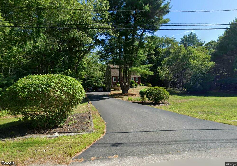
432 S Worcester St Norton, MA 02766
Estimated Value: $574,000 - $714,000
3
Beds
2
Baths
1,798
Sq Ft
$351/Sq Ft
Est. Value
About This Home
This home is located at 432 S Worcester St, Norton, MA 02766 and is currently estimated at $630,688, approximately $350 per square foot. 432 S Worcester St is a home located in Bristol County with nearby schools including J.C. Solmonese Elementary School, Henri A. Yelle Elementary School, and Norton Middle School.
Ownership History
Date
Name
Owned For
Owner Type
Purchase Details
Closed on
Dec 12, 2016
Sold by
Hoffman James M and Hoffman Jennifer
Bought by
Hoffman James M
Current Estimated Value
Purchase Details
Closed on
Sep 28, 2006
Sold by
Courchaine Adam and Courchaine Dara
Bought by
Hoffman James Michael and Hoffman Jennifer
Home Financials for this Owner
Home Financials are based on the most recent Mortgage that was taken out on this home.
Original Mortgage
$270,800
Interest Rate
6.52%
Mortgage Type
Purchase Money Mortgage
Purchase Details
Closed on
Mar 30, 2001
Sold by
Binder Michael H
Bought by
Courchaine Adam and Courchaine Dara
Purchase Details
Closed on
Oct 31, 1994
Sold by
Lebaron Dawn A
Bought by
Binder Michael H
Purchase Details
Closed on
Jun 26, 1992
Sold by
Egan Kevin B and Egan Karen A
Bought by
Lebarron Dawn A
Create a Home Valuation Report for This Property
The Home Valuation Report is an in-depth analysis detailing your home's value as well as a comparison with similar homes in the area
Home Values in the Area
Average Home Value in this Area
Purchase History
| Date | Buyer | Sale Price | Title Company |
|---|---|---|---|
| Hoffman James M | -- | -- | |
| Hoffman James Michael | $338,500 | -- | |
| Courchaine Adam | $233,000 | -- | |
| Binder Michael H | $149,500 | -- | |
| Lebarron Dawn A | $140,000 | -- |
Source: Public Records
Mortgage History
| Date | Status | Borrower | Loan Amount |
|---|---|---|---|
| Previous Owner | Lebarron Dawn A | $265,800 | |
| Previous Owner | Hoffman James Michael | $270,800 | |
| Previous Owner | Lebarron Dawn A | $231,500 |
Source: Public Records
Tax History Compared to Growth
Tax History
| Year | Tax Paid | Tax Assessment Tax Assessment Total Assessment is a certain percentage of the fair market value that is determined by local assessors to be the total taxable value of land and additions on the property. | Land | Improvement |
|---|---|---|---|---|
| 2025 | $62 | $477,100 | $188,300 | $288,800 |
| 2024 | $5,884 | $454,400 | $179,300 | $275,100 |
| 2023 | $5,571 | $428,900 | $169,100 | $259,800 |
| 2022 | $5,310 | $372,400 | $153,700 | $218,700 |
| 2021 | $0 | $341,300 | $146,400 | $194,900 |
| 2020 | $0 | $331,400 | $142,100 | $189,300 |
| 2019 | $5,150 | $311,700 | $129,600 | $182,100 |
| 2018 | $4,624 | $305,000 | $129,600 | $175,400 |
| 2017 | $1,336 | $285,500 | $129,600 | $155,900 |
| 2016 | $4,241 | $271,700 | $129,600 | $142,100 |
| 2015 | $4,098 | $266,300 | $125,800 | $140,500 |
| 2014 | $3,902 | $253,900 | $119,800 | $134,100 |
Source: Public Records
Map
Nearby Homes
- 196 Taunton Ave Unit B
- 198 Taunton Ave Unit A
- 198 Taunton Ave Unit B
- 25 Wintergreen Ln
- 3 Gilberts Way
- 51 Cobb Brook
- 470 Hodges St
- 3 Jeffrey Ln
- 38 Danielle St
- Lot 8 Joel Harvey Way
- 125 John Scott Blvd
- 127 John Scott Blvd
- 48 Dean St
- 4 Colonial Dr Unit 4
- 75 Barrows St
- 152 Pine St Unit 23
- 225 S Worcester St Unit 1
- 225 S Worcester St Unit 2
- 15 Alcott Cir Unit D3
- 178 S Worcester St
- 431 S Worcester St
- 4 John Scott Blvd
- 1 Jackson St
- 0 John B Scott Blvd Unit 70919937
- 0 John B Scott Blvd Unit 71343047
- 0 John B Scott Blvd Unit 71491225
- 430 S Worcester St
- 429 S Worcester St
- 19 Jackson St
- 5 John Scott Blvd
- 427 S Worcester St
- 4 Jackson St
- 8 Jackson St
- 58 Eddy St
- 73 Eddy St
- 6 Jackson St
- 10 Jackson St
- 15 John Scott Blvd
- 2 Jackson St
- 425 S Worcester St