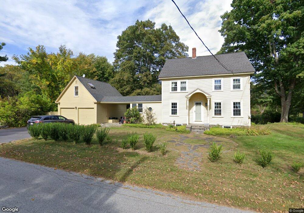
432 Stow Rd Boxborough, MA 01719
Estimated Value: $905,000 - $1,110,000
3
Beds
2
Baths
1,888
Sq Ft
$534/Sq Ft
Est. Value
About This Home
This home is located at 432 Stow Rd, Boxborough, MA 01719 and is currently estimated at $1,007,660, approximately $533 per square foot. 432 Stow Rd is a home located in Middlesex County with nearby schools including Acton-Boxborough Regional High School.
Ownership History
Date
Name
Owned For
Owner Type
Purchase Details
Closed on
Aug 19, 2013
Sold by
Butler Marnie K and Davidson Bruce G
Bought by
Caprara Rebecca and Caprara Stefano
Current Estimated Value
Home Financials for this Owner
Home Financials are based on the most recent Mortgage that was taken out on this home.
Original Mortgage
$260,000
Outstanding Balance
$192,734
Interest Rate
4.31%
Mortgage Type
New Conventional
Estimated Equity
$814,926
Purchase Details
Closed on
Jan 20, 1998
Sold by
Davidson Robert S and Davidson Nancy E
Bought by
Butler Marnie K and Davidson Bruce G
Home Financials for this Owner
Home Financials are based on the most recent Mortgage that was taken out on this home.
Original Mortgage
$221,000
Interest Rate
7.08%
Mortgage Type
Purchase Money Mortgage
Create a Home Valuation Report for This Property
The Home Valuation Report is an in-depth analysis detailing your home's value as well as a comparison with similar homes in the area
Home Values in the Area
Average Home Value in this Area
Purchase History
| Date | Buyer | Sale Price | Title Company |
|---|---|---|---|
| Caprara Rebecca | $450,000 | -- | |
| Caprara Rebecca | $450,000 | -- | |
| Butler Marnie K | $260,000 | -- |
Source: Public Records
Mortgage History
| Date | Status | Borrower | Loan Amount |
|---|---|---|---|
| Open | Caprara Rebecca | $260,000 | |
| Closed | Caprara Rebecca | $260,000 | |
| Previous Owner | Butler Marnie K | $250,000 | |
| Previous Owner | Butler Marnie K | $224,000 | |
| Previous Owner | Butler Marnie K | $221,000 |
Source: Public Records
Tax History Compared to Growth
Tax History
| Year | Tax Paid | Tax Assessment Tax Assessment Total Assessment is a certain percentage of the fair market value that is determined by local assessors to be the total taxable value of land and additions on the property. | Land | Improvement |
|---|---|---|---|---|
| 2025 | $13,862 | $915,600 | $282,200 | $633,400 |
| 2024 | $12,367 | $825,000 | $270,800 | $554,200 |
| 2023 | $9,452 | $609,000 | $232,600 | $376,400 |
| 2022 | $9,280 | $532,700 | $232,600 | $300,100 |
| 2020 | $8,467 | $506,400 | $232,600 | $273,800 |
| 2019 | $11,450 | $506,400 | $232,600 | $273,800 |
| 2018 | $7,839 | $476,800 | $221,800 | $255,000 |
| 2017 | $7,756 | $461,400 | $221,800 | $239,600 |
| 2016 | $7,365 | $450,200 | $221,800 | $228,400 |
| 2015 | $6,910 | $415,000 | $199,700 | $215,300 |
| 2014 | $7,262 | $410,500 | $193,800 | $216,700 |
Source: Public Records
Map
Nearby Homes
- 20 Lyons Ln Unit 20
- 20 Lyons Ln
- 351 Burroughs Rd
- 52 Mayfair Dr
- 1155 Burroughs Rd
- 30 Paul Revere Rd
- 207 Boxboro Rd
- 134 Russet Ln
- 68 Macintosh Ln
- 777 Depot Rd
- 404 Arlington St
- 17 Cherry Ridge Rd
- 349 Arlington St
- 30-6 Taylor Rd
- 92 Willow St Unit 3
- 92 Willow St Unit 2
- 90 Willow St Unit 1
- 58 Spencer Rd Unit 18K
- 15 Withington Ln
- 42 Swanson Ct Unit 14A