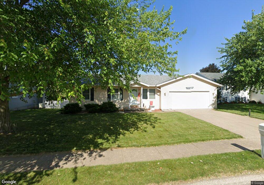
4320 Cedar St Davenport, IA 52806
North Side NeighborhoodEstimated Value: $240,793 - $269,000
3
Beds
2
Baths
1,464
Sq Ft
$179/Sq Ft
Est. Value
About This Home
This home is located at 4320 Cedar St, Davenport, IA 52806 and is currently estimated at $261,948, approximately $178 per square foot. 4320 Cedar St is a home located in Scott County with nearby schools including Martin Luther King Jr. Elementary School, Buchanan Elementary School, and Cumberland Hall School.
Ownership History
Date
Name
Owned For
Owner Type
Purchase Details
Closed on
Aug 28, 2009
Sold by
Meder Christopher J and Deskins Rachel A
Bought by
Nelson Nolan A
Current Estimated Value
Home Financials for this Owner
Home Financials are based on the most recent Mortgage that was taken out on this home.
Original Mortgage
$142,348
Outstanding Balance
$92,812
Interest Rate
5.21%
Mortgage Type
FHA
Estimated Equity
$169,136
Create a Home Valuation Report for This Property
The Home Valuation Report is an in-depth analysis detailing your home's value as well as a comparison with similar homes in the area
Home Values in the Area
Average Home Value in this Area
Purchase History
| Date | Buyer | Sale Price | Title Company |
|---|---|---|---|
| Nelson Nolan A | $155,000 | None Available |
Source: Public Records
Mortgage History
| Date | Status | Borrower | Loan Amount |
|---|---|---|---|
| Open | Nelson Nolan A | $142,348 |
Source: Public Records
Tax History Compared to Growth
Tax History
| Year | Tax Paid | Tax Assessment Tax Assessment Total Assessment is a certain percentage of the fair market value that is determined by local assessors to be the total taxable value of land and additions on the property. | Land | Improvement |
|---|---|---|---|---|
| 2025 | $3,346 | $209,180 | $33,380 | $175,800 |
| 2024 | $3,136 | $197,460 | $33,380 | $164,080 |
| 2023 | $3,434 | $190,250 | $33,380 | $156,870 |
| 2022 | $3,122 | $169,610 | $30,040 | $139,570 |
| 2021 | $3,122 | $154,420 | $30,040 | $124,380 |
| 2020 | $3,048 | $149,130 | $30,040 | $119,090 |
| 2019 | $3,006 | $142,520 | $30,040 | $112,480 |
| 2018 | $2,938 | $142,520 | $30,040 | $112,480 |
| 2017 | $793 | $142,520 | $30,040 | $112,480 |
| 2016 | $2,930 | $142,520 | $0 | $0 |
| 2015 | $2,930 | $135,970 | $0 | $0 |
| 2014 | $2,826 | $135,970 | $0 | $0 |
| 2013 | $2,774 | $0 | $0 | $0 |
| 2012 | -- | $142,060 | $30,710 | $111,350 |
Source: Public Records
Map
Nearby Homes
- 4406 Regency Place
- 4132 Rodeo Rd
- 2426 W 44th St
- 4123 N Linwood Ave
- 4104 N Linwood Ave
- 28 W Village Cir
- 2127 W 51st St
- 5109 N Pine St
- 3812 N Thornwood Ave
- 2724 W 38th Place
- 2728 W 38th Place
- 3812 Joyce Ln
- 3612 Wilkes Ave
- 2159 W 35th St
- 4036 Hillandale Rd
- 4705 N Sturdevant St
- 1453 W 41st St
- 2223 W 34th St
- 3831 N Sturdevant St
- Lot 29 W 34th St
- 4328 Cedar St
- 4312 Cedar St
- 4319 Regency Place
- 4327 Regency Place
- 4311 Regency Place
- 4334 Cedar St
- 2206 W 43rd St
- 4319 Cedar St
- 4333 Regency Place
- 2218 W 43rd St
- 2116 W 43rd St
- 4333 Cedar St
- 4400 N Cedar St
- 4405 Regency Place
- 4320 Kelling St
- 4403 Cedar St
- 4320 Regency Place
- 4328 Kelling St
- 4328 Regency Place
- 4312 Kelling St