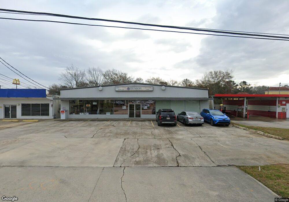
4320 Highway 19 Zachary, LA 70791
Estimated Value: $382,884
--
Bed
--
Bath
7,000
Sq Ft
$55/Sq Ft
Est. Value
About This Home
This home is located at 4320 Highway 19, Zachary, LA 70791 and is currently estimated at $382,884, approximately $54 per square foot. 4320 Highway 19 is a home located in East Baton Rouge Parish with nearby schools including Rollins Place Elementary School, Northwestern Elementary School, and Zachary Elementary School.
Ownership History
Date
Name
Owned For
Owner Type
Purchase Details
Closed on
Aug 10, 2017
Sold by
Calhoun Ann Mckee
Bought by
A Mckee Building Llc A Texas Limited Lia
Current Estimated Value
Create a Home Valuation Report for This Property
The Home Valuation Report is an in-depth analysis detailing your home's value as well as a comparison with similar homes in the area
Home Values in the Area
Average Home Value in this Area
Purchase History
| Date | Buyer | Sale Price | Title Company |
|---|---|---|---|
| A Mckee Building Llc A Texas Limited Lia | -- | None Available |
Source: Public Records
Tax History Compared to Growth
Tax History
| Year | Tax Paid | Tax Assessment Tax Assessment Total Assessment is a certain percentage of the fair market value that is determined by local assessors to be the total taxable value of land and additions on the property. | Land | Improvement |
|---|---|---|---|---|
| 2024 | $5,234 | $41,272 | $13,750 | $27,522 |
| 2023 | $5,234 | $37,520 | $12,500 | $25,020 |
| 2022 | $4,705 | $37,520 | $12,500 | $25,020 |
| 2021 | $4,705 | $37,520 | $12,500 | $25,020 |
| 2020 | $5,182 | $40,940 | $6,180 | $34,760 |
| 2019 | $5,535 | $39,750 | $6,000 | $33,750 |
| 2018 | $3,641 | $26,050 | $1,400 | $24,650 |
| 2017 | $3,641 | $26,050 | $1,400 | $24,650 |
| 2016 | $3,563 | $26,050 | $1,400 | $24,650 |
| 2015 | $3,469 | $25,800 | $1,150 | $24,650 |
| 2014 | $3,458 | $25,800 | $1,150 | $24,650 |
| 2013 | -- | $25,800 | $1,150 | $24,650 |
Source: Public Records
Map
Nearby Homes
- 4311 Locke St
- 4848 Lois Dr
- 4904 Bob Odom Dr Unit B1
- 4906 Bob Odom Dr Unit C2
- 4908 Bob Odom Dr Unit B2
- 5325 Lower Zachary Rd
- 5081 Kennedy Dr
- 5417 Greenridge Ln
- 5633 Emmie Dr Unit C2
- 5635 Emmie Dr Unit B1
- 5629 Emmie Dr Unit A2
- 5631 Emmie Dr Unit B2
- 5420 Greenridge Ln
- 5125 Harlem St
- 5702 Blvd
- 5708 Montegudo Blvd
- 5710 Montegudo Blvd
- 5704 Montegudo Blvd
- 5706 Montegudo Blvd
- 4464 New Weis Rd