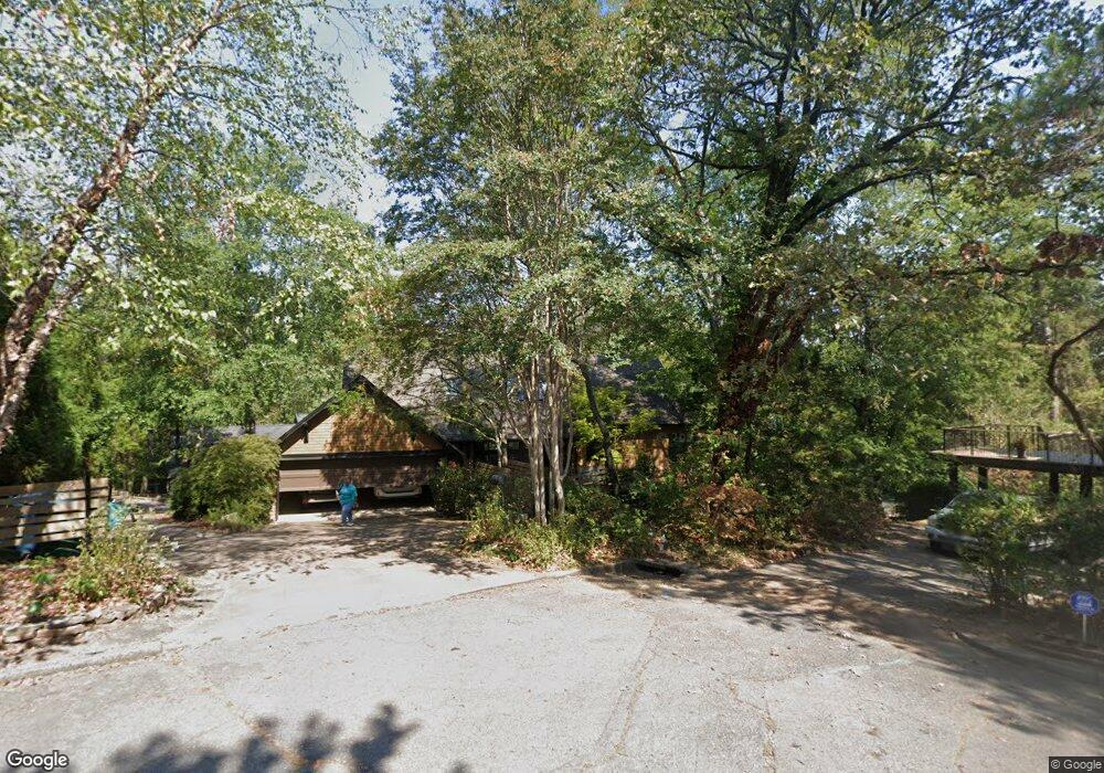
4320 I St Little Rock, AR 72205
Hillcrest NeighborhoodEstimated Value: $450,000 - $589,534
--
Bed
3
Baths
2,905
Sq Ft
$187/Sq Ft
Est. Value
About This Home
This home is located at 4320 I St, Little Rock, AR 72205 and is currently estimated at $542,134, approximately $186 per square foot. 4320 I St is a home located in Pulaski County with nearby schools including Pulaski Heights Elementary School, Pulaski Heights Middle School, and Central High School.
Ownership History
Date
Name
Owned For
Owner Type
Purchase Details
Closed on
Aug 27, 2012
Sold by
Evans Donald W and Evans Audrey R
Bought by
Evans Audrey R and Evans Donald W
Current Estimated Value
Purchase Details
Closed on
Oct 12, 2011
Sold by
Evans Audrey R and Evans Donald W
Bought by
Evans Donald W and Evans Audrey R
Home Financials for this Owner
Home Financials are based on the most recent Mortgage that was taken out on this home.
Original Mortgage
$250,000
Outstanding Balance
$22,723
Interest Rate
3.47%
Mortgage Type
New Conventional
Estimated Equity
$519,411
Purchase Details
Closed on
Feb 21, 2004
Sold by
Evans Donald W and Evans Audrey R
Bought by
Evans Audrey R and Evans Donald W
Purchase Details
Closed on
Oct 3, 2001
Sold by
Rector William Field
Bought by
Evans Donald W and Evans Audrey R
Create a Home Valuation Report for This Property
The Home Valuation Report is an in-depth analysis detailing your home's value as well as a comparison with similar homes in the area
Home Values in the Area
Average Home Value in this Area
Purchase History
| Date | Buyer | Sale Price | Title Company |
|---|---|---|---|
| Evans Audrey R | -- | None Available | |
| Evans Donald W | -- | Lenders Title Company | |
| Evans Audrey R | -- | -- | |
| Evans Donald W | $40,000 | Stewart Title |
Source: Public Records
Mortgage History
| Date | Status | Borrower | Loan Amount |
|---|---|---|---|
| Open | Evans Donald W | $250,000 |
Source: Public Records
Tax History Compared to Growth
Tax History
| Year | Tax Paid | Tax Assessment Tax Assessment Total Assessment is a certain percentage of the fair market value that is determined by local assessors to be the total taxable value of land and additions on the property. | Land | Improvement |
|---|---|---|---|---|
| 2025 | $4,246 | $102,246 | $30,000 | $72,246 |
| 2024 | $4,246 | $102,246 | $30,000 | $72,246 |
| 2023 | $4,246 | $102,246 | $30,000 | $72,246 |
| 2022 | $4,246 | $102,246 | $30,000 | $72,246 |
| 2021 | $4,276 | $91,480 | $19,000 | $72,480 |
| 2020 | $3,871 | $91,480 | $19,000 | $72,480 |
| 2019 | $3,871 | $91,480 | $19,000 | $72,480 |
| 2018 | $3,896 | $91,480 | $19,000 | $72,480 |
| 2017 | $3,896 | $91,480 | $19,000 | $72,480 |
| 2016 | $3,896 | $95,350 | $15,000 | $80,350 |
| 2015 | $4,252 | $60,651 | $15,000 | $45,651 |
| 2014 | $4,252 | $60,651 | $15,000 | $45,651 |
Source: Public Records
Map
Nearby Homes
- 131 Fairview Rd
- 314 N Walnut St
- 501 N Palm St
- 1100 N Palm St
- 4001 Cedar Hill Rd
- 416 N Spruce St
- 326 Ash St
- 1109 N Spruce St
- 3901 Cedar Hill #23 Rd
- 304 Walnut St
- 3901 Cedar Hill Rd
- 4009 Kenyon Dr
- 621 N Pine St
- 220 Rose St
- 4819 Lee Ave
- 4907 N Lookout St
- 201 Beechwood St
- 116 Beechwood St
- 5009 N Lookout Dr
- 4213 A St