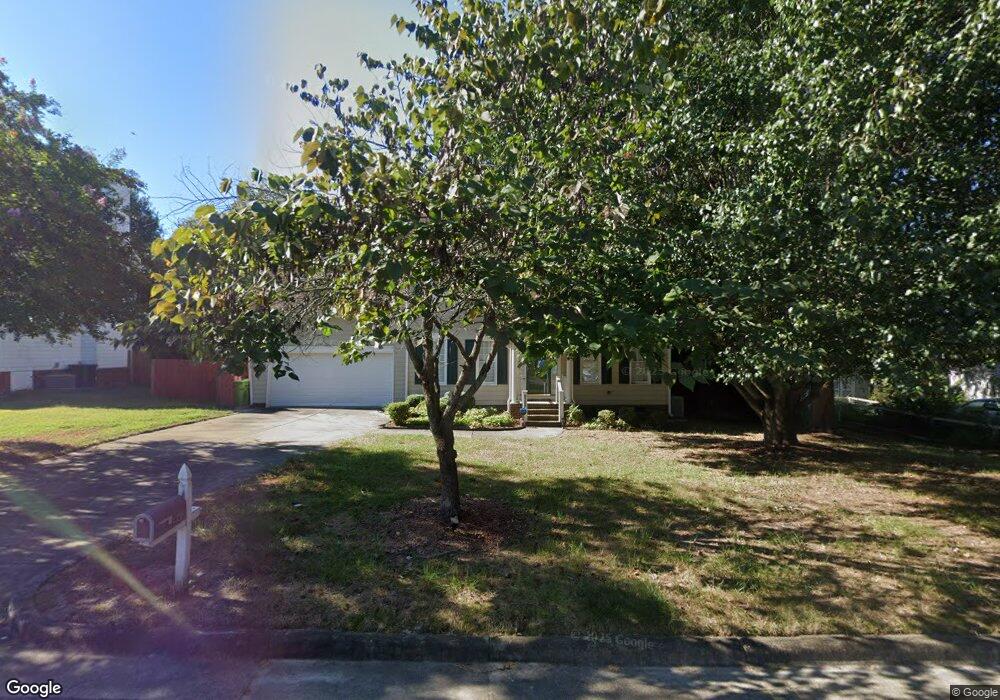
4320 Riverport Rd Raleigh, NC 27616
Forestville NeighborhoodEstimated Value: $427,897 - $446,000
3
Beds
3
Baths
2,245
Sq Ft
$196/Sq Ft
Est. Value
About This Home
This home is located at 4320 Riverport Rd, Raleigh, NC 27616 and is currently estimated at $439,224, approximately $195 per square foot. 4320 Riverport Rd is a home located in Wake County with nearby schools including Harris Creek Elementary School, Rolesville Middle School, and Rolesville High School.
Ownership History
Date
Name
Owned For
Owner Type
Purchase Details
Closed on
Oct 21, 2011
Sold by
Saunooke Michelle A
Bought by
Greene Josette D
Current Estimated Value
Home Financials for this Owner
Home Financials are based on the most recent Mortgage that was taken out on this home.
Original Mortgage
$190,056
Outstanding Balance
$129,751
Interest Rate
4.12%
Mortgage Type
FHA
Estimated Equity
$309,473
Purchase Details
Closed on
Apr 25, 2005
Sold by
Saunooke Timothy W and Saunooke Michelle A
Bought by
Saunooke Michelle A
Purchase Details
Closed on
Dec 29, 2000
Sold by
Central Carolina Inc
Bought by
Saunooke Timothy W and Saunooke Michelle A
Home Financials for this Owner
Home Financials are based on the most recent Mortgage that was taken out on this home.
Original Mortgage
$174,800
Interest Rate
7.75%
Create a Home Valuation Report for This Property
The Home Valuation Report is an in-depth analysis detailing your home's value as well as a comparison with similar homes in the area
Home Values in the Area
Average Home Value in this Area
Purchase History
| Date | Buyer | Sale Price | Title Company |
|---|---|---|---|
| Greene Josette D | $195,000 | None Available | |
| Saunooke Michelle A | -- | -- | |
| Saunooke Timothy W | $170,000 | -- |
Source: Public Records
Mortgage History
| Date | Status | Borrower | Loan Amount |
|---|---|---|---|
| Open | Greene Josette D | $190,056 | |
| Previous Owner | Saunooke Timothy W | $174,800 |
Source: Public Records
Tax History Compared to Growth
Tax History
| Year | Tax Paid | Tax Assessment Tax Assessment Total Assessment is a certain percentage of the fair market value that is determined by local assessors to be the total taxable value of land and additions on the property. | Land | Improvement |
|---|---|---|---|---|
| 2025 | $4,011 | $457,613 | $110,000 | $347,613 |
| 2024 | $3,994 | $457,613 | $110,000 | $347,613 |
| 2023 | $3,059 | $278,847 | $48,000 | $230,847 |
| 2022 | $2,843 | $278,847 | $48,000 | $230,847 |
| 2021 | $2,733 | $278,847 | $48,000 | $230,847 |
| 2020 | $2,684 | $278,847 | $48,000 | $230,847 |
| 2019 | $2,344 | $200,543 | $40,000 | $160,543 |
| 2018 | $2,211 | $200,543 | $40,000 | $160,543 |
| 2017 | $2,106 | $200,543 | $40,000 | $160,543 |
| 2016 | $2,030 | $200,543 | $40,000 | $160,543 |
| 2015 | $2,055 | $200,010 | $38,000 | $162,010 |
| 2014 | $1,984 | $200,010 | $38,000 | $162,010 |
Source: Public Records
Map
Nearby Homes
- 4317 Laurel Pond Way
- 4305 Laurel Pond Way
- 4226 Gray Alder Ln
- 3321 Beech Bluff Ln
- 4331 Laurel Pond Way
- 4335 Laurel Pond Way
- 4339 Laurel Pond Way
- 4343 Laurel Pond Way
- 4347 Laurel Pond Way
- 4351 Laurel Pond Way
- 4355 Laurel Pond Way
- 4342 Laurel Pond Way
- Landrum III Plan at Everlee - Summit Collection
- Tryon III Plan at Everlee - Summit Collection
- Carson II Plan at Everlee - Designer Collection
- Mayflower III Plan at Everlee - Summit Collection
- Clayton III Plan at Everlee - Summit Collection
- 3209 Leebrook Rd
- 4112 Timberbrook Dr
- 1317 Kubek Way Unit 65
- 4316 Riverport Rd
- 4328 Riverport Rd
- 4319 Riverport Rd
- 4323 Riverport Rd
- 4312 Riverport Rd
- 4332 Riverport Rd
- 4315 Riverport Rd
- 4329 Riverport Rd
- 3300 Beech Bluff Ln
- 3301 Beech Bluff Ln
- 4308 Riverport Rd
- 4333 Riverport Rd
- 4336 Riverport Rd
- 3304 Beech Bluff Ln
- 3305 Beech Bluff Ln
- 3201 Arden Branch Ln
- 4304 Riverport Rd
- 3205 Arden Branch Ln
- 4304 Red Banks Ct
- 3208 Terrell Mill Rd