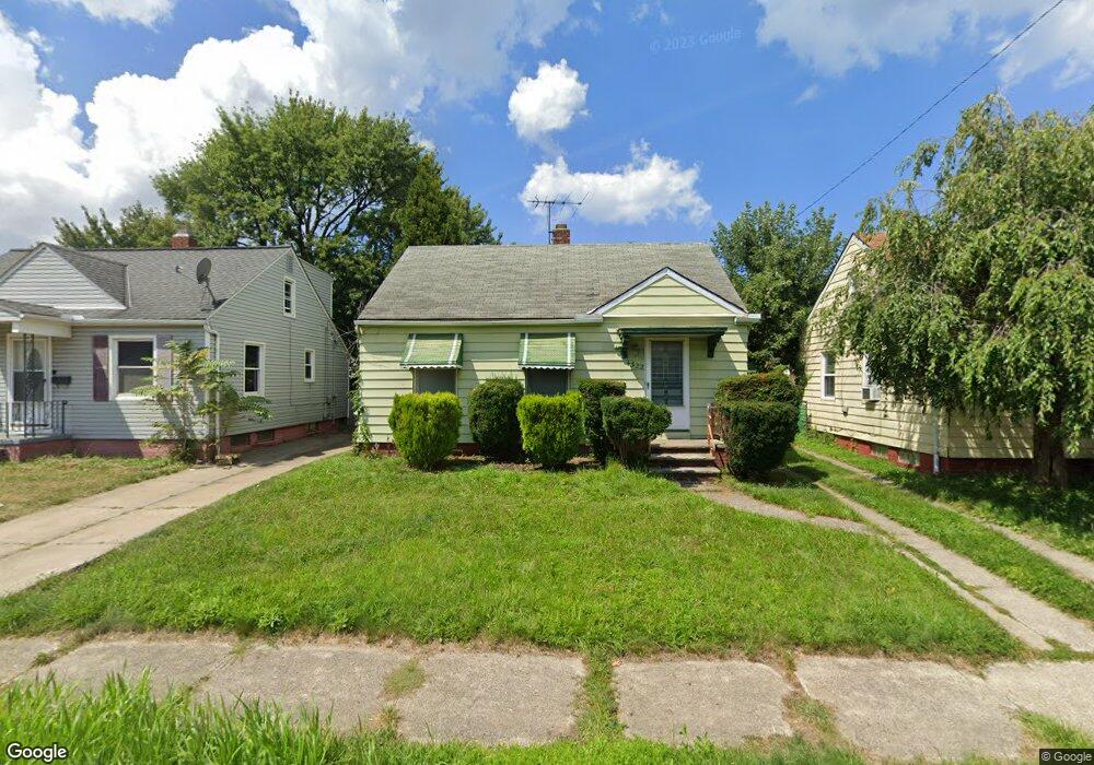
4322 Redding Rd Cleveland, OH 44109
Old Brooklyn NeighborhoodEstimated Value: $111,758 - $162,000
2
Beds
1
Bath
690
Sq Ft
$201/Sq Ft
Est. Value
About This Home
This home is located at 4322 Redding Rd, Cleveland, OH 44109 and is currently estimated at $138,440, approximately $200 per square foot. 4322 Redding Rd is a home located in Cuyahoga County with nearby schools including Benjamin Franklin, Almira Academy, and Anton Grdina School.
Ownership History
Date
Name
Owned For
Owner Type
Purchase Details
Closed on
Sep 11, 2004
Sold by
Akuszewski Michael E
Bought by
Soboslay Elizabeth Ann
Current Estimated Value
Home Financials for this Owner
Home Financials are based on the most recent Mortgage that was taken out on this home.
Original Mortgage
$96,475
Outstanding Balance
$48,718
Interest Rate
6.17%
Mortgage Type
FHA
Estimated Equity
$89,722
Purchase Details
Closed on
Jun 30, 1992
Sold by
Petznick Josephine
Bought by
Akuszewski Michael E
Purchase Details
Closed on
Apr 23, 1986
Bought by
Petznick Josephine
Purchase Details
Closed on
Apr 3, 1985
Sold by
Petznick Wm H and Petznick Josephine
Bought by
Petznick William H
Purchase Details
Closed on
Jan 1, 1975
Bought by
Petznick Wm H and Petznick Josephine
Create a Home Valuation Report for This Property
The Home Valuation Report is an in-depth analysis detailing your home's value as well as a comparison with similar homes in the area
Home Values in the Area
Average Home Value in this Area
Purchase History
| Date | Buyer | Sale Price | Title Company |
|---|---|---|---|
| Soboslay Elizabeth Ann | $98,000 | Executive Title Agency | |
| Akuszewski Michael E | $55,000 | -- | |
| Petznick Josephine | -- | -- | |
| Petznick William H | -- | -- | |
| Petznick Wm H | -- | -- |
Source: Public Records
Mortgage History
| Date | Status | Borrower | Loan Amount |
|---|---|---|---|
| Open | Soboslay Elizabeth Ann | $96,475 |
Source: Public Records
Tax History Compared to Growth
Tax History
| Year | Tax Paid | Tax Assessment Tax Assessment Total Assessment is a certain percentage of the fair market value that is determined by local assessors to be the total taxable value of land and additions on the property. | Land | Improvement |
|---|---|---|---|---|
| 2024 | $2,294 | $35,000 | $9,030 | $25,970 |
| 2023 | $2,084 | $27,480 | $6,650 | $20,830 |
| 2022 | $2,072 | $27,480 | $6,650 | $20,830 |
| 2021 | $2,052 | $27,480 | $6,650 | $20,830 |
| 2020 | $1,839 | $21,280 | $5,150 | $16,140 |
| 2019 | $1,700 | $60,800 | $14,700 | $46,100 |
| 2018 | $1,694 | $21,280 | $5,150 | $16,140 |
| 2017 | $1,668 | $20,230 | $3,640 | $16,590 |
| 2016 | $1,655 | $20,230 | $3,640 | $16,590 |
| 2015 | $1,661 | $20,230 | $3,640 | $16,590 |
| 2014 | $1,661 | $20,230 | $3,640 | $16,590 |
Source: Public Records
Map
Nearby Homes
- 1516 Amberley Ave
- 1101 Birch Ln
- 4463 S Hills Dr
- 1905 Creston Ave
- 1825 Treadway Ave
- 4475 W 12th St
- 1511 Crestline Ave
- 4091 Valley Rd
- 4233 Valley Rd
- 4226 Valley Rd
- 1703 Crestline Ave
- 1610 Crestline Ave
- 4490 Broadale Rd
- 4267 W 21st St
- 902 Colonel Dr
- 2101 Broadview Rd
- 2219 Hood Ave
- 2312 Roanoke Ave Unit 1-2
- 1025 Timothy Ln
- 4342 Sky Lane Dr
- 4326 Redding Rd
- 4318 Redding Rd
- 4330 Redding Rd
- 4314 Redding Rd
- 1317 Plymouth Rd
- 1313 Plymouth Rd
- 1321 Plymouth Rd
- 4334 Redding Rd
- 1309 Plymouth Rd
- 4310 Redding Rd
- 4319 Redding Rd
- 4323 Redding Rd
- 1305 Plymouth Rd
- 4315 Redding Rd
- 4327 Redding Rd
- 4338 Redding Rd
- 1329 Plymouth Rd
- 4331 Redding Rd
- 4309 Redding Rd
- 1219 Irving Ave