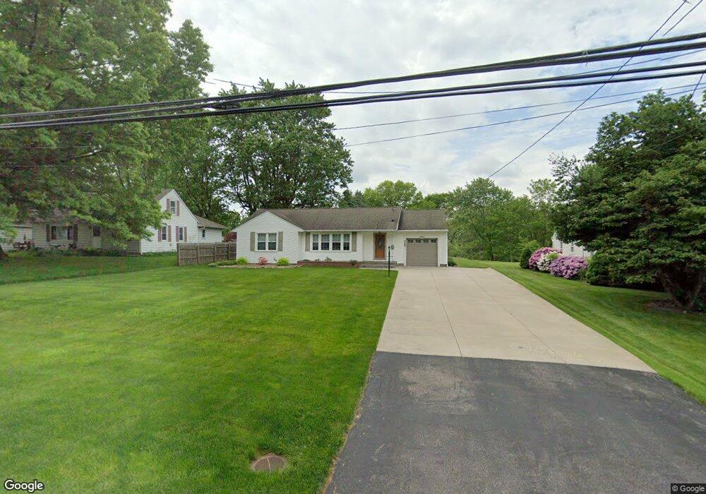
4324 Summit Rd Norton, OH 44203
North Barberton NeighborhoodEstimated Value: $186,000 - $193,000
2
Beds
2
Baths
1,384
Sq Ft
$137/Sq Ft
Est. Value
About This Home
This home is located at 4324 Summit Rd, Norton, OH 44203 and is currently estimated at $189,368, approximately $136 per square foot. 4324 Summit Rd is a home located in Summit County with nearby schools including Barberton Middle School, Barberton Intermediate School 3-5, and Barberton High School.
Ownership History
Date
Name
Owned For
Owner Type
Purchase Details
Closed on
Aug 12, 2005
Sold by
Stoll Donna M and Stoll Ralph R
Bought by
Ondo Joseph A and Ondo Sheila K
Current Estimated Value
Home Financials for this Owner
Home Financials are based on the most recent Mortgage that was taken out on this home.
Original Mortgage
$116,400
Interest Rate
5.8%
Mortgage Type
Fannie Mae Freddie Mac
Purchase Details
Closed on
Aug 9, 2004
Sold by
Stoll Donna M
Bought by
Stoll Donna M and Stoll Ralph R
Create a Home Valuation Report for This Property
The Home Valuation Report is an in-depth analysis detailing your home's value as well as a comparison with similar homes in the area
Home Values in the Area
Average Home Value in this Area
Purchase History
| Date | Buyer | Sale Price | Title Company |
|---|---|---|---|
| Ondo Joseph A | $120,000 | Old Republic National Title | |
| Stoll Donna M | -- | -- |
Source: Public Records
Mortgage History
| Date | Status | Borrower | Loan Amount |
|---|---|---|---|
| Closed | Ondo Joseph A | $116,400 |
Source: Public Records
Tax History
| Year | Tax Paid | Tax Assessment Tax Assessment Total Assessment is a certain percentage of the fair market value that is determined by local assessors to be the total taxable value of land and additions on the property. | Land | Improvement |
|---|---|---|---|---|
| 2024 | $2,668 | $49,260 | $15,173 | $34,087 |
| 2023 | $2,668 | $49,260 | $15,173 | $34,087 |
| 2022 | $1,999 | $31,578 | $9,727 | $21,851 |
| 2021 | $1,999 | $31,578 | $9,727 | $21,851 |
| 2020 | $1,885 | $31,580 | $9,730 | $21,850 |
| 2019 | $2,517 | $37,920 | $8,980 | $28,940 |
| 2018 | $2,481 | $37,920 | $8,980 | $28,940 |
| 2017 | $2,446 | $37,920 | $8,980 | $28,940 |
| 2016 | $2,451 | $36,700 | $8,980 | $27,720 |
| 2015 | $2,446 | $36,700 | $8,980 | $27,720 |
| 2014 | $2,434 | $36,700 | $8,980 | $27,720 |
| 2013 | $2,353 | $36,700 | $8,980 | $27,720 |
Source: Public Records
Map
Nearby Homes
- 266 Hazelwood Ave
- 1974 Newton Ave
- 174 Yonker St
- 197 W State St Unit 182
- 26 W Hiram St
- 0 Romig Ave
- 162 Mitchell St
- 2025 Mcgowan Rd
- 76 Hazelwood Ave
- 52 Norwood St
- 1146 Wooster Rd N
- 172 & 173 Belcher Ave
- 217 W Summit St
- 345 Morgan St
- 0 Wooster Rd N
- 553 Princeton Ave
- 613 Wooster Rd N
- 1315 Kohler Ave
- 485 Lloyd St
- 491 Taft Ave
- 4318 Summit Rd
- 4334 Summit Rd
- 4312 Summit Rd
- 1871 Caroline Ave
- 4306 Summit Rd
- 0 Madison Caroline
- 1879 Caroline Ave
- 4327 Summit Rd
- 4335 Summit Rd
- 1854 Caroline Ave
- 1888 Connect Rd
- 4313 Summit Rd
- 4362 Summit Rd
- 1887 Caroline Ave
- 2999 Orchard Ave
- 4341 Summit Rd
- 4292 Summit Rd
- 1896 Connect Rd
- 3009 Orchard Ave
- 1897 Caroline Ave
Your Personal Tour Guide
Ask me questions while you tour the home.