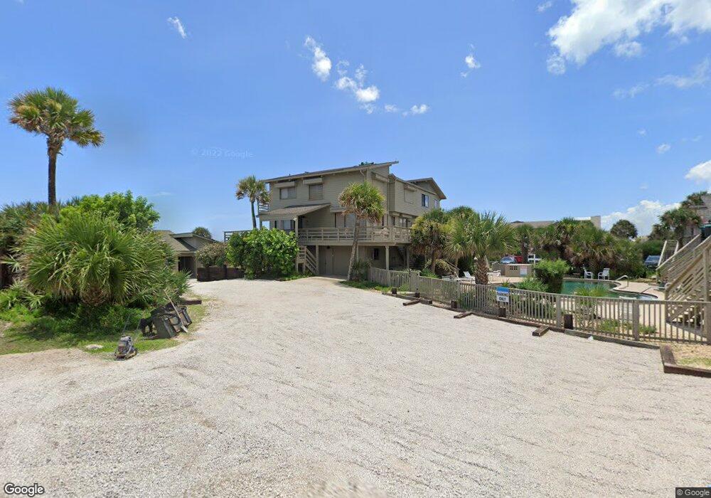
4325 S Atlantic Ave Unit A1 New Smyrna Beach, FL 32169
New Smyrna Beachfront NeighborhoodEstimated Value: $810,000 - $1,473,000
3
Beds
2
Baths
1,424
Sq Ft
$732/Sq Ft
Est. Value
About This Home
This home is located at 4325 S Atlantic Ave Unit A1, New Smyrna Beach, FL 32169 and is currently estimated at $1,042,055, approximately $731 per square foot. 4325 S Atlantic Ave Unit A1 is a home located in Volusia County with nearby schools including Coronado Beach Elementary School, New Smyrna Beach Middle School, and New Smyrna Beach High School.
Ownership History
Date
Name
Owned For
Owner Type
Purchase Details
Closed on
Jun 30, 2006
Sold by
Devane Gary W and Devane Barbara D
Bought by
Stanley Robert Michael and Stanley Mary Katherine
Current Estimated Value
Purchase Details
Closed on
Aug 15, 1988
Bought by
Stanley Robert Michael Tr
Purchase Details
Closed on
Apr 15, 1987
Bought by
Stanley Robert Michael Tr
Purchase Details
Closed on
Mar 15, 1984
Bought by
Stanley Robert Michael Tr
Purchase Details
Closed on
May 15, 1979
Bought by
Stanley Robert Michael Tr
Create a Home Valuation Report for This Property
The Home Valuation Report is an in-depth analysis detailing your home's value as well as a comparison with similar homes in the area
Home Values in the Area
Average Home Value in this Area
Purchase History
| Date | Buyer | Sale Price | Title Company |
|---|---|---|---|
| Stanley Robert Michael | $750,000 | Watson Title Services Inc | |
| Stanley Robert Michael Tr | $192,000 | -- | |
| Stanley Robert Michael Tr | $160,000 | -- | |
| Stanley Robert Michael Tr | $43,400 | -- | |
| Stanley Robert Michael Tr | $85,900 | -- |
Source: Public Records
Tax History Compared to Growth
Tax History
| Year | Tax Paid | Tax Assessment Tax Assessment Total Assessment is a certain percentage of the fair market value that is determined by local assessors to be the total taxable value of land and additions on the property. | Land | Improvement |
|---|---|---|---|---|
| 2025 | $11,758 | $884,720 | $440,000 | $444,720 |
| 2024 | $11,758 | $894,228 | $440,000 | $454,228 |
| 2023 | $11,758 | $683,484 | $328,800 | $354,684 |
| 2022 | $12,161 | $809,324 | $411,000 | $398,324 |
| 2021 | $11,163 | $653,201 | $395,000 | $258,201 |
| 2020 | $10,521 | $649,242 | $395,000 | $254,242 |
| 2019 | $10,456 | $676,467 | $395,000 | $281,467 |
| 2018 | $8,964 | $495,344 | $210,000 | $285,344 |
| 2017 | $8,206 | $417,140 | $180,000 | $237,140 |
| 2016 | $7,709 | $365,213 | $0 | $0 |
| 2015 | $7,634 | $347,546 | $0 | $0 |
| 2014 | $7,521 | $337,168 | $0 | $0 |
Source: Public Records
Map
Nearby Homes
- 4401 Sea Mist Dr Unit 201
- 4403 Sea Mist Dr Unit 211
- 4325 Sea Mist Dr Unit 247
- 4405 Sea Mist Dr Unit 114
- 4405 Sea Mist Dr Unit 218
- 4411 Sea Mist Ct Unit 174
- 4411 Sea Mist Ct Unit 275
- 4407 Sea Mist Ct Unit 267
- 4381 S Atlantic Ave Unit 504
- 4322 Sea Mist Dr
- 4366 Sea Cove
- 4493 S Atlantic Ave Unit 3040
- 4225 S Atlantic Ave Unit 2070
- 4287 Sea Mist Dr
- 4285 Sea Mist Dr
- 881 Windover Ct Unit 50A
- 898 Baybreeze Way Unit 880
- 858 Baybreeze Way Unit 68C
- 4501 S Atlantic Ave Unit 5070
- 4501 S Atlantic Ave Unit 507
- 4325 S Atlantic Ave Unit B5
- 4325 S Atlantic Ave Unit C9
- 4325 S Atlantic Ave
- 4325 S Atlantic Ave Unit A-2
- 4325 S Atlantic Ave Unit B-6
- 4325 S Atlantic Ave Unit B8
- 4335 S Atlantic Ave Unit C10
- 4335 S Atlantic Ave
- 4335 S Atlantic Ave Unit B7
- 4335 S Atlantic Ave Unit B6
- 4335 S Atlantic Ave Unit B5
- 4335 S Atlantic Ave Unit B8
- 4315 S Atlantic Ave Unit 9
- 4315 S Atlantic Ave Unit A-2
- 4315 S Atlantic Ave Unit B8
- 4315 S Atlantic Ave Unit B7
- 4315 S Atlantic Ave Unit B5
- 4315 S Atlantic Ave Unit B6
- 4345 S Atlantic Ave Unit 5
- 4345 S Atlantic Ave Unit 9