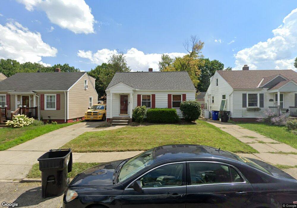
4327 Redding Rd Cleveland, OH 44109
Old Brooklyn NeighborhoodEstimated Value: $159,000 - $182,000
3
Beds
2
Baths
1,026
Sq Ft
$164/Sq Ft
Est. Value
About This Home
This home is located at 4327 Redding Rd, Cleveland, OH 44109 and is currently estimated at $168,131, approximately $163 per square foot. 4327 Redding Rd is a home located in Cuyahoga County with nearby schools including Constellation Schools: Old Brooklyn Community Middle School, Mary Queen Of Peace School, and Luther Memorial School.
Ownership History
Date
Name
Owned For
Owner Type
Purchase Details
Closed on
Jan 7, 2005
Sold by
Odonnell Neal S and Odonnell Melanie
Bought by
Odonnell Neal S and Odonnell Melanie
Current Estimated Value
Purchase Details
Closed on
Nov 29, 1996
Sold by
Krall John D
Bought by
O'Donnell Neal S
Home Financials for this Owner
Home Financials are based on the most recent Mortgage that was taken out on this home.
Original Mortgage
$59,500
Outstanding Balance
$3,781
Interest Rate
7.94%
Mortgage Type
New Conventional
Estimated Equity
$164,350
Purchase Details
Closed on
May 31, 1991
Sold by
Mills Delmer C
Bought by
Krall John D
Purchase Details
Closed on
Jul 29, 1983
Sold by
Spenzer David E
Bought by
Mills Delmer C
Purchase Details
Closed on
Aug 24, 1976
Sold by
Lindsey Charles and S E
Bought by
Spenzer David E
Purchase Details
Closed on
Jan 1, 1975
Bought by
Lindsey Charles and S E
Create a Home Valuation Report for This Property
The Home Valuation Report is an in-depth analysis detailing your home's value as well as a comparison with similar homes in the area
Home Values in the Area
Average Home Value in this Area
Purchase History
| Date | Buyer | Sale Price | Title Company |
|---|---|---|---|
| Odonnell Neal S | -- | -- | |
| O'Donnell Neal S | $67,000 | -- | |
| Krall John D | $59,000 | -- | |
| Mills Delmer C | $38,000 | -- | |
| Spenzer David E | $27,900 | -- | |
| Lindsey Charles | -- | -- |
Source: Public Records
Mortgage History
| Date | Status | Borrower | Loan Amount |
|---|---|---|---|
| Open | O'Donnell Neal S | $59,500 |
Source: Public Records
Tax History
| Year | Tax Paid | Tax Assessment Tax Assessment Total Assessment is a certain percentage of the fair market value that is determined by local assessors to be the total taxable value of land and additions on the property. | Land | Improvement |
|---|---|---|---|---|
| 2025 | $3,402 | $51,870 | $9,030 | $42,840 |
| 2024 | $3,400 | $51,870 | $9,030 | $42,840 |
| 2023 | $2,570 | $33,880 | $6,650 | $27,230 |
| 2022 | $2,555 | $33,880 | $6,650 | $27,230 |
| 2021 | $2,529 | $33,880 | $6,650 | $27,230 |
| 2020 | $2,268 | $26,250 | $5,150 | $21,110 |
| 2019 | $2,097 | $75,000 | $14,700 | $60,300 |
| 2018 | $1,955 | $26,250 | $5,150 | $21,110 |
| 2017 | $1,836 | $22,260 | $3,640 | $18,620 |
| 2016 | $1,821 | $22,260 | $3,640 | $18,620 |
| 2015 | $1,828 | $22,260 | $3,640 | $18,620 |
| 2014 | $1,828 | $22,260 | $3,640 | $18,620 |
Source: Public Records
Map
Nearby Homes
- 1115 Birch Ln
- 1301 Spring Rd
- 4290 Jennings Rd
- 1812 Treadway Ave
- 1717 Tarlton Ave
- 4475 W 12th St
- 1711 Ardoyne Ave
- 4498 S Hills Dr
- 1420 Tampa Ave
- 1703 Crestline Ave
- 4027 Crest Dr
- 4011 Crest Dr
- 902 Colonel Dr
- 2027 Treadway Ave
- 4270 Valley Rd
- 1201 Galaxy Dr
- 4276 W 21st St
- 2215 Hood Ave
- 2302 Hood Ave
- 2315 Hood Ave
- 4331 Redding Rd
- 4323 Redding Rd
- 4319 Redding Rd
- 4335 Redding Rd
- 4338 Garwood Rd
- 4334 Garwood Rd
- 4342 Garwood Rd
- 4315 Redding Rd
- 4339 Redding Rd
- 4330 Garwood Rd
- 4346 Garwood Rd
- 4326 Redding Rd
- 4330 Redding Rd
- 4326 Garwood Rd
- 4334 Redding Rd
- 4322 Redding Rd
- 4343 Redding Rd
- 4309 Redding Rd
- 4338 Redding Rd
- 4350 Garwood Rd
Your Personal Tour Guide
Ask me questions while you tour the home.