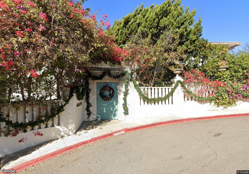
4329 Avalon Dr San Diego, CA 92103
Mission Hills NeighborhoodEstimated Value: $4,144,000 - $4,921,000
5
Beds
4
Baths
6,215
Sq Ft
$740/Sq Ft
Est. Value
About This Home
This home is located at 4329 Avalon Dr, San Diego, CA 92103 and is currently estimated at $4,600,237, approximately $740 per square foot. 4329 Avalon Dr is a home located in San Diego County with nearby schools including Grant K-8, Richard Henry Dana Middle School, and Roosevelt International Middle School.
Ownership History
Date
Name
Owned For
Owner Type
Purchase Details
Closed on
Dec 1, 2003
Sold by
Ravin William W and Ravin Betty Anne
Bought by
4329 Avalon Lp
Current Estimated Value
Purchase Details
Closed on
Jul 1, 1997
Sold by
Ravin Betty Ann
Bought by
Ravin William W
Home Financials for this Owner
Home Financials are based on the most recent Mortgage that was taken out on this home.
Original Mortgage
$30,000
Interest Rate
7.92%
Purchase Details
Closed on
Apr 13, 1995
Sold by
Tisdale William K and Tisdale Patricia Ann
Bought by
Ravin William W
Purchase Details
Closed on
Sep 7, 1993
Sold by
Tisdale William K and Tisdale Patricia Ann
Bought by
Tisdale William K and Tisdale Patricia Ann
Home Financials for this Owner
Home Financials are based on the most recent Mortgage that was taken out on this home.
Original Mortgage
$500,000
Interest Rate
7.13%
Create a Home Valuation Report for This Property
The Home Valuation Report is an in-depth analysis detailing your home's value as well as a comparison with similar homes in the area
Home Values in the Area
Average Home Value in this Area
Purchase History
| Date | Buyer | Sale Price | Title Company |
|---|---|---|---|
| 4329 Avalon Lp | $1,750,000 | First American Title | |
| Ravin William W | -- | First American Title | |
| Ravin William W | -- | Chicago Title Co | |
| Ravin William W | $800,000 | Commonwealth Land Title Co | |
| Tisdale William K | -- | First American Title Co |
Source: Public Records
Mortgage History
| Date | Status | Borrower | Loan Amount |
|---|---|---|---|
| Previous Owner | Ravin William W | $30,000 | |
| Previous Owner | Tisdale William K | $500,000 |
Source: Public Records
Tax History Compared to Growth
Tax History
| Year | Tax Paid | Tax Assessment Tax Assessment Total Assessment is a certain percentage of the fair market value that is determined by local assessors to be the total taxable value of land and additions on the property. | Land | Improvement |
|---|---|---|---|---|
| 2025 | $34,926 | $2,895,427 | $1,448,585 | $1,446,842 |
| 2024 | $34,926 | $2,838,655 | $1,420,182 | $1,418,473 |
| 2023 | $34,158 | $2,782,996 | $1,392,336 | $1,390,660 |
| 2022 | $33,248 | $2,728,429 | $1,365,036 | $1,363,393 |
| 2021 | $33,019 | $2,674,931 | $1,338,271 | $1,336,660 |
| 2020 | $32,618 | $2,647,504 | $1,324,549 | $1,322,955 |
| 2019 | $32,036 | $2,595,593 | $1,298,578 | $1,297,015 |
| 2018 | $29,947 | $2,544,700 | $1,273,116 | $1,271,584 |
| 2017 | $29,236 | $2,494,804 | $1,248,153 | $1,246,651 |
| 2016 | $28,775 | $2,445,887 | $1,223,680 | $1,222,207 |
| 2015 | $28,350 | $2,409,149 | $1,205,300 | $1,203,849 |
| 2014 | $27,901 | $2,361,958 | $1,181,690 | $1,180,268 |
Source: Public Records
Map
Nearby Homes
- 4396 Arcadia Dr
- 4171 Ibis St
- 1605 Hotel Cir S Unit B102
- 1625 Hotel Cir S Unit C309
- 1621 Hotel Cir S Unit E228
- 1621 Hotel Cir S Unit E114
- Lot 19 Randolph St
- 4109 Ibis St
- 720 W Lewis St Unit 6
- 4135 Eagle St
- 845 Fort Stockton Dr Unit 308
- 4055 Falcon St Unit 102
- 1329 Fort Stockton Dr
- 1728 W Lewis St
- 1753 W Lewis St
- 1860 W Montecito Way
- 3972 Jackdaw St
- 4095 Albatross St
- 2120 Pine St
- 3963 Eagle St Unit 8
- 4335 Avalon Dr
- 4382 Arcadia Dr
- 4334 Avalon Dr
- 4378 Arcadia Dr
- 4325 Avalon Dr
- 4355 Arcadia Dr
- 4356 Arcadia Dr
- 4384 Arcadia Dr
- 4320 Avalon Dr
- 4370 Arcadia Dr
- 4374 Arcadia Dr
- 4319 Avalon Dr
- 4364 Arcadia Dr
- 4350 Arcadia Dr
- 4315 Avalon Dr
- 4345 Arcadia Dr
- 4311 Avalon Dr
- 4392 Arcadia Dr
- 4310 Avalon Dr
- 4388 Hawk St Unit 19