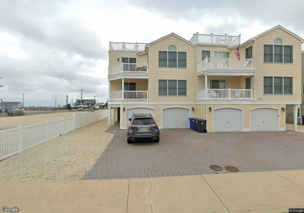
433 2nd St Beach Haven, NJ 08008
Long Beach Island Neighborhood
--
Bed
--
Bath
--
Sq Ft
9,060
Sq Ft Lot
About This Home
This home is located at 433 2nd St, Beach Haven, NJ 08008. 433 2nd St is a home located in Ocean County with nearby schools including Beach Haven School, Southern Regional Middle School, and Southern Regional High School.
Ownership History
Date
Name
Owned For
Owner Type
Purchase Details
Closed on
Jan 30, 2008
Sold by
Cb Development Corp
Bought by
Knox Ronald D and Knox Samantha S
Home Financials for this Owner
Home Financials are based on the most recent Mortgage that was taken out on this home.
Original Mortgage
$417,000
Outstanding Balance
$264,131
Interest Rate
6.14%
Mortgage Type
Purchase Money Mortgage
Purchase Details
Closed on
May 16, 2005
Sold by
Tait Robert D
Bought by
Cb Development Corp
Home Financials for this Owner
Home Financials are based on the most recent Mortgage that was taken out on this home.
Original Mortgage
$1,025,000
Interest Rate
5.79%
Mortgage Type
Construction
Create a Home Valuation Report for This Property
The Home Valuation Report is an in-depth analysis detailing your home's value as well as a comparison with similar homes in the area
Home Values in the Area
Average Home Value in this Area
Purchase History
| Date | Buyer | Sale Price | Title Company |
|---|---|---|---|
| Knox Ronald D | $735,000 | None Available | |
| Cb Development Corp | $735,000 | First American Title Ins Co |
Source: Public Records
Mortgage History
| Date | Status | Borrower | Loan Amount |
|---|---|---|---|
| Open | Knox Ronald D | $417,000 | |
| Previous Owner | Cb Development Corp | $1,025,000 |
Source: Public Records
Tax History Compared to Growth
Tax History
| Year | Tax Paid | Tax Assessment Tax Assessment Total Assessment is a certain percentage of the fair market value that is determined by local assessors to be the total taxable value of land and additions on the property. | Land | Improvement |
|---|---|---|---|---|
| 2025 | -- | -- | -- | -- |
| 2024 | -- | $0 | $0 | $0 |
| 2023 | -- | $0 | $0 | $0 |
| 2022 | $0 | $0 | $0 | $0 |
| 2021 | $0 | $0 | $0 | $0 |
| 2020 | $0 | $0 | $0 | $0 |
| 2019 | $0 | $0 | $0 | $0 |
| 2018 | $0 | $0 | $0 | $0 |
| 2017 | $0 | $0 | $0 | $0 |
| 2016 | $0 | $0 | $0 | $0 |
Source: Public Records
Map
Nearby Homes
- 100 Northwest Ave
- 320 3rd St
- 317 3rd St
- 100 N West Ave Unit 7A
- 507 Amber Street U-B
- 507 Amber St Unit B
- 225 4th St
- 415 N Bay Ave Unit C
- 415 N Bay Ave Unit B
- 415 N Bay Ave Unit D
- 415 N Bay Ave Unit A
- 224 5th St Unit A
- 224 5th St
- 310 W West Ave Unit 2E
- 301 N Beach Ave
- 222 7th St
- 109 Centre St
- 218 7th St Unit A
- 204 Coral St
- 132 Coral St
- 433 2nd St Unit B
- 433 2nd St Unit U-B
- 433 2nd St Unit A
- 429 2nd St
- 436 3rd St
- 432 3rd St
- 425 2nd St
- 440 2nd St Unit 3
- 440 2nd St Unit 4
- 440 2nd St Unit 2
- 440 2nd St Unit 1
- 440 2nd St
- 428 3rd St
- 129 N Pennsylvania Ave Unit U2
- 129 N Pennsylvania Ave Unit U1
- 129 N Pennsylvania Ave Unit U4
- 129 N Pennsylvania Ave Unit U3
- 129 N Pennsylvania Ave
- 129 N Pennsylvania Ave Unit 2
- 129 N Pennsylvania Ave Unit 4