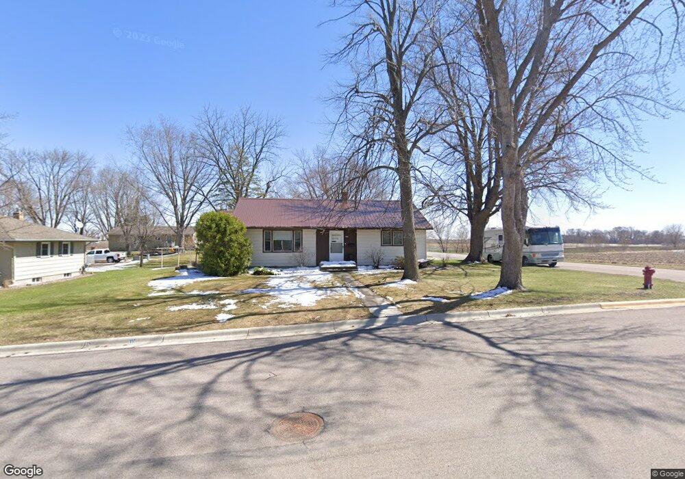
433 8th Ave S Brownton, MN 55312
Estimated Value: $202,568 - $244,000
2
Beds
2
Baths
1,092
Sq Ft
$203/Sq Ft
Est. Value
About This Home
This home is located at 433 8th Ave S, Brownton, MN 55312 and is currently estimated at $221,142, approximately $202 per square foot. 433 8th Ave S is a home with nearby schools including Lincoln Elementary School, Lakeside Elementary School, and Glencoe-Silver Lake Jr. High School.
Create a Home Valuation Report for This Property
The Home Valuation Report is an in-depth analysis detailing your home's value as well as a comparison with similar homes in the area
Home Values in the Area
Average Home Value in this Area
Tax History Compared to Growth
Tax History
| Year | Tax Paid | Tax Assessment Tax Assessment Total Assessment is a certain percentage of the fair market value that is determined by local assessors to be the total taxable value of land and additions on the property. | Land | Improvement |
|---|---|---|---|---|
| 2024 | $3,222 | $154,900 | $31,100 | $123,800 |
| 2023 | $2,854 | $154,900 | $31,100 | $123,800 |
| 2022 | $2,834 | $132,600 | $27,000 | $105,600 |
| 2021 | $2,872 | $117,800 | $23,500 | $94,300 |
| 2020 | $2,884 | $117,800 | $23,500 | $94,300 |
| 2019 | $1,634 | $106,600 | $21,300 | $85,300 |
| 2018 | $1,628 | $0 | $0 | $0 |
| 2017 | $1,386 | $0 | $0 | $0 |
| 2016 | $1,334 | $0 | $0 | $0 |
| 2015 | $1,210 | $0 | $0 | $0 |
| 2014 | -- | $0 | $0 | $0 |
Source: Public Records
Map
Nearby Homes
- 7612 Plum Ave
- 752 2nd St N
- 531 2nd St N
- 221 3rd Ave S
- Lot 2 U S Highway 212
- 122 2nd Ave S
- xxx Lot 3 Division St W
- 304 1st Ave N
- 237 5th St N
- XXX US Hwy 212
- xxx Lot 2 Us Hwy 212
- 16452 90th St
- 11655 Sunset Cir
- 11742 Sunset Cir
- 7900 Lace Ave N
- 7900 Lace Ave
- 13198 100th St
- 12893 County Road 7
- Lot 2 Tagus Ave
- 15554 130th St